Towns & cities · West Midlands
Stretton
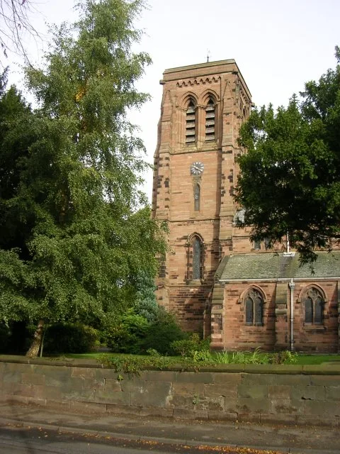
Stretton — village and civil parish in Warrington, Cheshire, UK.

Wikimedia Commons contributors — see linked file page for photographer and licence licence
Plan your visit
- Typical visit
- 3 h–6 h
- Nearest railway station
- Warrington Bank Quay · 5.6 km
- Free entry
- Family-friendly
- Dog-friendly
About
Stretton is a town, city, village or settlement in the United Kingdom. Recent population estimates put it at around 1,009 people. Address: WA4. Wikidata describes it as: "village and civil parish in Warrington, Cheshire, UK". Coordinates: 53.3381°, -2.5775°.
Photo gallery
From the Wikipedia article
Stretton is a village and civil parish in the Borough of Warrington, Cheshire, England. The parish includes the village of Lower Stretton. It is at the very southern tip of Warrington, about 4 miles (6.4 km) south of the town centre. It has a large hotel (Park Royal Hotel) and is the site of Warrington's private hospital, run by Spire Healthcare. The village is near junction 10 of the M56 motorway. The Royal Navy Air Station HMS Blackcap existed at Stretton between June 1942 and November 1958. Stretton means "settlement on a Roman Road" (from the Old English stræt and tun). In this case the road ran Northwich to Warrington.
Excerpt from Wikipedia under CC BY-SA 4.0. See the source article linked in Sources below.
- Coordinates
- 53.3381, -2.5775
- District
- Warrington
- Parish
- Stretton
- Postcode
- WA4
- Parliamentary constituency
- Warrington South
- Population
- 1,009
- Nearest railway station
- Warrington Bank Quay — 5.6 km
Sources
- wikidata: Q904019 (CC0)
- wikipedia: Stretton, Warrington (CC BY-SA 4.0)
- commons: Stretton Fox - geograph.org.uk - 1725535.jpg (CC BY-SA 4.0)
Other places nearby
Loading nearby places…
Nearby
 📷 3
📷 3Historic churches · West Midlands
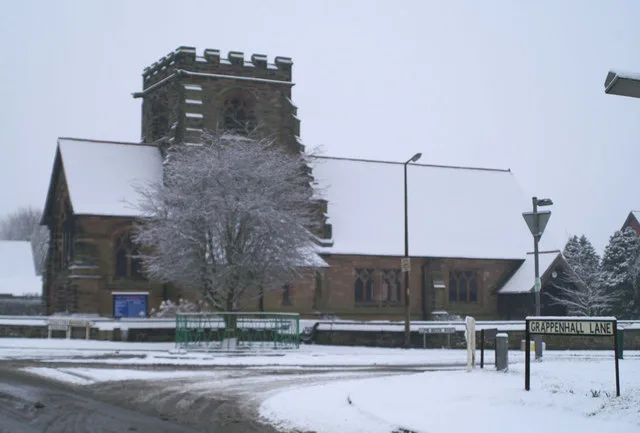
St Matthew's Church, Stretton
St Matthew's Church, Stretton — grade II listed church in the Borough of Warrington, Cheshire, England, UK.
 📷 3
📷 3Memorials & monuments · West Midlands
High Warren
High Warren — a memorial in england-west-midlands, United Kingdom.
 📷 3
📷 3Memorials & monuments · West Midlands
Appleton Cross
Appleton Cross — a memorial in england-west-midlands, United Kingdom.
 📷 3
📷 3Farms (open to visitors) · West Midlands
Amazing Maize Maze - Apple Jacks Farm
Amazing Maize Maze - Apple Jacks Farm — a other in england-west-midlands, United Kingdom.
 📷 3
📷 3Historic churches · West Midlands
St Cross Church, Appleton Thorn
St Cross Church, Appleton Thorn — Grade II listed church in Cheshire, England, UK.
_-_geograph.org.uk_-_60497.jpg?width=1200) 📷 5
📷 5Towns & cities · West Midlands
Appleton Thorn
Appleton Thorn — village in Warrington, Cheshire, UK.
More towns in this region
 Flagship📷 3
Towns & cities · West Midlands
Adderbury
Adderbury — village and civil parish in Cherwell district, Oxfordshire, England.
 Flagship📷 3
Towns & cities · West Midlands
Admington
Admington — village in Warwickshire, England, UK.
 Flagship📷 3
Towns & cities · West Midlands
Aldington
Aldington — village in Worcestershire, United Kingdom.
 Flagship📷 5
Towns & cities · West Midlands
Anstey
Anstey — large village in Leicestershire, England.
Frequently asked questions
- Where is Stretton?
- Stretton is in the West Midlands, United Kingdom (postcode WA4), in the parish of Stretton.
- Is Stretton free to visit?
- Yes, Stretton is free to enter.
- How do I get to Stretton?
- The nearest railway station is Warrington Bank Quay, about 5.6 km away. Drivers can navigate to postcode WA4.