Towns & cities · North West England
Staveley
Also known as: Staveley, Cumbria
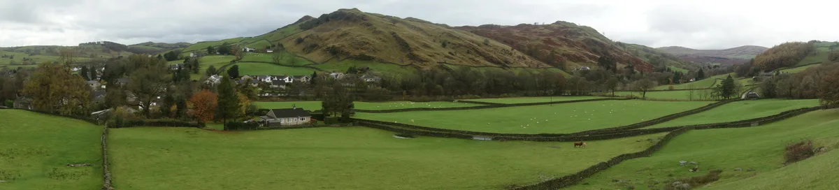
Staveley — village in Cumbria, UK.

Wikimedia Commons contributors — see linked file page for photographer and licence licence
Plan your visit
- Typical visit
- 3 h–6 h
- Nearest railway station
- Staveley · 0.0 km
- Free entry
- Family-friendly
- Dog-friendly
About
Staveley is a town, city, village or settlement in the United Kingdom. Recent population estimates put it at around 1,147 people. Address: LA8. Wikidata describes it as: "village in Cumbria, UK". Coordinates: 54.3756°, -2.8189°.
Photo gallery
Protected designations
- Site of Special Scientific Interest: River Kent and Tributaries SSSI
- Site of Special Scientific Interest: River Eden and Tributaries SSSI
Designations sourced from Natural England open data under OGL v3.
From the Wikipedia article
Staveley (grid reference SD469981) is a village in the Westmorland and Furness Unitary Authority, in Cumbria, England. Historically part of Westmorland, it is situated 4 miles (6 km) northwest of Kendal where the River Kent is joined by its tributary the Gowan. It is also known as Staveley-in-Westmorland and Staveley-in-Kendal to distinguish it from Staveley-in-Cartmel (a small village near Newby Bridge which is now in Cumbria but was previously in Lancashire). There are three civil parishes – Nether Staveley, Over Staveley and Hugill (part). Their total population at the 2011 Census was 1,593 but this includes those living in the hamlet of Ings in Hugill parish.
Excerpt from Wikipedia under CC BY-SA 4.0. See the source article linked in Sources below.
Background
History
The area has been inhabited since around 4000 BC (evidence of which can be seen close to High Borrans) when ancient Britons established farms. It has been suggested that the Romans built a road near Staveley to link the Roman forts at Kendal (Alauna) and Ambleside (Galava). However, the existence of any Roman road in the immediate vicinity of Kendal is not confirmed. On the other hand, the Roman road at High Street (a few miles north of Staveley) is well evidenced. Weekly markets and a three-day annual fair were held from 1329 when the village was granted a market charter. In the 18th century a turnpike road from Kendal to Ambleside was constructed through Staveley. In Dorothy Wordsworth's…
Sourced from Wikipedia under CC BY-SA 4.0.
- Coordinates
- 54.3756, -2.8189
- District
- Westmorland and Furness
- Parish
- Nether Staveley
- Postcode
- LA8
- Parliamentary constituency
- Westmorland and Lonsdale
- Population
- 1,147
- Nearest railway station
- Staveley — 0 km
Sources
- wikidata: Q985762 (CC0)
- wikipedia: Staveley, Cumbria (CC BY-SA 4.0)
- commons: Staveley from Reston Scar.jpg (CC BY-SA 4.0)
Other places nearby
Loading nearby places…
Nearby
 📷 3
📷 3Theatres · North West England
Staveley Roundhouse Theatre
Staveley Roundhouse Theatre is a theatre in the United Kingdom.
 📷 3
📷 3Historic bridges · North West England
Barley Bridge Over The River Kent
Barley Bridge Over The River Kent — Grade II listed building-listed bridge in england-north-west, United Kingdom.
 📷 4
📷 4Natural landmarks · North West England
Reston Scar
Reston Scar — mountain in United Kingdom.
 📷 4
📷 4Mountains & hills · North West England
Reston Scar
Reston Scar — Named summit at 255 m.
Campsites · North West England
Windermere Camping and Caravanning Club
Windermere Camping and Caravanning Club — a campsite in england north west.
Campsites · North West England
Ings Kippers
Ings Kippers — a campsite in england north west.
More towns in this region
 Flagship📷 5
Towns & cities · North West England
Aughton
Aughton — village and civil parish within the West Lancashire district of Lancashire, England.
 Flagship📷 5
Towns & cities · North West England
Haigh
Haigh — village and civil parish of the Metropolitan Borough of Wigan in Greater Manchester, England.
 Flagship📷 5
Towns & cities · North West England
Lancaster
Lancaster — county town of Lancashire, England.
 Flagship📷 3
Towns & cities · North West England
Preston
Preston — city and the administrative centre of Lancashire, England.
Frequently asked questions
- Where is Staveley?
- Staveley is in North-West England, United Kingdom (postcode LA8), in the parish of Nether Staveley.
- Is Staveley a protected site?
- Yes — Staveley is part of the River Kent and Tributaries SSSI Site of Special Scientific Interest and the River Eden and Tributaries SSSI Site of Special Scientific Interest.
- Is Staveley free to visit?
- Yes, Staveley is free to enter.
- How do I get to Staveley?
- The nearest railway station is Staveley, about 0.0 km away. Drivers can navigate to postcode LA8.