Towns & cities · South Wales
St Briavels
St Briavels — village and civil parish in Gloucestershire, United Kingdom.

Wikimedia Commons contributors — see linked file page for photographer and licence licence
Plan your visit
- Typical visit
- 3 h–6 h
- Nearest railway station
- Perrygrove · 5.4 km
- Free entry
- Family-friendly
- Dog-friendly
About
St Briavels is a town, city, village or settlement in the United Kingdom. Recent population estimates put it at around 1,192 people. Address: GL15. Wikidata describes it as: "village and civil parish in Gloucestershire, United Kingdom". Coordinates: 51.7366°, -2.6380°.
Photo gallery
Protected designations
- Site of Special Scientific Interest: River Wye SSSI
- Site of Special Scientific Interest: Severn Estuary SSSI
- Area of Outstanding Natural Beauty: Wye Valley
- Ramsar wetland: Severn Estuary
Designations sourced from Natural England open data under OGL v3.
From the Wikipedia article
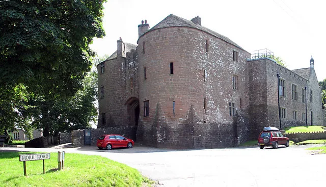
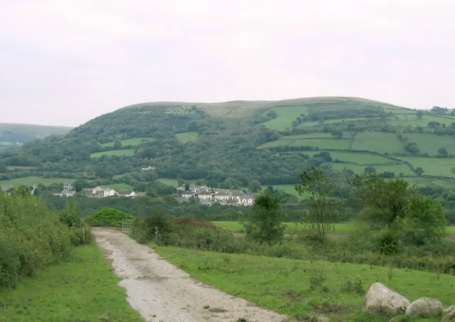
St Briavels (pronounced Brevels, once known as 'Ledenia Parva' (Little Lydney)), is a medium-sized village and civil parish in the Royal Forest of Dean in west Gloucestershire, England; close to the England-Wales border, and 5 miles (8 km) south of Coleford. It stands almost 800 feet (240 m) above sea level on the edge of a limestone plateau above the valley of the River Wye, above an ancient meander of the river. To the west, Cinder Hill drops off sharply into the valley. It is sheltered behind the crumbling walls of the 12th century St Briavels Castle.
Excerpt from Wikipedia under CC BY-SA 4.0. See the source article linked in Sources below.
Background
History
Little is known about the origin of St Briavels. The name is thought to be from a much-travelled early Christian missionary, Brioc, whose name also appears in places as far afield as Cornwall and Brittany. Later King Offa of Mercia built Offa's Dyke from the mouth of the River Wye near Chepstow to Prestatyn and local remains can still be seen in the nearby Hudnalls Wood. The Normans thought it an ideal site for one of the many castles built from Chepstow to Chester to check the attempts of the Welsh from the Kingdom of Gwent to retake native lands previously lost to the Anglo-Saxons. At Windward, the highest point in the parish, the land rises to 800 ft above sea level; St Briavels Castle…
Sourced from Wikipedia under CC BY-SA 4.0.
- Coordinates
- 51.7366, -2.6380
- County
- Gloucestershire
- District
- Forest of Dean
- Parish
- St. Briavels
- Postcode
- GL15
- Parliamentary constituency
- Forest of Dean
- Population
- 1,192
- Nearest railway station
- Perrygrove — 5.4 km
- Official site
- neighbourhood.statistics.gov.uk
Sources
- wikidata: Q675897 (CC0)
- wikipedia: St Briavels (CC BY-SA 4.0)
- commons: StBriavelscastle.jpg (CC BY-SA 4.0)
Other places nearby
Loading nearby places…
Nearby
 📷 5
📷 5Castles · South Wales
St Briavels Castle
St Briavels Castle — Grade I listed castle in Forest of Dean, United Kingdom.
 📷 3
📷 3Memorials & monuments · South Wales
Monument To James Gough In The Churchyard About 15 Metres South Of The Chancel Wall Of The Church Of St Mary
Monument To James Gough In The Churchyard About 15 Metres South Of The Chancel Wall Of The Church Of St Mary — Grade II* listed building-listed memorial in wales-south, United Kingdom.
 📷 3
📷 3Memorials & monuments · South Wales
Monument To Elizabeth Butler In The Churchyard About 3 Metres South Of The South West Corner Of The South Transept To The Church
Monument To Elizabeth Butler In The Churchyard About 3 Metres South Of The South West Corner Of The South Transept To The Church — Grade II* listed building-listed memorial in wales-south, United King
 📷 3
📷 3Historic churches · South Wales
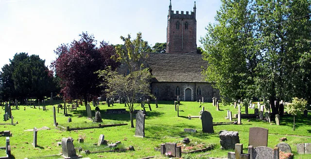
Church of St Mary
Church of St Mary — church in St Briavels Forest of DSt Briavels, Forest of Dean, Gloucestershire, England, UK.
 📷 3
📷 3Castles · South Wales
Stow Green
Stow Green — castle in St Briavels, Gloucestershire, England, UK.
 📷 3
📷 3Manor houses · South Wales
Bigsweir House
Bigsweir House — a manor in wales-south, United Kingdom.
More towns in this region
 📷 4
📷 4Towns & cities · South Wales
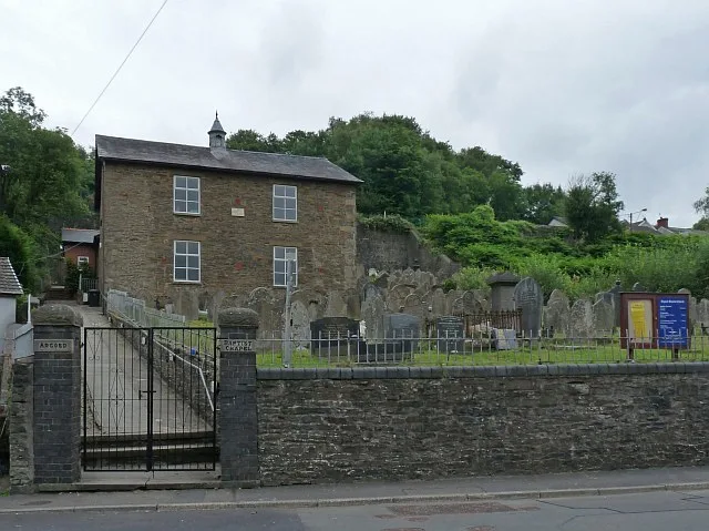
Argoed
Argoed — village and community in Caerphilly County Borough, Wales.
 Flagship📷 3
Towns & cities · South Wales
Betws
Betws — village and community in Carmarthenshire, Wales.
 Flagship📷 5
Towns & cities · South Wales
Caerleon
Caerleon — village and community in Newport, Wales, UK.
 Flagship📷 3
Towns & cities · South Wales
Camrose
Camrose — village and community in Pembrokeshire, Wales, UK.
Frequently asked questions
- Where is St Briavels?
- St Briavels is in Gloucestershire, South Wales, United Kingdom (postcode GL15), in the parish of St. Briavels.
- Is St Briavels a protected site?
- Yes — St Briavels is part of the River Wye SSSI Site of Special Scientific Interest and the Severn Estuary SSSI Site of Special Scientific Interest.
- Is St Briavels free to visit?
- Yes, St Briavels is free to enter.
- How do I get to St Briavels?
- The nearest railway station is Perrygrove, about 5.4 km away. Drivers can navigate to postcode GL15.