Mountains & hills · North Wales
Snowdon
Also known as: Yr Wyddfa, An Wodhva
Wales's highest mountain at 1,085 m.

Wikimedia Commons contributors — see linked file page for photographer and licence licence
Plan your visit
- Typical visit
- 3 h–8 h
- Best time of year
- Late spring – early autumn (May–Oct)
- Nearest railway station
- Y Copa · 0.0 km
- Free entry
- Dog-friendly
About
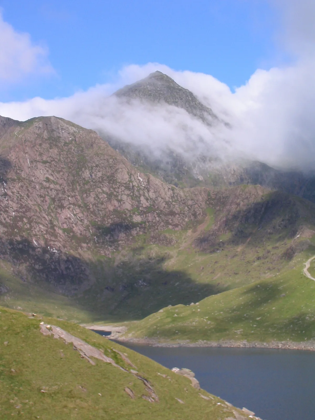
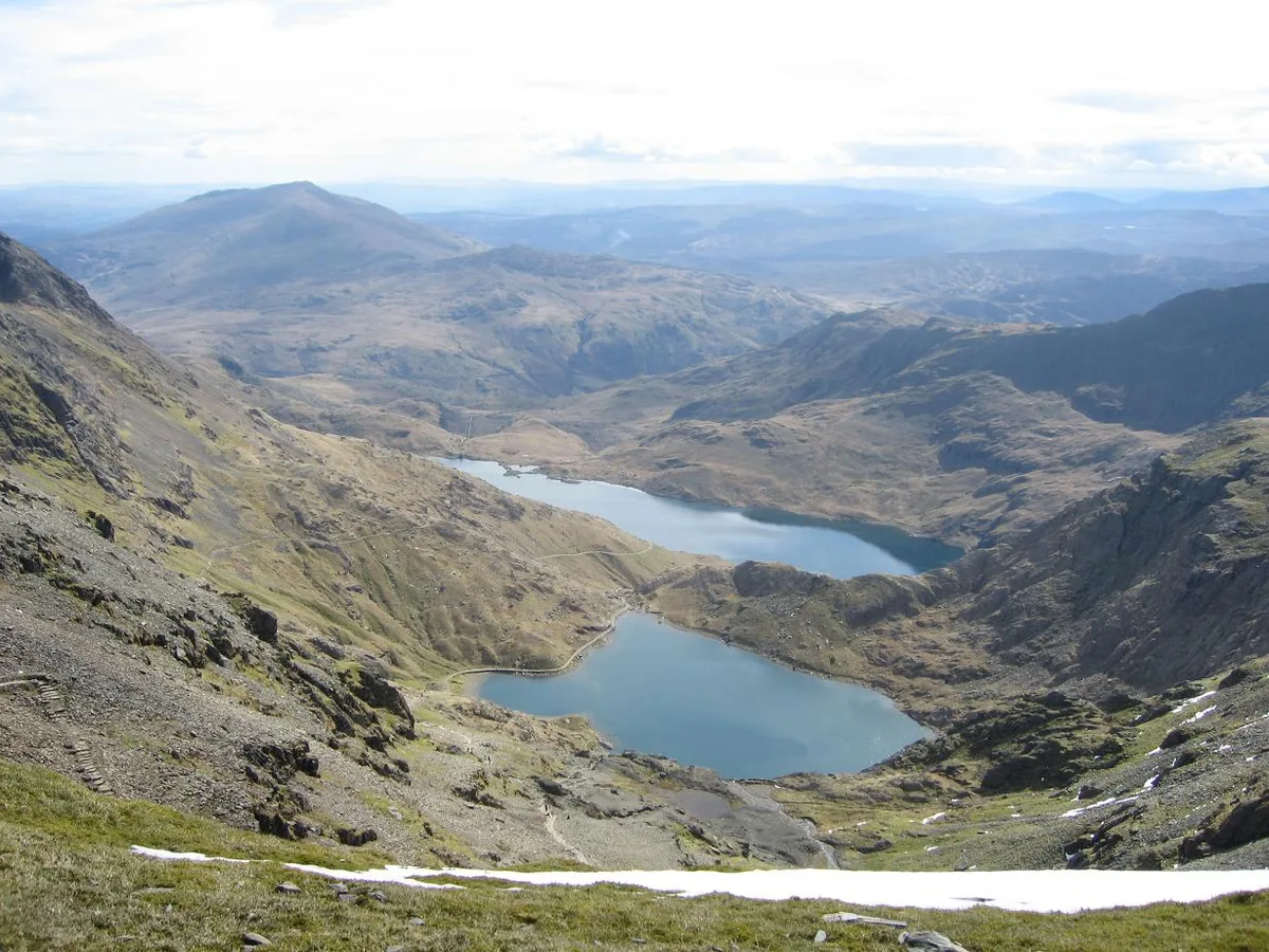
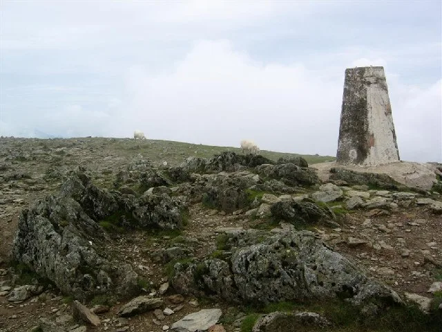
Snowdon (Welsh: Yr Wyddfa, 'the burial mound') is the highest mountain in Wales at 1,085 metres and the centrepiece of Snowdonia National Park. Six routes to the summit (Llanberis Path, Pyg Track, Miners' Track, Snowdon Ranger, Rhyd Ddu, Watkin) accommodate everyone from family walkers to scramblers; a rack-and-pinion railway from Llanberis runs to the summit station from May to October. The summit café (Hafod Eryri) was redesigned in 2009 to a Carlo Sant'Anna scheme.
Photo gallery
From the Wikipedia article
Snowdon (), or Yr Wyddfa (Welsh: [ər ˈʊɨ̞̯ðva] ), is a mountain in Snowdonia in North Wales. It has an elevation of approx. 1,085 metres (3,560 ft) above sea level, which makes it both the highest mountain in Wales and the highest in the British Isles south of the Scottish Highlands. Snowdon is designated a national nature reserve for its rare flora and fauna, and is located within Snowdonia National Park. The rocks that form Snowdon were produced by volcanoes in the Ordovician period, and the massif has been extensively sculpted by glaciation, forming the pyramidal peak of Snowdon and the arêtes of Crib Goch and Y Lliwedd. It is part of the larger Snowdon range, which includes Garnedd Ugain, Yr Aran, and Moel Eilio. There are several lakes on the mountain, the largest of which is Llyn Llydaw (110 acres (45 ha)), located on the eastern flank at 1,430 ft (440 m). The mountain has been described as the "busiest in the United Kingdom", and in 2022 it was climbed by 543,541 walkers. There are six main paths to the summit, the most popular of which begins in the village of Llanberis to the north. The summit can also be reached using the Snowdon Mountain Railway, which carried 98,567 passengers in 2021. The rack railway, which opened in 1896, operates over 4+3⁄4 miles (7.6 kilometres), from Llanberis to the Summit station. It generally operates from March to the end of October, with trains running to the summit station from May. The cliff faces on Snowdon, including Clogwyn Du'r Arddu, are significant for rock climbing, and the mountain was used by Edmund Hillary in training for the 1953 ascent of Mount Everest. The mountain, alongside Ben Nevis in Scotland and Scafell Pike in England, is climbed as part of the National Three Peaks Challenge.
Excerpt from Wikipedia under CC BY-SA 4.0. See the source article linked in Sources below.
Background
Visiting
In 1968, scenes representing the Khyber Pass were filmed for Carry On... Up the Khyber on the lower part of the Watkin Path. In 2005, Angela Douglas, one of the stars of the film, unveiled a plaque at the precise location where filming took place to commemorate the location filming. It now forms part of the North Wales Film and Television Trail run by the Wales Screen Commission.
Sourced from Wikipedia under CC BY-SA 4.0.
- Coordinates
- 53.0686, -4.0764
- Address
- Gwynedd, Wales
- Nearest railway station
- Y Copa — 0 km
Sources
- wikidata: Q217142 (CC0)
- wikipedia: Snowdon (CC BY-SA 4.0)
- commons: Snowdon from Llyn Llydaw.jpg (CC BY-SA 4.0)
Featured in these 4 guides
Itinerary
Iconic Britain: a 7-day greatest-hits tour
Stonehenge, Bath, Edinburgh, Hadrian's Wall, the Lake District, Snowdonia, London.
Itinerary
Cairngorms wildlife & summits
Five days of mountain summits, ospreys and pine forest.
Itinerary
The Wainwright Lake District peaks
Ten classic Wainwrights for first-time fell-walkers.
Itinerary
Snowdonia in 3 days
Snowdon, Cadair Idris and Welsh slate heritage.
Cinematic fly-through
Rendered from Environment Agency LIDAR (OGL v3) using Blender. Drag the timeline to scrub.
3D view
Drag to rotate · scroll to zoom · Copernicus DEM 30m / European Space Agency (CC BY 4.0)
Other places nearby
Loading nearby places…
Nearby
 📷 3
📷 3Memorials & monuments · North Wales
Gwenllian
Gwenllian — a memorial in wales-north, United Kingdom.
 📷 5
📷 5Mountains & hills · North Wales
Yr Wyddfa
Yr Wyddfa — Named summit at 1085 m.
 📷 3
📷 3Reservoirs & lochs · North Wales
Glaslyn
Glaslyn — lake in Gwynedd, Wales.
 📷 3
📷 3Natural landmarks · North Wales
Carnedd Ugain
Carnedd Ugain — mountain (1065.3m) in Gwynedd, Wales, UK.
 📷 3
📷 3Mountains & hills · North Wales
Garnedd Ugain
Garnedd Ugain — Named summit at 1065 m.
 📷 3
📷 3Archaeological sites · North Wales
Clogwyn Coch Copper Mines
Clogwyn Coch Copper Mines — a archaeological in wales-north, United Kingdom.
More mountains in this region
 📷 5
📷 5Mountains & hills · North Wales
Cemlyn Bay and lagoon
Cemlyn Bay and lagoon — Site of Special Scientific Interest in Wales.
 📷 3
📷 3Mountains & hills · North Wales
Aberffraw Bay
Aberffraw Bay — bay on the west coast of Anglesey, in Wales, UK.
 📷 3
📷 3Mountains & hills · North Wales
Allt-fawr
Allt-fawr — Named summit at 698 m.
 📷 3
📷 3Mountains & hills · North Wales
Aran Benllyn
Aran Benllyn — Named summit at 884 m.
Frequently asked questions
- Where is Snowdon?
- Snowdon is in North Wales, United Kingdom.
- Is Snowdon free to visit?
- Yes, Snowdon is free to enter.
- How do I get to Snowdon?
- The nearest railway station is Y Copa, about 0.0 km away.