Natural landmarks · Northern Ireland
Slieve Muck
Slieve Muck — mountain in Northern Ireland.

Wikimedia Commons contributors — see linked file page for photographer and licence licence
Plan your visit
- Typical visit
- 1 h–2 h
- Free entry
- Dog-friendly
About
Slieve Muck is a named natural landmark in the United Kingdom. Wikidata describes it as: "mountain in Northern Ireland". Coordinates: 54.1851°, -5.9895°.
Photo gallery
From the Wikipedia article
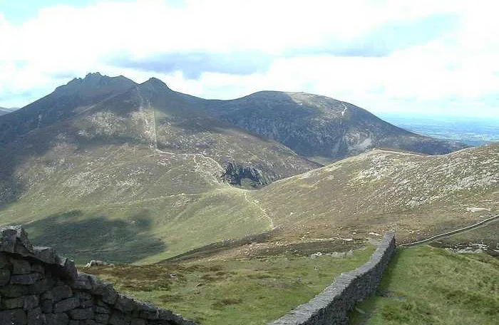
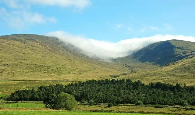
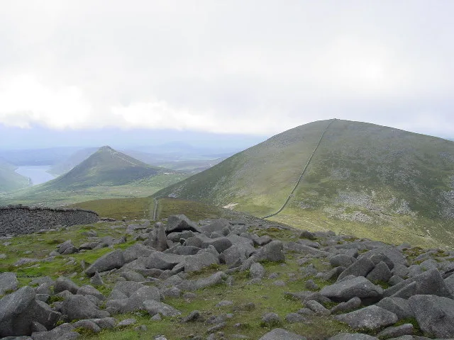
Slieve Muck ( SLEEV MUK; from Irish Sliabh Muc, meaning 'pig mountain') is one of the Mourne Mountains in County Down, Northern Ireland. It has a height of 670.4 metres (2,199 ft). The River Bann has its source on the northern slope. Slieve Muck has three summits which are composed of Silurian shale covering the underlying granite. The shale forms an escarpment near the eastern side of the summits. The western slope is grassy and has a number of small streams flowing into the Deer's Meadow below. The eastern slope below the escarpment is made up of stony scree with lighter coloured areas appearing to spell out POV when seen from a distance, local people have used their imagination to complete the word Poverty, which has led to the mountain also being referred to as Poverty Mountain.
Excerpt from Wikipedia under CC BY-SA 4.0. See the source article linked in Sources below.
- Coordinates
- 54.1851, -5.9895
- Address
- County Down, Northern Ireland
- Official site
- mountainviews.ie
Sources
- wikidata: Q548760 (CC0)
- wikipedia: Slieve Muck (CC BY-SA 4.0)
- commons: Mourne countryside at Slievenagore - geograph.org.uk - 1205489.jpg (CC BY-SA 4.0)
Other places nearby
Loading nearby places…
Nearby
 📷 3
📷 3Natural landmarks · Northern Ireland
Slieve Bearnagh
Slieve Bearnagh — mountain in the United Kingdom.
 📷 3
📷 3Mountains & hills · Northern Ireland
Slieve Bearnagh
Slieve Bearnagh — Named summit at 739 m.
 📷 3
📷 3Mountains & hills · Northern Ireland
Slieve Meelmore
Slieve Meelmore — Named summit at 687 m.
 📷 3
📷 3Mountains & hills · Northern Ireland
Slieve Meelbeg
Slieve Meelbeg — Named summit at 701.9 m.
 📷 4
📷 4Mountains & hills · Northern Ireland
Ben Crom
Ben Crom — Named summit at 526 m.
 📷 4
📷 4Natural landmarks · Northern Ireland
Slievelamagan
Slievelamagan in Northern Ireland, United Kingdom.
More natural landmarks in this region
 Flagship📷 4
Natural landmarks · Northern Ireland
Lough Erne
Lough Erne — lake in County Fermanagh, Northern Ireland, UK.
 Flagship📷 4
Natural landmarks · Northern Ireland
Lough Neagh
Lough Neagh — large lake in Northern Ireland.
 📷 3
📷 3Natural landmarks · Northern Ireland
Ballysaggart Lough
Ballysaggart Lough — lake in the United Kingdom.
 📷 5
📷 5Natural landmarks · Northern Ireland
Belmore Mountain
Belmore Mountain — mountain in the United Kingdom.
Frequently asked questions
- Where is Slieve Muck?
- Slieve Muck is in Northern Ireland, in the United Kingdom — coordinates 54.1851°, -5.9895°.
- Is Slieve Muck free to visit?
- Yes — admission to Slieve Muck is free.