Natural landmarks · Northern Ireland
Slieve Gullion
Slieve Gullion is a natural landmark in the United Kingdom.

Wikimedia Commons contributors — see linked file page for photographer and licence licence
Plan your visit
- Typical visit
- 1 h–2 h
- Nearest railway station
- Newry · 7.7 km
- Free entry
- Dog-friendly
About
Slieve Gullion is a named natural landmark in the United Kingdom. Part of Ring of Gullion. Coordinates: 54.1333°, -6.4333°. This entry is part of The Great Britain Guide, a free, ad-free, open-data tourist directory.
Photo gallery
From the Wikipedia article
Slieve Gullion (from Irish Sliabh gCuillinn, meaning 'hill of the steep slope' or Sliabh Cuilinn, "Culann's mountain") is a mountain in the south of County Armagh, Northern Ireland. The mountain is the heart of the Ring of Gullion and is the highest point in the county, with an elevation of 573 metres (1,880 ft). At the summit is a small lake and two ancient burial cairns, one of which is the highest surviving passage grave in Ireland. Slieve Gullion appears in Irish mythology, where it is associated with the Cailleach and the heroes Fionn mac Cumhaill and Cú Chulainn. It dominates the countryside around it, offering views as far away as County Antrim, Dublin Bay and County Wicklow on a clear day. Slieve Gullion Forest Park is on its eastern slope. Villages around Slieve Gullion include Meigh, Drumintee, Forkhill, Mullaghbawn and Lislea. The mountain gives its name to the surrounding countryside, and is the name of an electoral area within Newry, Mourne and Down District Council.
Excerpt from Wikipedia under CC BY-SA 4.0. See the source article linked in Sources below.
- Coordinates
- 54.1333, -6.4333
- District
- Newry, Mourne and Down
- Postcode
- BT35 9UW
- Parliamentary constituency
- Newry and Armagh
- Nearest railway station
- Newry — 7.7 km
Sources
- wikidata: Q823575 (CC0)
- wikipedia: Slieve Gullion (CC BY-SA 4.0)
- commons: Slieve Gullion.jpg (CC BY-SA 4.0)
Other places nearby
Loading nearby places…
Nearby
 📷 4
📷 4Natural landmarks · Northern Ireland
Ring of Gullion
Ring of Gullion in Northern Ireland, United Kingdom.
📷 3Burial mounds & barrows · Northern Ireland
Slieve Gullion North Cairn
Slieve Gullion North Cairn — a burial mound in northern-ireland, United Kingdom.
 📷 3
📷 3Natural landmarks · Northern Ireland
Ballard
Ballard in Northern Ireland, United Kingdom.
 📷 3
📷 3Burial mounds & barrows · Northern Ireland
Slieve Gullion South Cairn
Slieve Gullion South Cairn — a burial mound in northern-ireland, United Kingdom.
 📷 3
📷 3Castles · Northern Ireland
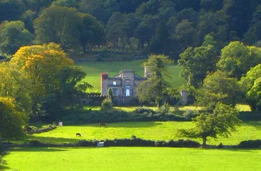
Killeavy Castle
Killeavy Castle — a castle in northern-ireland, United Kingdom.
 📷 3
📷 3Castles · Northern Ireland
Killevy Castle
Killevy Castle — country house in Clonlum, County Armagh, Northern Ireland.
More natural landmarks in this region
 Flagship📷 4
Natural landmarks · Northern Ireland
Lough Erne
Lough Erne — lake in County Fermanagh, Northern Ireland, UK.
 Flagship📷 4
Natural landmarks · Northern Ireland
Lough Neagh
Lough Neagh — large lake in Northern Ireland.
 📷 3
📷 3Natural landmarks · Northern Ireland
Ballysaggart Lough
Ballysaggart Lough — lake in the United Kingdom.
 📷 5
📷 5Natural landmarks · Northern Ireland
Belmore Mountain
Belmore Mountain — mountain in the United Kingdom.
Frequently asked questions
- Where is Slieve Gullion?
- Slieve Gullion is in Northern Ireland, United Kingdom (postcode BT35 9UW).
- Is Slieve Gullion free to visit?
- Yes, Slieve Gullion is free to enter.
- How do I get to Slieve Gullion?
- The nearest railway station is Newry, about 7.7 km away. Drivers can navigate to postcode BT35 9UW.