Forests & woodlands · London
Shepherds Close
Shepherds Close is a forest or woodland in the United Kingdom.

Wikimedia Commons contributors — see linked file page for photographer and licence licence
Plan your visit
- Typical visit
- 1 h–3 h
- Nearest railway station
- Huntingdon · 10.0 km
- Free entry
- Family-friendly
- Dog-friendly
About
Shepherds Close is a named forest, woodland or nature reserve in the United Kingdom. Coordinates: 52.3232°, -0.3389°. This entry is part of The Great Britain Guide, a free, ad-free, open-data tourist directory.
Photo gallery
From the Wikipedia article
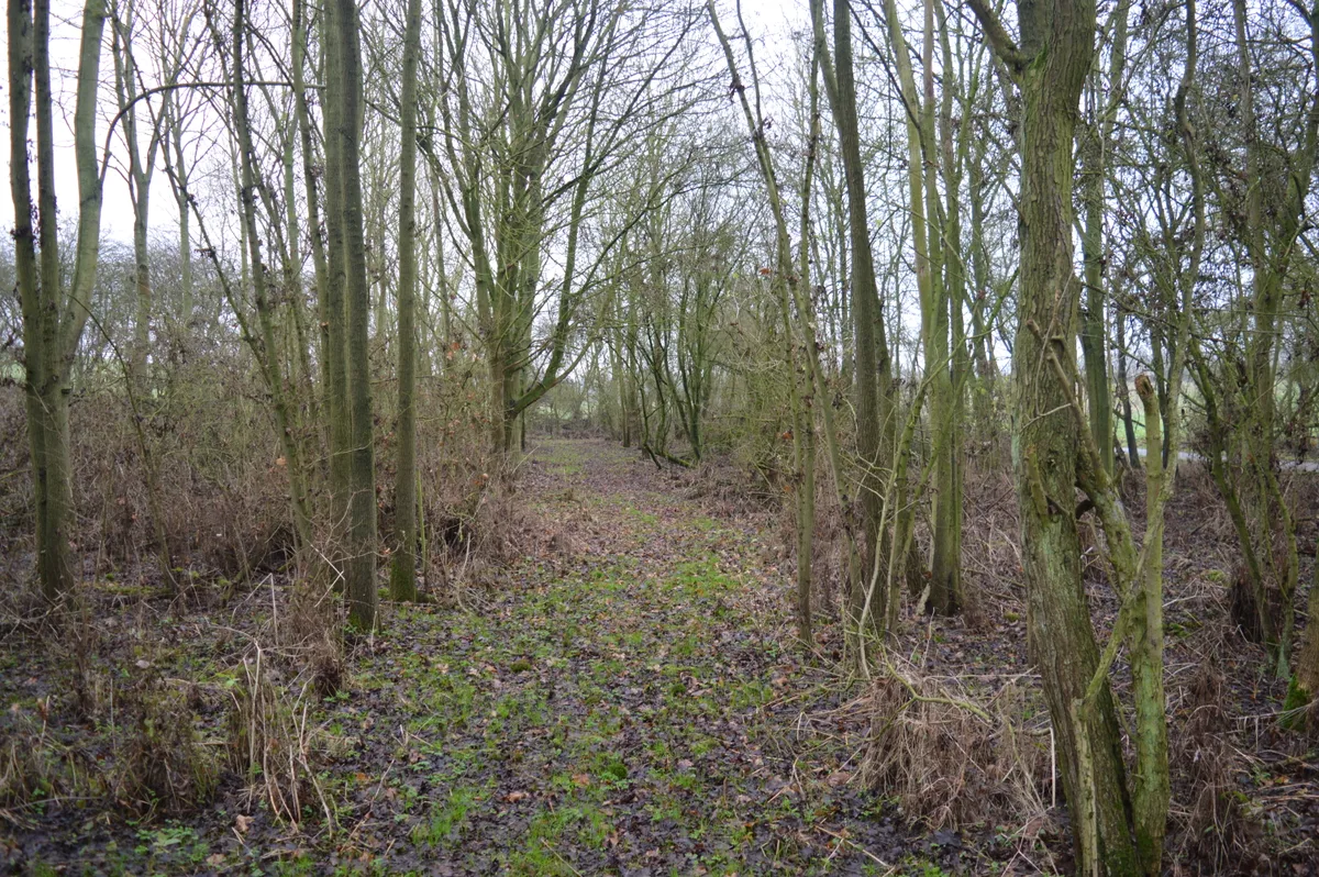
Shepherd's Close is a 1.2-hectare (3.0-acre) nature reserve south of Spaldwick in Cambridgeshire. It is managed by the Wildlife Trust for Bedfordshire, Cambridgeshire and Northamptonshire. This small wood was planted in 1984 with ash, field maple and oak. Birds include blackcaps and chiffchaffs, and there are peacock, orange-tip and speckled wood butterflies. There is access from Stonely Road.
Excerpt from Wikipedia under CC BY-SA 4.0. See the source article linked in Sources below.
- Coordinates
- 52.3232, -0.3389
- County
- Cambridgeshire
- District
- Huntingdonshire
- Parish
- Easton
- Postcode
- PE28 0TS
- Parliamentary constituency
- Huntingdon
- Nearest railway station
- Huntingdon — 10 km
- Official site
- www.wildlifebcn.org
Sources
- osm: w777329056 (ODbL)
- wikipedia: Shepherd's Close (CC BY-SA 4.0)
- commons: Shepherd's Close 8.jpg (CC BY-SA 4.0)
Other places nearby
Loading nearby places…
Nearby
 📷 5
📷 5Wildlife reserves · London
Shepherd's Close
Shepherd's Close — nature reserve in the United Kingdom.
 📷 5
📷 5Historic churches · London
Parish Church of St Peter
Parish Church of St Peter — church in Easton, Cambridgeshire, England, UK.
 📷 5
📷 5Towns & cities · London
Spaldwick
Spaldwick — Rural village in Cambridgeshire, England, UK.
 📷 5
📷 5Memorials & monuments · London
Spaldwick War Memorial
Spaldwick War Memorial — Grade II listed building-listed memorial in england-london, United Kingdom.
 📷 5
📷 5Historic bridges · London
Spaldwick Bridge
Spaldwick Bridge — scheduled monument-listed bridge in england-london, United Kingdom.
 📷 5
📷 5Towns & cities · London
Ellington
Ellington — village and civil parish in Cambridgeshire, UK.
More forests in this region
 📷 5
📷 5Forests & woodlands · London
Ackroyd Drive Green Link
Ackroyd Drive Green Link is a forest or woodland in the United Kingdom.
 📷 5
📷 5Forests & woodlands · London
Adams Road Bird Sanctuary
Adams Road Bird Sanctuary is a forest or woodland in the United Kingdom.
 📷 5
📷 5Forests & woodlands · London
Adelaide Nature Reserve
Adelaide Nature Reserve is a forest or woodland in the United Kingdom.
 📷 5
📷 5Forests & woodlands · London
Angel's Wings
Angel's Wings — Public artwork by Thomas Heatherwick.
Frequently asked questions
- Where is Shepherds Close?
- Shepherds Close is in Cambridgeshire, London, United Kingdom (postcode PE28 0TS), in the parish of Easton.
- Who owns Shepherds Close?
- Shepherds Close is owned by Wildlife Trust for Bedfordshire, Cambridgeshire and Northamptonshire.
- Is Shepherds Close free to visit?
- Yes, Shepherds Close is free to enter.
- How do I get to Shepherds Close?
- Drivers can navigate to postcode PE28 0TS. It sits within the Huntingdon parliamentary constituency.