Archaeological sites · Northern Ireland
Roe Valley Country Park
Roe Valley Country Park — park in Northern Ireland.

Wikimedia Commons contributors — see linked file page for photographer and licence licence
Plan your visit
- Typical visit
- 45 min–1.5 h
- Free entry
- Dog-friendly
About
Roe Valley Country Park is an archaeological site in the United Kingdom. Wikidata describes it as: "park in Northern Ireland". Coordinates: 55.0250°, -6.9390°.
Photo gallery
From the Wikipedia article
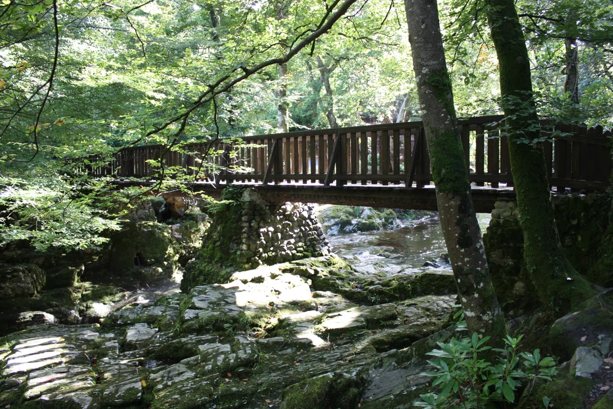
The Roe Valley Country Park is a forested area containing part of the River Roe, south west of Limavady, County Londonderry, Northern Ireland. It is maintained by the Northern Ireland Environment Agency, which is part of the Department of the Environment of Northern Ireland. The park is approximately three miles (4.8 km) long and consists of mainly deciduous, riparian woodland on each side of the Roe. The terrain next to the river is mostly steep sided gorge, with some areas of flat grassland on the northwest bank. As the river has a large, freely draining catchment area, it significantly increases in volume and speed soon after heavy rain. This is most visible around the visitor centre, where the river is forced through a narrow section of the gorge. The river is known for the legend of the dog who leaped the river Roe, fleeing enemies to warn the O'Cahan's of Limavady of danger via a message in its mouth.
Excerpt from Wikipedia under CC BY-SA 4.0. See the source article linked in Sources below.
Background
Description
A visitor centre provides managerial office space, a cafe, exhibition space and a presentation area. The area around the visitor centre contains the Green Lane Museum, with exhibits on local history, the area linen industry, agriculture and artefacts of rural life. In the 18th century, the local linen industry was based on the same site, the remains of which include flax drying fields with watch towers, derelict buildings and a waterwheel originally used to power the machinery. There is also a disused hydroelectric generating station which was the first to operate in Northern Ireland in 1896.
Sourced from Wikipedia under CC BY-SA 4.0.
- Coordinates
- 55.0250, -6.9390
- District
- Causeway Coast and Glens
- Postcode
- BT49 9NN
- Parliamentary constituency
- East Londonderry
Sources
- wikidata: Q7357534 (CC0)
- wikipedia: Roe Valley Country Park (CC BY-SA 4.0)
- commons: Weir in the Roe Valley Country Park, Limavady. - geograph.org.uk - 542088.jpg (CC BY-SA 4.0)
Other places nearby
Loading nearby places…
Nearby
 📷 3
📷 3Historic houses · Northern Ireland
Beetling Mill
Beetling Mill — a historic house in northern-ireland, United Kingdom.
 📷 3
📷 3Castles · Northern Ireland
Limavady Castle
Limavady Castle is a castle in the United Kingdom.
📷 3Museums · Northern Ireland
Green Lane Museum
Green Lane Museum — a museum in northern-ireland, United Kingdom.
📷 3Archaeological sites · Northern Ireland
O'Cahan's Fort
O'Cahan's Fort — a archaeological in northern-ireland, United Kingdom.
📷 3Viewpoints · Northern Ireland
O'Cahan's Rock
O'Cahan's Rock is a viewpoint in the United Kingdom.
 📷 2
📷 2Towns & cities · Northern Ireland
Ardgarvan
Ardgarvan — village in County Londonderry, Northern Ireland, UK.
More archaeological sites in this region
 Flagship📷 5
Archaeological sites · Northern Ireland
Tollymore Forest Park
Tollymore Forest Park — park in the United Kingdom.
 📷 3
📷 3Archaeological sites · Northern Ireland
Annalong Forest
Annalong Forest — Forest in County Down, Northern Ireland.
 📷 3
📷 3Archaeological sites · Northern Ireland
Ballysallagh Forest
Ballysallagh Forest — forest in Northern Ireland.
 📷 3
📷 3Archaeological sites · Northern Ireland
Castleward Forest
Castleward Forest — castleward Forest: Northern Ireland.
Frequently asked questions
- Where is Roe Valley Country Park?
- Roe Valley Country Park is in Northern Ireland, in the United Kingdom — coordinates 55.0250°, -6.9390°.
- Is Roe Valley Country Park free to visit?
- Yes — admission to Roe Valley Country Park is free.