Towns & cities · North West England
Ribchester
Ribchester — village and civil parish in Lancashire, UK.

Wikimedia Commons contributors — see linked file page for photographer and licence licence
Plan your visit
- Typical visit
- 3 h–6 h
- Nearest railway station
- Ramsgreave and Wilpshire · 5.1 km
- Free entry
- Family-friendly
- Dog-friendly
About
Ribchester is a town, city, village or settlement in the United Kingdom. Recent population estimates put it at around 1,530 people. Address: PR3. Wikidata describes it as: "village and civil parish in Lancashire, UK". Coordinates: 53.8130°, -2.5323°.
Photo gallery
Protected designations
- Area of Outstanding Natural Beauty: Forest Of Bowland
Designations sourced from Natural England open data under OGL v3.
From the Wikipedia article
Ribchester () is a village and civil parish within the Ribble Valley district of Lancashire, England. It lies on the banks of the River Ribble, six miles (10 km) northwest of Blackburn and twelve miles (19 km) east of Preston. The village has a long history with evidence of Bronze Age beginnings. It is well known as a significant Roman site being the location of a Roman cavalry fort called Bremetennacum, some parts of which have been exposed by excavation. In common with many towns and villages in East Lancashire its later history was dominated by cotton weaving; firstly in the form of hand-loom weaving and later in two mills. Neither mill still operates and the village is primarily a dormitory village for commuters to the town of Blackburn and the cities of Preston and Manchester. The main access road into Ribchester is the B6245. From the north-west, this is Preston Road, which merges into Church Street. From the east, it is Blackburn Road, which, at its westernmost extremity, also links up with Church Street, closer to the centre of the village. Stonygate Lane, which runs to the north, partially follows the route of the old Roman road into Ribchester.
Excerpt from Wikipedia under CC BY-SA 4.0. See the source article linked in Sources below.
Background
Description
This is the ancient centre of the village standing at the "Y" junction where the Roman branch roads lead up Water Street and Stonygate Lane to join the main route from Chester to Hadrian's Wall. It has been used for leisure and relaxation since around the first century. Although the Hillock gives the impression of being a market cross, no evidence exists of this being a part of its history.
Sourced from Wikipedia under CC BY-SA 4.0.
- Coordinates
- 53.8130, -2.5323
- County
- Lancashire
- District
- Ribble Valley
- Parish
- Ribchester
- Postcode
- PR3
- Parliamentary constituency
- Ribble Valley
- Population
- 1,530
- Nearest railway station
- Ramsgreave and Wilpshire — 5.1 km
- Official site
- ribchestermuseum.org
Sources
- wikidata: Q1083066 (CC0)
- wikipedia: Ribchester (CC BY-SA 4.0)
- commons: Aerial view of Ribchester.jpg (CC BY-SA 4.0)
Other places nearby
Loading nearby places…
Nearby
 📷 4
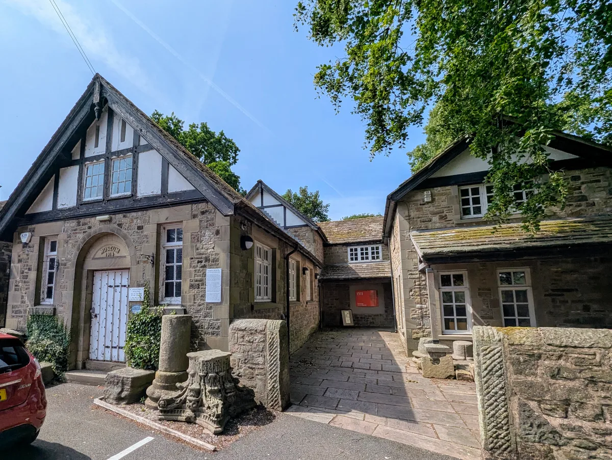
📷 4Museums · North West England
Ribchester Roman Museum
Ribchester Roman Museum — Museum in Ribchester, England.
 📷 3
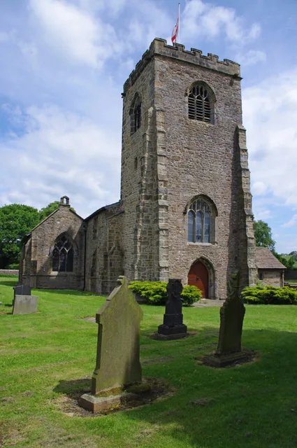
📷 3Historic churches · North West England
St Wilfrid's Church, Ribchester
St Wilfrid's Church, Ribchester — Grade I listed church in Ribchester, Ribble Valley, Lancashire, England, UK.
 📷 5
📷 5Follies · North West England
Roman temple in Ribchester
Roman temple in Ribchester — a temple folly in england-north-west, United Kingdom.
 📷 3
📷 3Archaeological sites · North West England
Bremetennacum
Bremetennacum — a archaeological in england-north-west, United Kingdom.
 📷 3
📷 3Historic bridges · North West England
Bridge At Southern End Of Lane, 40 Metres North Of Junction With Blackburn Road
Bridge At Southern End Of Lane, 40 Metres North Of Junction With Blackburn Road — Grade II listed building-listed bridge in england-north-west, United Kingdom.
 📷 3
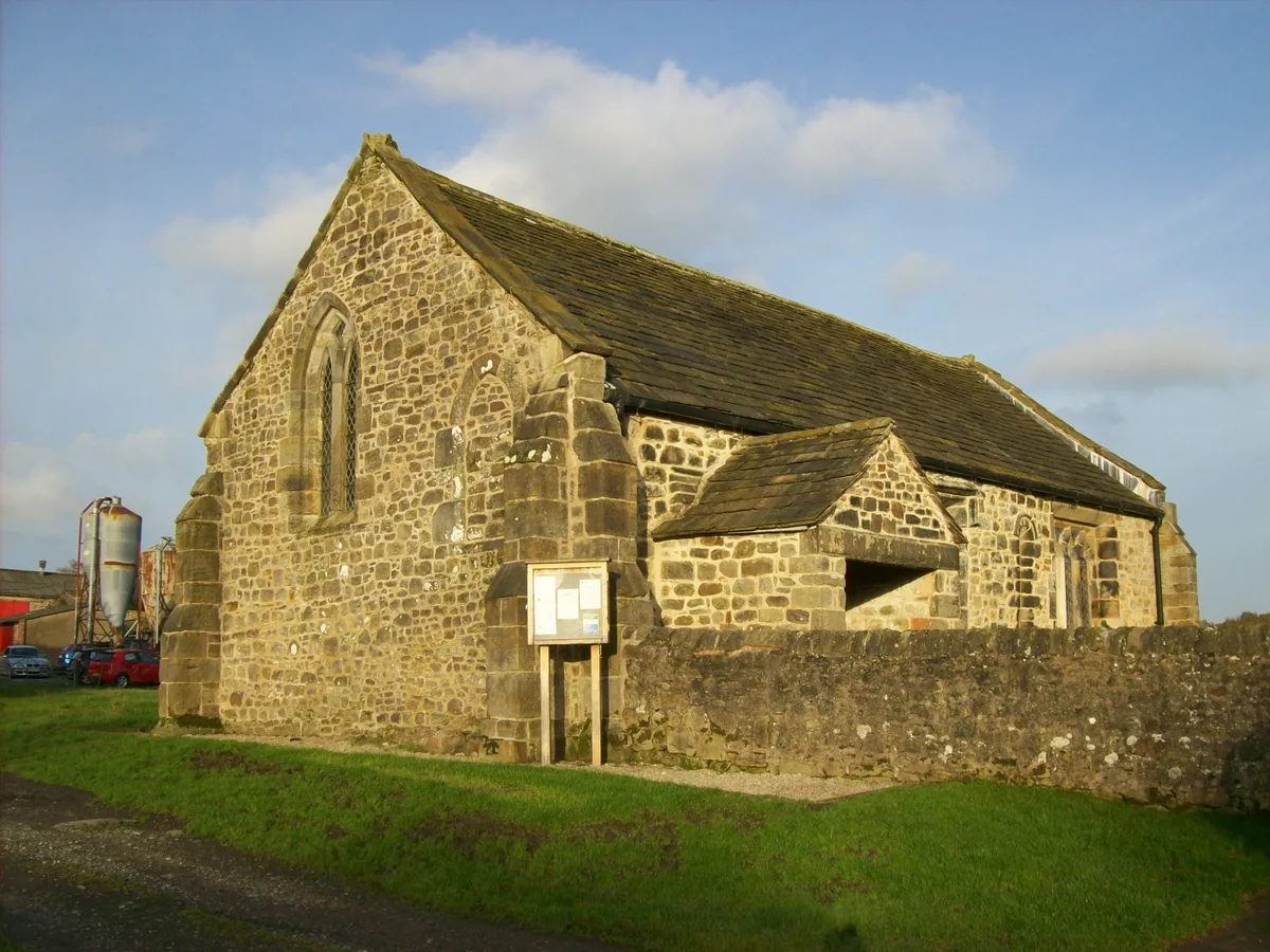
📷 3Historic churches · North West England
St Saviour's Church, Stydd
St Saviour's Church, Stydd — Grade I listed church in Dutton, Ribble Valley, Lancashire, England, UK.
More towns in this region
 Flagship📷 5
Towns & cities · North West England
Aughton
Aughton — village and civil parish within the West Lancashire district of Lancashire, England.
 Flagship📷 5
Towns & cities · North West England
Haigh
Haigh — village and civil parish of the Metropolitan Borough of Wigan in Greater Manchester, England.
 Flagship📷 5
Towns & cities · North West England
Lancaster
Lancaster — county town of Lancashire, England.
 Flagship📷 3
Towns & cities · North West England
Preston
Preston — city and the administrative centre of Lancashire, England.
Frequently asked questions
- Where is Ribchester?
- Ribchester is in Lancashire, North-West England, United Kingdom (postcode PR3), in the parish of Ribchester.
- Is Ribchester a protected site?
- Yes — Ribchester is part of the Forest Of Bowland National Landscape (AONB).
- Is Ribchester free to visit?
- Yes, Ribchester is free to enter.
- How do I get to Ribchester?
- The nearest railway station is Ramsgreave and Wilpshire, about 5.1 km away. Drivers can navigate to postcode PR3.