Reservoirs & lochs · East Midlands
Rhodeswood Reservoir
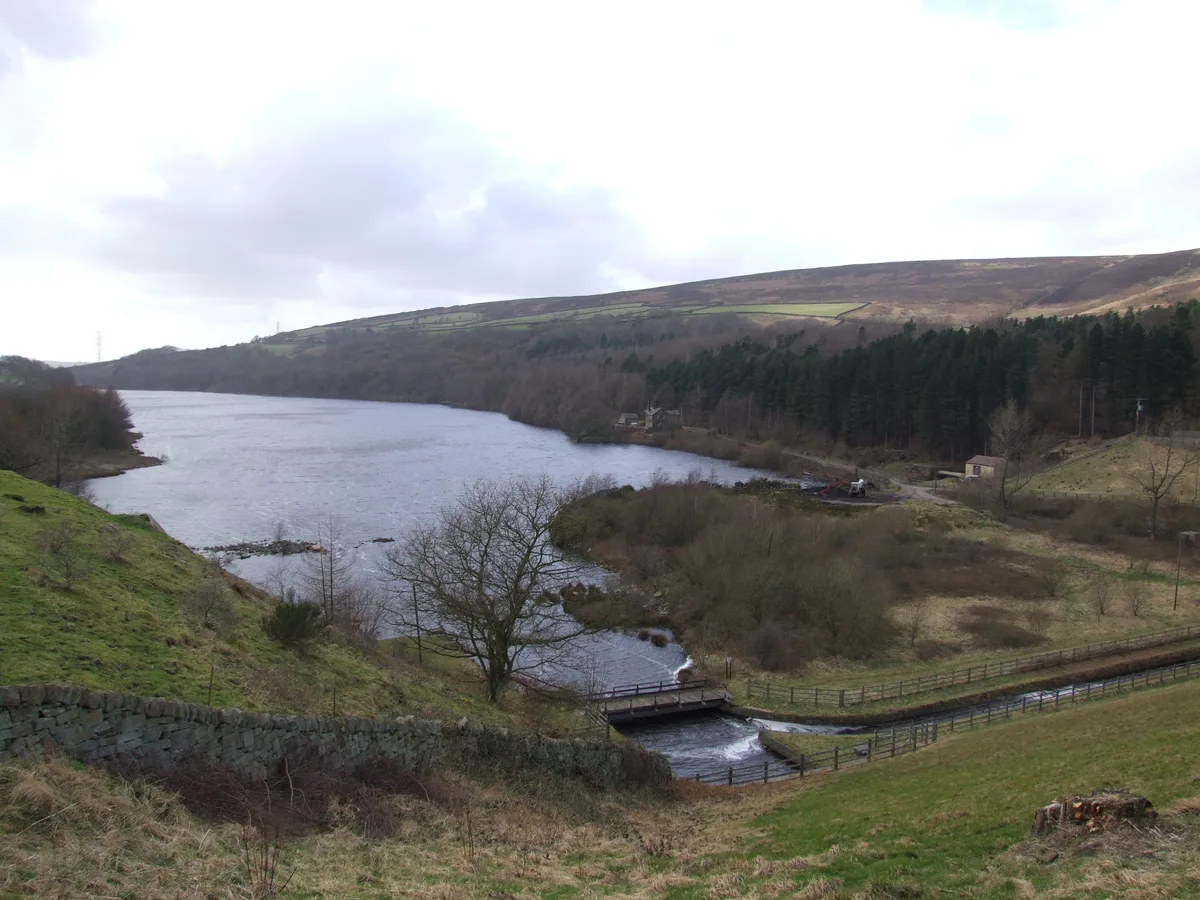
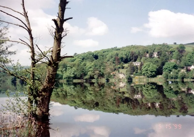
Rhodeswood Reservoir — reservoir in Derbyshire, England, UK.

Wikimedia Commons contributors — see linked file page for photographer and licence licence
Plan your visit
- Typical visit
- 1 h–2.5 h
- Nearest railway station
- Hadfield · 3.3 km
- Free entry
- Dog-friendly
About
Rhodeswood Reservoir is a reservoir in the United Kingdom. Managed by Manchester Corporation Water Works. Part of Longdendale Chain. Wikidata describes it as: "reservoir in Derbyshire, England, UK". Coordinates: 53.4810°, -1.9290°.
Photo gallery
Protected designations
- Site of Special Scientific Interest: Dark Peak SSSI
Designations sourced from Natural England open data under OGL v3.
From the Wikipedia article
Rhodeswood Reservoir is a man-made lake in Longdendale in north Derbyshire, England. It was constructed by John Frederick Bateman between 1849 and June 1855 as part of the Longdendale Chain of reservoirs to supply water from the River Etherow to the urban areas of Greater Manchester. It is third in the chain, and it is from here that the water is extracted to pass through the Mottram Tunnel to Godley for Manchester. The Manchester Corporation Waterworks Act 1847 (10 & 11 Vict. c. cciii) gave permission for the construction of the Woodhead and Arnfield reservoirs; the Manchester Corporation Waterworks Amendment Act 1848 (11 & 12 Vict. c. ci) allowed the construction of Torside and Rhodeswood Reservoirs, and an aqueduct to convey the water to the Arnfield reservoir where it would pass through the Mottram Tunnel to Godley. During construction, landslips were a problem. On the night of 6 February 1852, 30 acres (120,000 m2) of land beneath the contractors' village of New Yarmouth moved 6 inches (150 mm) obliquely to the watercourse. Bateman consulted the engineers Robert Stephenson and Isambard Kingdom Brunel. Pipes were sunk to draw off the water from the underlying shale. The purest water in a reservoir lies between 1.5 and 3 metres (4 ft 11 in and 9 ft 10 in) beneath the water's surface, so water was extracted by means of syphons. The water now flows directly to the Arnfield Treatment Works in Tintwistle and to the Mottram Tunnel. A statutory report, prepared under the Reservoirs Act 1975 and dated 12 June 1984, stated that all five reservoirs could be overtopped during a Probable Maximum Flood. Woodhead as the fountainhead would have the most extensive improvements, and with these completed there was no danger at Rhodeswood of overtopping; however, there was weakness in the north spillway. To reduce the pressure, the roadway was consolidated to protect the north spillway from erosion, the embankment was raised by 40 millimetres (1.6 in) above the road, the wave…
Excerpt from Wikipedia under CC BY-SA 4.0. See the source article linked in Sources below.
- Coordinates
- 53.4810, -1.9290
- County
- Derbyshire
- District
- High Peak
- Parish
- Charlesworth
- Postcode
- SK13 1HU
- Parliamentary constituency
- High Peak
- Nearest railway station
- Hadfield — 3.3 km
Sources
- wikidata: Q7321084 (CC0)
- wikipedia: Rhodeswood Reservoir (CC BY-SA 4.0)
- commons: Longdendale4698.JPG (CC BY-SA 4.0)
Other places nearby
Loading nearby places…
Nearby
 📷 3
📷 3Reservoirs & lochs · East Midlands
Valehouse Reservoir
Valehouse Reservoir — reservoir in Derbyshire, England, UK.
 📷 3
📷 3Reservoirs & lochs · East Midlands
Torside Reservoir
Torside Reservoir — reservoir in Derbyshire, England, UK.
 📷 5
📷 5Reservoirs & lochs · East Midlands
Longdendale Chain
Longdendale Chain — group of reservoirs in Derbyshire, England, UK.
Climbing & bouldering crags · East Midlands
Bottoms Quarry
Bottoms Quarry — a climbing crag in england east midlands.
Caravan parks · East Midlands
Windy Harbour Hotel Caravan and Camping Site
Windy Harbour Hotel Caravan and Camping Site — a caravan park in england east midlands.
 📷 3
📷 3Chapels · East Midlands
Ebenezer Chapel
Ebenezer Chapel — chapel in Tintwistle, High Peak, Derbyshire, England, UK.
More places run by Manchester Corporation Water Works
 📷 5
📷 5Reservoirs & lochs · East Midlands
Arnfield Reservoir
Arnfield Reservoir — reservoir in Derbyshire, England, UK.
 📷 3
📷 3Reservoirs & lochs · East Midlands
Bottoms Reservoir
Bottoms Reservoir — reservoir in Derbyshire, England, UK.
 📷 3
📷 3Reservoirs & lochs · East Midlands
Hollingworth Reservoir
Hollingworth Reservoir — former reservoir in Derbyshire/Greater Manchester, England, UK.
📷 3Reservoirs & lochs · East Midlands
Torside Reservoir
Torside Reservoir — reservoir in Derbyshire, England, UK.
More places in this region
 Flagship📷 5
Reservoirs & lochs · East Midlands
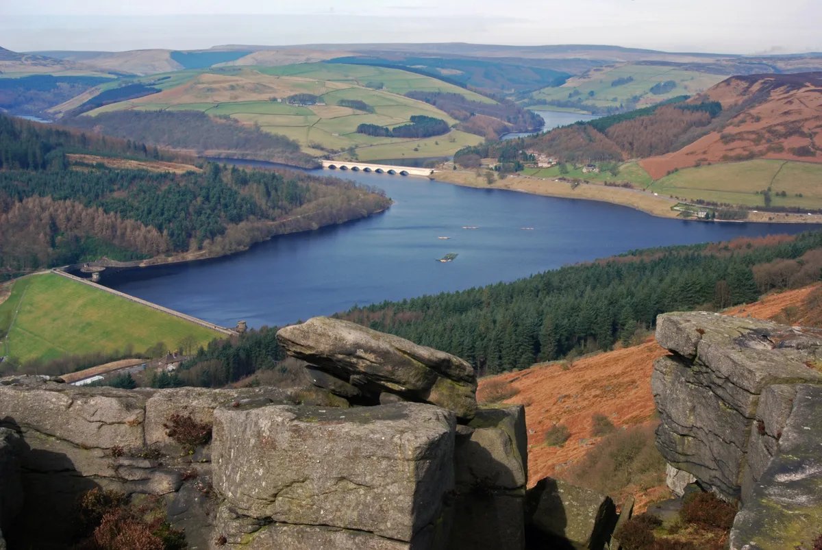
Ladybower Reservoir
Ladybower Reservoir — reservoir in Derbyshire, England.
 📷 3
📷 3Reservoirs & lochs · East Midlands
Toddbrook Reservoir
Toddbrook Reservoir — reservoir in Derbyshire, England, UK.
 📷 3
📷 3Reservoirs & lochs · East Midlands
Agden Reservoir
Agden Reservoir — reservoir in South Yorkshire, England, UK.
 📷 3
📷 3Reservoirs & lochs · East Midlands
Blackbrook Reservoir
Blackbrook Reservoir — reservoir and Site of Special Scientific Interest in Leicestershire, United Kingdom.
Frequently asked questions
- Where is Rhodeswood Reservoir?
- Rhodeswood Reservoir is in Derbyshire, the East Midlands, United Kingdom (postcode SK13 1HU), in the parish of Charlesworth.
- Who runs Rhodeswood Reservoir?
- Rhodeswood Reservoir is operated by Manchester Corporation Water Works.
- Is Rhodeswood Reservoir a protected site?
- Yes — Rhodeswood Reservoir is part of the Dark Peak SSSI Site of Special Scientific Interest.
- How do I get to Rhodeswood Reservoir?
- The nearest railway station is Hadfield, about 3.3 km away. Drivers can navigate to postcode SK13 1HU.