Mountains & hills · North West England
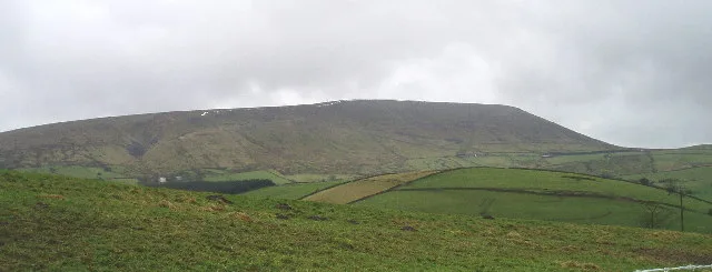
Pendle Hill
Pendle Hill — Named summit at 558 m.

Wikimedia Commons contributors — see linked file page for photographer and licence licence
Plan your visit
- Typical visit
- 3 h–8 h
- Best time of year
- Late spring – early autumn (May–Oct)
- Nearest railway station
- Clitheroe · 6.3 km
- Free entry
- Dog-friendly
About
Pendle Hill is a named summit in the United Kingdom. Wikidata describes it as: "Named summit at 558 m.". Coordinates: 53.8686°, -2.2986°.
Photo gallery
Protected designations
- Area of Outstanding Natural Beauty: Forest Of Bowland
Designations sourced from Natural England open data under OGL v3.
From the Wikipedia article
Pendle Hill is in the east of Lancashire, England, near the towns of Burnley, Nelson, Colne, Brierfield, Clitheroe and Padiham. Its summit is 557 metres (1,827 ft) above mean sea level. It gives its name to the Borough of Pendle. It is an isolated hill in the Pennines, separated from the South Pennines to the east, the Bowland Fells to the northwest, and the West Pennine Moors to the south. It is included in a detached part of the Forest of Bowland Area of Outstanding Natural Beauty.
Excerpt from Wikipedia under CC BY-SA 4.0. See the source article linked in Sources below.
Background
History
The name "Pendle Hill" combines the words for hill from two different languages (including two from the same language at different stages of its history) - as does Bredon Hill in Worcestershire. In the 13th century it was called Pennul or Penhul, apparently from the Cumbric pen and Old English hyll, both meaning "hill". The modern English "hill" was appended later, after the original meaning of Pendle had become opaque. Neolithic and Bronze Age burial sites have been discovered at and around the summit of the hill. There is an ancient local legend that the Devil once jumped from Hameldon Hill to an outcrop overlooking Sabden, on the southwest slope of Pendle, leaving footprints in the…
Sourced from Wikipedia under CC BY-SA 4.0.
- Coordinates
- 53.8686, -2.2986
- County
- Lancashire
- District
- Pendle
- Parish
- Barley-with-Wheatley Booth
- Postcode
- BB9 6LG
- Parliamentary constituency
- Pendle and Clitheroe
- Nearest railway station
- Clitheroe — 6.3 km
- Official site
- web.archive.org
Sources
- osm: n29798197 (ODbL)
- wikipedia: Pendle Hill (CC BY-SA 4.0)
- commons: Pendle hill.jpg (CC BY-SA 4.0)
Other places nearby
Loading nearby places…
Nearby
 📷 5
📷 5Natural landmarks · North West England
Pendle Hill
Pendle Hill — hill in Lancashire, England.
 📷 4
📷 4Memorials & monuments · North West England
Scout Cairn
Scout Cairn — a memorial in england-north-west, United Kingdom.
 📷 5
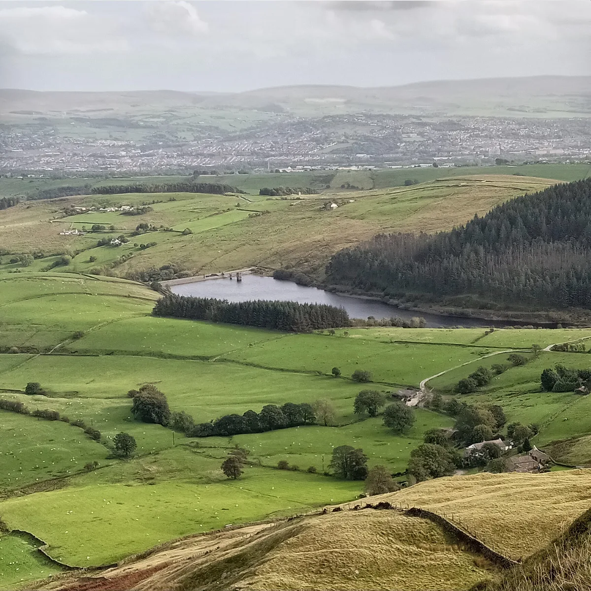
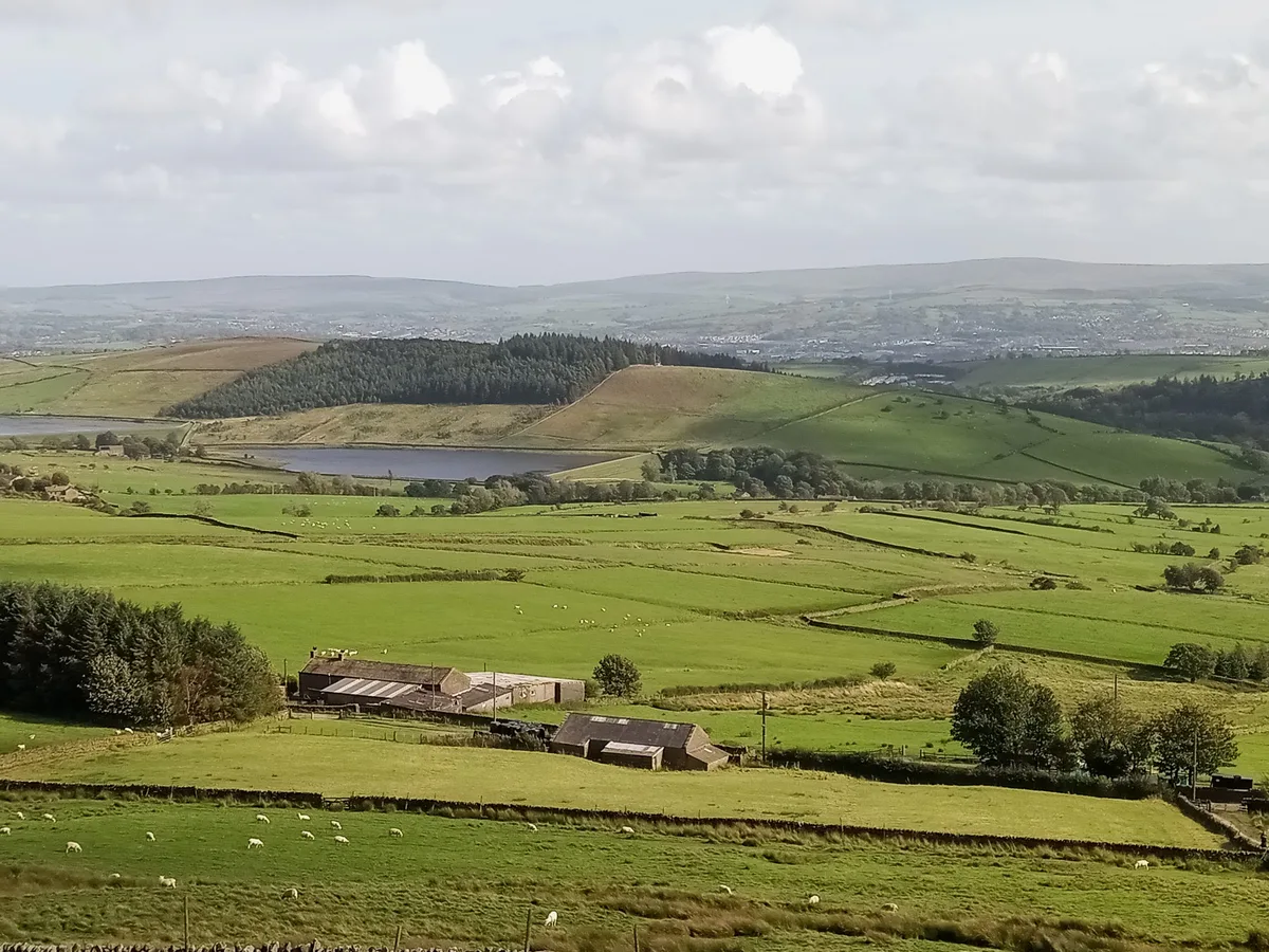
📷 5Reservoirs & lochs · North West England
Ogden Reservoirs
Ogden Reservoirs — reservoirs in Lancashire, England, UK.
 📷 3
📷 3Historic houses · North West England
Historic Cottage
Historic Cottage — a historic house in england-north-west, United Kingdom.
 📷 5
📷 5Reservoirs & lochs · North West England
Black Moss Reservoirs
Black Moss Reservoirs — reservoirs in Lancashire, England, UK.
 📷 3
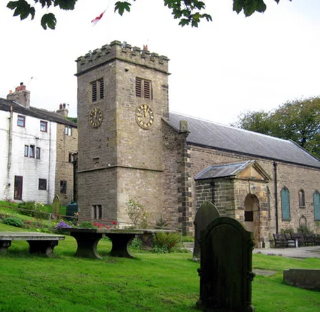
📷 3Historic churches · North West England
St Mary's Church
St Mary's Church — church in Newchurch in Pendle, Goldshaw Booth, Pendle, Lancashire, England, UK.
More mountains in this region
 📷 3
📷 3Mountains & hills · North West England
Allen Crags
Allen Crags — Named summit at 785 m.
 📷 3
📷 3Mountains & hills · North West England
Alum Pot
Alum Pot — Open shaft pothole in North Yorkshire.
 📷 3
📷 3Mountains & hills · North West England
Arnside Knott
Arnside Knott — Named summit at 159 m.
 📷 3
📷 3Mountains & hills · North West England
Aye Gill Pike
Aye Gill Pike — Named summit at 556.3 m.
Frequently asked questions
- Where is Pendle Hill?
- Pendle Hill is in Lancashire, North-West England, United Kingdom (postcode BB9 6LG), in the parish of Barley-with-Wheatley Booth.
- Is Pendle Hill a protected site?
- Yes — Pendle Hill is part of the Forest Of Bowland National Landscape (AONB).
- Is Pendle Hill free to visit?
- Yes, Pendle Hill is free to enter.
- How do I get to Pendle Hill?
- The nearest railway station is Clitheroe, about 6.3 km away. Drivers can navigate to postcode BB9 6LG.