Towns & cities · North Wales
Peckforton
Peckforton — village in Cheshire, England.

Wikimedia Commons contributors — see linked file page for photographer and licence licence
Plan your visit
- Typical visit
- 3 h–6 h
- Free entry
- Family-friendly
- Dog-friendly
About
Peckforton is a town, city, village or settlement in the United Kingdom. Recent population estimates put it at around 141 people. Address: CW6. Wikidata describes it as: "village in Cheshire, England". Coordinates: 53.1030°, -2.6894°.
Photo gallery
From the Wikipedia article
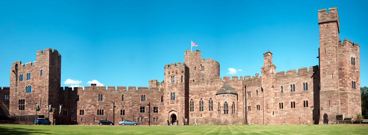
Peckforton ( PEK-fər-tən) is a scattered settlement (centred at SJ538564) and civil parish in the unitary authority of Cheshire East and the ceremonial county of Cheshire, England. The settlement is located 6.5 miles (10.5 km) to the north east of Malpas and 7.5 miles (12.1 km) to the west of Nantwich. The civil parish covers 1,754 acres (710 ha), with an estimated total population of 150 in 2006. The area is predominantly agricultural. Nearby villages include Bulkeley to the south, Beeston to the north, Higher Burwardsley to the west, Spurstow to the east and Bunbury to the north east. The Peckforton Hills form the western part of the civil parish with high points at Peckforton Point (203 metres) and Stanner Nab (200 metres). They are the source of the Weaver and Gowy rivers. Part of Peckforton Woods, largely planted in 1922, form a Site of Special Scientific Interest. The hills have been quarried since the Roman era. Peckforton appears in the Domesday Book survey of 1086. The earliest surviving buildings date from the early 17th century. Peckforton and the adjacent Beeston were part of an estate purchased by John Tollemache, Lord Tollemache in 1840. He had Peckforton Castle – a Victorian mansion designed by Anthony Salvin in imitation of a medieval castle – built at the northern end of the Peckforton ridge. Many of the local buildings were constructed for Lord Tollemache using brick in the 1860s and 1870s as part of the Peckforton Estate.
Excerpt from Wikipedia under CC BY-SA 4.0. See the source article linked in Sources below.
Background
History
The Peckforton Hills were quarried during the Roman era. Peckforton appears in the Domesday Book survey of 1086, when it was held by Wulfric (possibly Wulfric Spot). The survey lists land for two ploughs. Peckforton fell in the ancient parish of Bunbury in the Eddisbury Hundred. Lord Tollemache built Peckforton Castle in 1844–50. Praised as a model landlord, he had over fifty farms and many cottages built on his Cheshire estate, at a cost of around £280,000. Labourers were encouraged to rent 3 acre of land to farm to supplement their income. In 2008, the Tollemache family remained the major landowners in Peckforton, although the castle itself was sold in 1989.
Sourced from Wikipedia under CC BY-SA 4.0.
- Coordinates
- 53.1030, -2.6894
- District
- Cheshire East
- Parish
- Peckforton
- Postcode
- CW6
- Parliamentary constituency
- Chester South and Eddisbury
- Population
- 141
Sources
- wikidata: Q1884360 (CC0)
- wikipedia: Peckforton (CC BY-SA 4.0)
- commons: Elephant+Castle, Peckforton.jpg (CC BY-SA 4.0)
Other places nearby
Loading nearby places…
Nearby
Vineyards · North Wales
Promontory fort east of Peckforton Mere
Promontory fort east of Peckforton Mere — a UK vineyard in wales north, producing English or Welsh wine from cool-climate grape varieties.
 📷 3
📷 3Public art & sculpture · North Wales
Phineas the Pheasant
Phineas the Pheasant — a public art in wales-north, United Kingdom.
 📷 5
📷 5Towns & cities · North Wales
Beeston
Beeston — village and civil parish in Cheshire West, Cheshire, UK.
Vineyards · North Wales
Haycroft
Haycroft — a UK vineyard in wales north, producing English or Welsh wine from cool-climate grape varieties.
 📷 3
📷 3Natural landmarks · North Wales
106:RW
106:RW — a other in wales-north, United Kingdom.
 📷 3
📷 3Castles · North Wales
Peckforton Castle
Peckforton Castle — Grade I listed country house in Peckforton, Cheshire, England, UK.
More towns in this region
 📷 5
📷 5Towns & cities · North Wales
Bangor
Bangor — city in Gwynedd, Wales.
 Flagship📷 3
Towns & cities · North Wales
Beddgelert
Beddgelert — village and community in Gwynedd, Wales.
 Flagship📷 5
Towns & cities · North Wales
Chester
Chester — city in Cheshire, England.
 Flagship📷 3
Towns & cities · North Wales
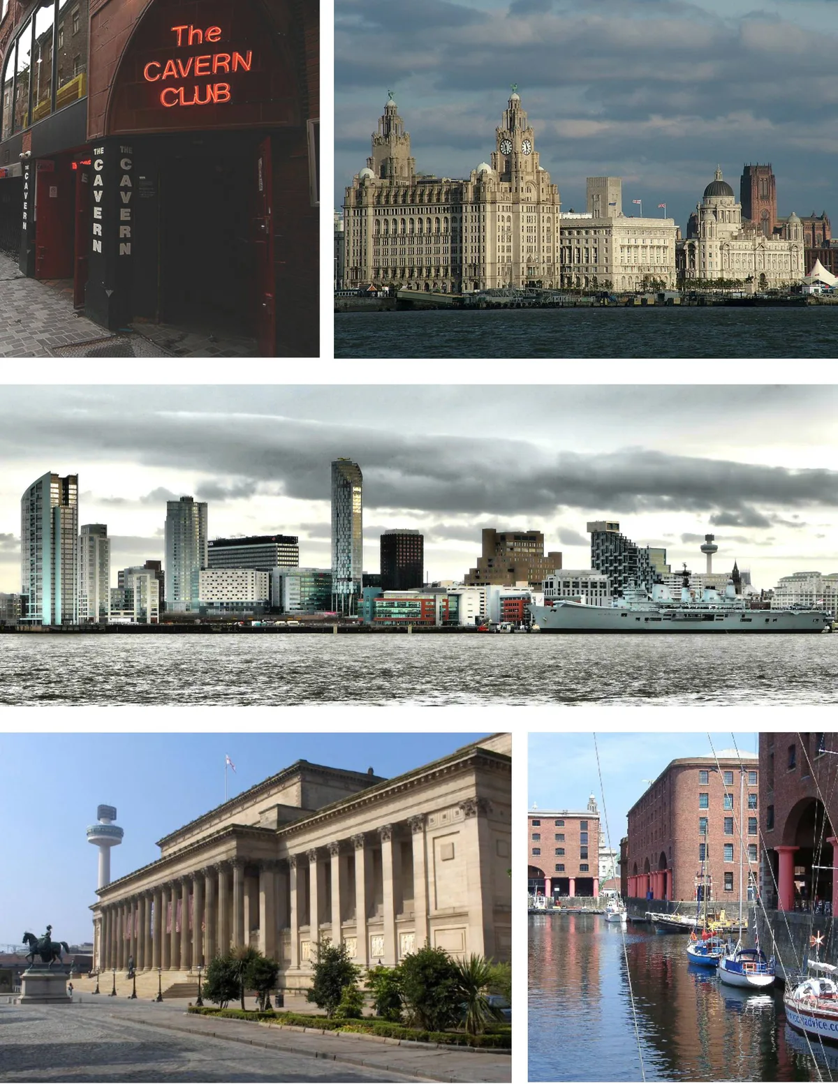
Liverpool
Liverpool — city in Merseyside, England, United Kingdom.
Frequently asked questions
- Where is Peckforton?
- Peckforton is in North Wales, United Kingdom (postcode CW6), in the parish of Peckforton.
- Is Peckforton free to visit?
- Yes, Peckforton is free to enter.
- How do I get to Peckforton?
- Drivers can navigate to postcode CW6. It sits within the Chester South and Eddisbury parliamentary constituency.