Mountains & hills · East Midlands
Oliver Hill
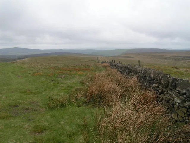
Oliver Hill — Named summit at 513 m.

Wikimedia Commons contributors — see linked file page for photographer and licence licence
Plan your visit
- Typical visit
- 3 h–8 h
- Best time of year
- Late spring – early autumn (May–Oct)
- Nearest railway station
- Buxton Miniature Railway · 6.4 km
- Free entry
- Dog-friendly
About
Oliver Hill is a named summit in the United Kingdom. Wikidata describes it as: "Named summit at 513 m.". Coordinates: 53.2054°, -1.9608°.
Photo gallery
Protected designations
- Site of Special Scientific Interest: Leek Moors SSSI
Designations sourced from Natural England open data under OGL v3.
From the Wikipedia article
Oliver Hill is a hill, 513 metres (1,683 ft) high, in the Peak District in the county of Staffordshire in England. It is a treeless summit surrounded by farmland in the southern part of the Peak District about 6 kilometres (3.7 mi) south-southwest of the town of Buxton. The summit has a tiny cairn near some aerials.
Excerpt from Wikipedia under CC BY-SA 4.0. See the source article linked in Sources below.
- Coordinates
- 53.2054, -1.9608
- County
- Staffordshire
- District
- Staffordshire Moorlands
- Parish
- Quarnford
- Postcode
- SK17 0SN
- Parliamentary constituency
- Staffordshire Moorlands
- Nearest railway station
- Buxton Miniature Railway — 6.4 km
Sources
- osm: n2819455966 (ODbL)
- wikipedia: Oliver Hill (Peak District) (CC BY-SA 4.0)
- commons: Oliver Hill - geograph.org.uk - 504871.jpg (CC BY-SA 4.0)
Other places nearby
Loading nearby places…
Nearby
 📷 3
📷 3Towns & cities · East Midlands
Quarnford
Quarnford — village and civil parish in Staffordshire, UK.
 📷 3
📷 3Mountains & hills · East Midlands
Cheeks Hill
Cheeks Hill — Named summit at 520 m.
_-_geograph.org.uk_-_1518946.jpg?width=1200) 📷 3
📷 3Memorials & monuments · East Midlands
Danebower Colliery ventilation chimney
Danebower Colliery ventilation chimney is a memorial in the United Kingdom.
 📷 3
📷 3Mountains & hills · East Midlands
Axe Edge Moor
Axe Edge Moor — Named summit at 551 m.
 📷 5
📷 5Wildlife reserves · East Midlands
Black Brook
Black Brook — nature reserve in Staffordshire, UK.
 📷 3
📷 3Natural landmarks · East Midlands
Gib Torr Rocks
Gib Torr Rocks — a other in england-east-midlands, United Kingdom.
More mountains in this region
📷 3Mountains & hills · East Midlands
Axe Edge Moor
Axe Edge Moor — Named summit at 551 m.
Mountains & hills · East Midlands
Beacon Hill
Beacon Hill — Named summit at 244.5 m.
Mountains & hills · East Midlands
Beacon Hill
Beacon Hill — Named summit at 105 m.
 📷 3
📷 3Mountains & hills · East Midlands
Black Edge - Summit
Black Edge - Summit — Named summit at 506.7 m.
Frequently asked questions
- Where is Oliver Hill?
- Oliver Hill is in Staffordshire, the East Midlands, United Kingdom (postcode SK17 0SN), in the parish of Quarnford.
- Is Oliver Hill a protected site?
- Yes — Oliver Hill is part of the Leek Moors SSSI Site of Special Scientific Interest.
- Is Oliver Hill free to visit?
- Yes, Oliver Hill is free to enter.
- How do I get to Oliver Hill?
- The nearest railway station is Buxton Miniature Railway, about 6.4 km away. Drivers can navigate to postcode SK17 0SN.