Mountains & hills · East Midlands
Cheeks Hill
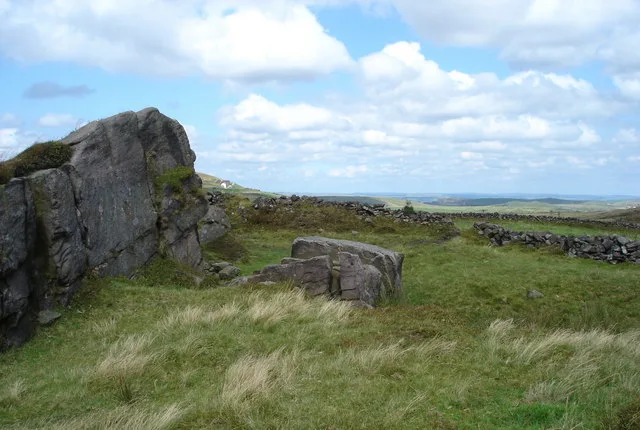
Cheeks Hill — Named summit at 520 m.

Wikimedia Commons contributors — see linked file page for photographer and licence licence
Plan your visit
- Typical visit
- 3 h–8 h
- Best time of year
- Late spring – early autumn (May–Oct)
- Nearest railway station
- Buxton Miniature Railway · 4.5 km
- Free entry
- Dog-friendly
About
Cheeks Hill is a named summit in the United Kingdom. Wikidata describes it as: "Named summit at 520 m.". Coordinates: 53.2262°, -1.9623°.
Photo gallery
Protected designations
- Site of Special Scientific Interest: Leek Moors SSSI
Designations sourced from Natural England open data under OGL v3.
From the Wikipedia article
Cheeks Hill is a hill on Axe Edge Moor in the Peak District, England. It lies just south of the Cat and Fiddle Road near Buxton, and forms part of the border between Derbyshire and Staffordshire. The highest and most northerly point in Staffordshire, at 520 metres (1,710 ft) above sea level, is just south-west of its summit.
Excerpt from Wikipedia under CC BY-SA 4.0. See the source article linked in Sources below.
- Coordinates
- 53.2262, -1.9623
- County
- Staffordshire
- District
- Staffordshire Moorlands
- Parish
- Quarnford
- Postcode
- SK17 0TG
- Parliamentary constituency
- Staffordshire Moorlands
- Nearest railway station
- Buxton Miniature Railway — 4.5 km
Sources
- osm: n2819455965 (ODbL)
- wikipedia: Cheeks Hill (CC BY-SA 4.0)
- commons: Cheeks Hill - geograph.org.uk - 175759.jpg (CC BY-SA 4.0)
Other places nearby
Loading nearby places…
Nearby
 📷 3
📷 3Mountains & hills · East Midlands
Axe Edge Moor
Axe Edge Moor — Named summit at 551 m.
_-_geograph.org.uk_-_1518946.jpg?width=1200) 📷 3
📷 3Memorials & monuments · East Midlands
Danebower Colliery ventilation chimney
Danebower Colliery ventilation chimney is a memorial in the United Kingdom.
 📷 3
📷 3Mountains & hills · East Midlands
Oliver Hill
Oliver Hill — Named summit at 513 m.
 📷 3
📷 3Towns & cities · East Midlands
Quarnford
Quarnford — village and civil parish in Staffordshire, UK.
Caravan parks · East Midlands
Buxton Caravan and Motorhome Club
Buxton Caravan and Motorhome Club — a caravan park in england east midlands.
 📷 5
📷 5Forts · East Midlands
Obelisk at Dog Hole Cottage (Dog Hole Cottage not included)
Obelisk at Dog Hole Cottage (Dog Hole Cottage not included) — a martello broad in england-east-midlands, United Kingdom.
More mountains in this region
📷 3Mountains & hills · East Midlands
Axe Edge Moor
Axe Edge Moor — Named summit at 551 m.
Mountains & hills · East Midlands
Beacon Hill
Beacon Hill — Named summit at 244.5 m.
Mountains & hills · East Midlands
Beacon Hill
Beacon Hill — Named summit at 105 m.
 📷 3
📷 3Mountains & hills · East Midlands
Black Edge - Summit
Black Edge - Summit — Named summit at 506.7 m.
Frequently asked questions
- Where is Cheeks Hill?
- Cheeks Hill is in Staffordshire, the East Midlands, United Kingdom (postcode SK17 0TG), in the parish of Quarnford.
- Is Cheeks Hill a protected site?
- Yes — Cheeks Hill is part of the Leek Moors SSSI Site of Special Scientific Interest.
- Is Cheeks Hill free to visit?
- Yes, Cheeks Hill is free to enter.
- How do I get to Cheeks Hill?
- The nearest railway station is Buxton Miniature Railway, about 4.5 km away. Drivers can navigate to postcode SK17 0TG.