Hill forts · Scottish Lowlands
Milefortlet 17
Milefortlet 17 — milefortlet of the Roman Cumbrian Coast defences.

Wikimedia Commons licence
Plan your visit
- Typical visit
- 1 h–2 h
- Nearest railway station
- Aspatria · 8.0 km
- Free entry
- Dog-friendly
About
Milefortlet 17 is a hill fort in the United Kingdom. Heritage designation: scheduled monument. Part of Hadrian's Wall. Wikidata describes it as: "milefortlet of the Roman Cumbrian Coast defences". Coordinates: 54.7973°, -3.4373°.
Photo gallery
Protected designations
- Site of Special Scientific Interest: Upper Solway Flats & Marshes SSSI
- Area of Outstanding Natural Beauty: Solway Coast
- Ramsar wetland: Upper Solway Flats & Marshes
Designations sourced from Natural England open data under OGL v3.
From the Wikipedia article
Milefortlet 17 (Dubmill Point) was a Milefortlet of the Roman Cumbrian Coast defences. These milefortlets and intervening stone watchtowers extended from the western end of Hadrian's Wall, along the Cumbrian coast and were linked by a wooden palisade. They were contemporary with defensive structures on Hadrian's Wall. There is little to see except a slight depression in the ground, but Milefortlet 17 has been located and surveyed.
Excerpt from Wikipedia under CC BY-SA 4.0. See the source article linked in Sources below.
Background
Description
Milefortlet 17 is situated at Dubmill Point, southwest of the village of Mawbray in the civil parish of Holme St Cuthbert. All that remains to be seen on the ground is a slight depression defining the ditch on the east and south sides. The fortlet was thought to have been lost to coastal erosion, but was located on aerial photographs in 1977. Limited excavations were conducted in 1983, although the only finds were some pottery and nails. A geophysical survey was carried out in 1994 which showed the precise position of the milefortlet, surrounded on three sides by a ditch, with the fourth west side now being overlaid by the modern road.
Sourced from Wikipedia under CC BY-SA 4.0.
- Coordinates
- 54.7973, -3.4373
- District
- Cumberland
- Parish
- Holme St Cuthbert
- Postcode
- CA15 6QJ
- Parliamentary constituency
- Penrith and Solway
- Nearest railway station
- Aspatria — 8 km
- Official site
- historicengland.org.uk
Sources
- wikidata: Q16247483 (CC0)
- wikipedia: Milefortlet 17 (CC BY-SA 4.0)
Other places nearby
Loading nearby places…
Nearby
 📷 3
📷 3Archaeological sites · Scottish Lowlands
Mawbray Sandpit Tower (Coastal Tower 16b)
Mawbray Sandpit Tower (Coastal Tower 16b) — a archaeological in scotland-lowlands, United Kingdom.
Caravan parks · Scottish Lowlands
Old Kiln Farm Caravan Club
Old Kiln Farm Caravan Club — a caravan park in scotland lowlands.
 📷 3
📷 3Public art & sculpture · Scottish Lowlands
Captain Tom Moore
Captain Tom Moore — a public art in scotland-lowlands, United Kingdom.
 📷 3
📷 3Archaeological sites · Scottish Lowlands
Bibra Roman Fort
Bibra Roman Fort — archaeological site in Holme St Cuthbert, Cumberland, Cumbria , England, UK.
Caravan parks · Scottish Lowlands
Rowanbank Caravan Park
Rowanbank Caravan Park — a caravan park in scotland lowlands.
 📷 3
📷 3Hill forts · Scottish Lowlands
Milefortlet 20
Milefortlet 20 — milefortlet of the Roman Cumbrian Coast defences.
More places in this region
 📷 3
📷 3Hill forts · Scottish Lowlands
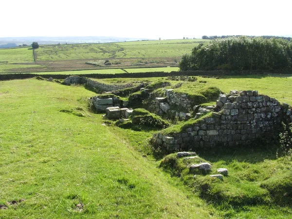
Aesica
Aesica — Roman fort, archaeological site in Northumberland, England, UK.
 📷 3
📷 3Hill forts · Scottish Lowlands
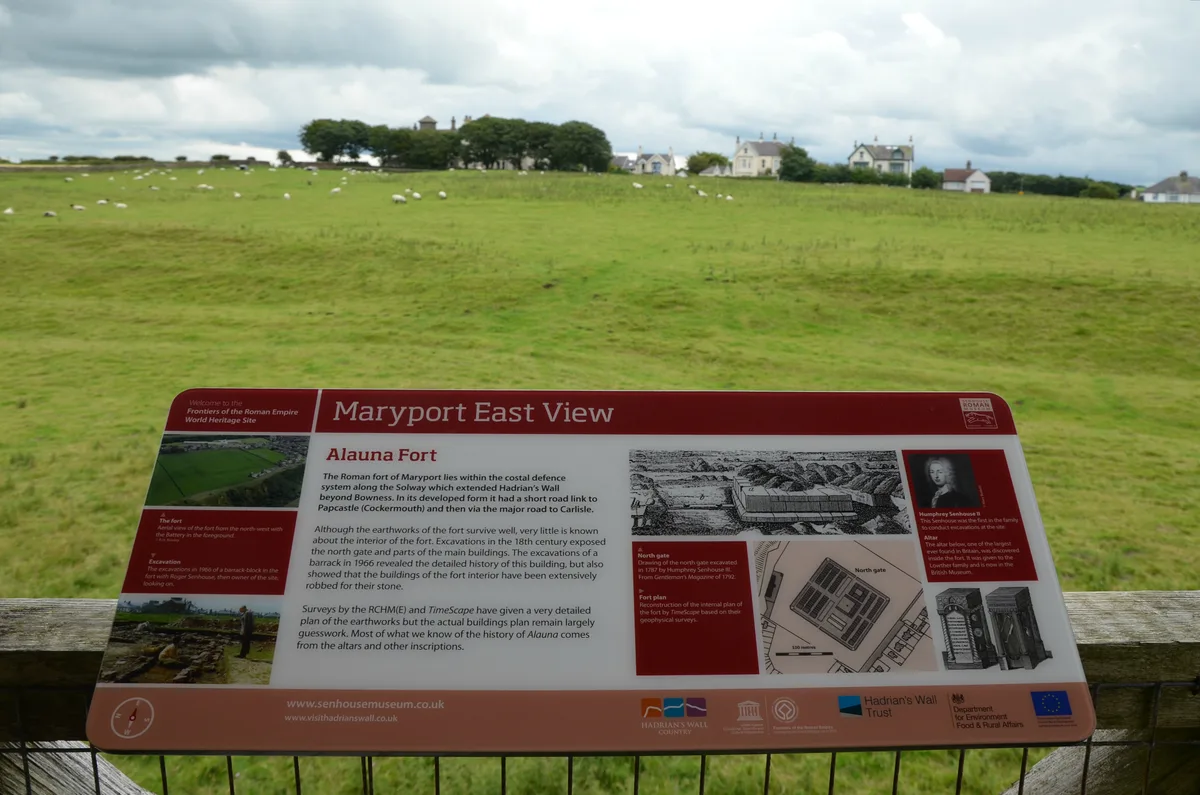
Alauna
Alauna — Roman fort and settlement on the site of present-day Maryport in Cumbria, England, UK.
 📷 4
📷 4Hill forts · Scottish Lowlands
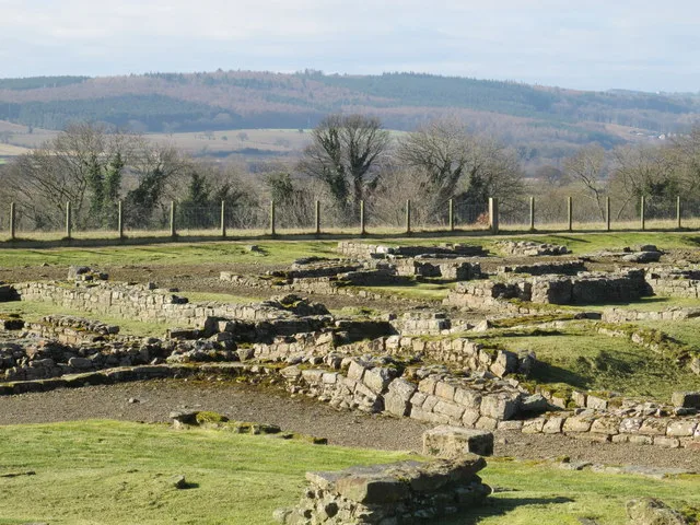
Carrawburgh
Carrawburgh — Roman fort in Northumberland, England, UK.
 📷 3
📷 3Hill forts · Scottish Lowlands
Coria
Coria — archaeological site in Corbridge, Northumberland, England, UK.
Frequently asked questions
- Where is Milefortlet 17?
- Milefortlet 17 is in the Scottish Lowlands, United Kingdom (postcode CA15 6QJ), in the parish of Holme St Cuthbert.
- Is Milefortlet 17 a listed building?
- Milefortlet 17 is officially recognised as scheduled monument listed.
- Is Milefortlet 17 a protected site?
- Yes — Milefortlet 17 is part of the Upper Solway Flats & Marshes SSSI Site of Special Scientific Interest and the Solway Coast National Landscape (AONB).
- Is Milefortlet 17 free to visit?
- Yes, Milefortlet 17 is free to enter.
- How do I get to Milefortlet 17?
- Drivers can navigate to postcode CA15 6QJ. It sits within the Penrith and Solway parliamentary constituency.