Towns & cities · North West England
Lupton
Lupton — village and civil parish in Cumbria, United Kingdom.

Wikimedia Commons contributors — see linked file page for photographer and licence licence
Plan your visit
- Typical visit
- 3 h–6 h
- Nearest railway station
- Oxenholme Lake District · 9.2 km
- Free entry
- Family-friendly
- Dog-friendly
About
Lupton is a town, city, village or settlement in the United Kingdom. Recent population estimates put it at around 162 people. Wikidata describes it as: "village and civil parish in Cumbria, United Kingdom". Coordinates: 54.2250°, -2.6860°.
Photo gallery
From the Wikipedia article
Lupton is a linear village and civil parish in the Westmorland and Furness district of Cumbria, England, along the main A65 road north west of Kirkby Lonsdale, 2.3 miles (3.7 km) from the village of Hutton Roof. In the 2001 census the parish had a population of 165, decreasing slightly at the 2011 census to 162. As well as All Saints Church, the village has a public house, the Plough. Lupton Tower is an 18th-century house now used as a corporate head office.
Excerpt from Wikipedia under CC BY-SA 4.0. See the source article linked in Sources below.
- Coordinates
- 54.2250, -2.6860
- District
- Westmorland and Furness
- Parish
- Lupton
- Postcode
- LA6 1PJ
- Parliamentary constituency
- Morecambe and Lunesdale
- Population
- 162
- Nearest railway station
- Oxenholme Lake District — 9.2 km
Sources
- wikidata: Q615756 (CC0)
- wikipedia: Lupton, Cumbria (CC BY-SA 4.0)
- commons: Lupton Village - geograph.org.uk - 124889.jpg (CC BY-SA 4.0)
Other places nearby
Loading nearby places…
Nearby
 📷 3
📷 3Historic churches · North West England
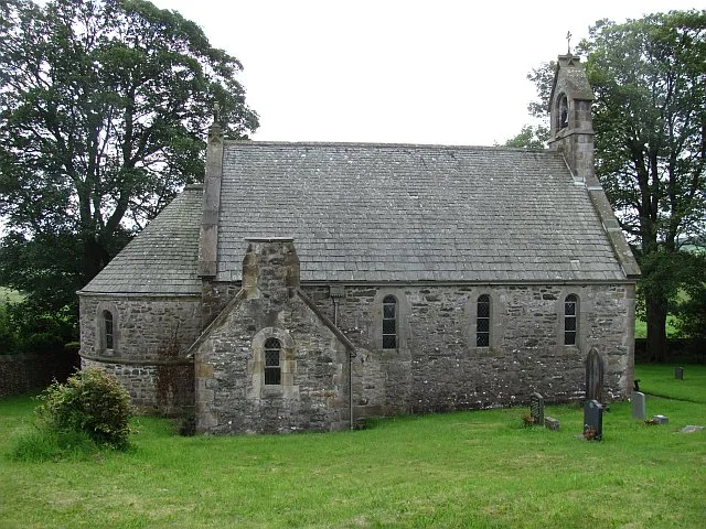
All Saints Church, Lupton
All Saints Church, Lupton — grade II listed church in Lupton, Westmorland and Furness, Cumbria , England, UK.
 📷 3
📷 3Aqueducts · North West England
Aqueduct Carrying Kendal/Lancaster Canal Over Farleton Beck
Aqueduct Carrying Kendal/Lancaster Canal Over Farleton Beck — aqueduct in Beetham, Westmorland and Furness, Cumbria, England, UK.
 📷 3
📷 3Historic bridges · North West England
Farleton Aqueduct
Farleton Aqueduct is a historic bridge in the United Kingdom.
 📷 3
📷 3Historic bridges · North West England
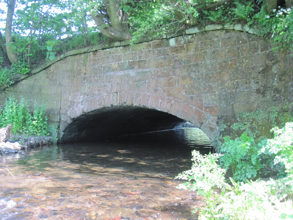
Dovehouses Bridge
Dovehouses Bridge is a historic bridge in the United Kingdom.
 📷 4
📷 4Historic bridges · North West England
Atkinson's Bridge
Atkinson's Bridge is a historic bridge in the United Kingdom.
 📷 3
📷 3Historic bridges · North West England
Atkinson's Bridge Over Kendal/Lancaster Canal
Atkinson's Bridge Over Kendal/Lancaster Canal — Grade II listed building-listed bridge in england-north-west, United Kingdom.
More towns in this region
 Flagship📷 5
Towns & cities · North West England
Aughton
Aughton — village and civil parish within the West Lancashire district of Lancashire, England.
 Flagship📷 5
Towns & cities · North West England
Haigh
Haigh — village and civil parish of the Metropolitan Borough of Wigan in Greater Manchester, England.
 Flagship📷 5
Towns & cities · North West England
Lancaster
Lancaster — county town of Lancashire, England.
 Flagship📷 3
Towns & cities · North West England
Preston
Preston — city and the administrative centre of Lancashire, England.
Frequently asked questions
- Where is Lupton?
- Lupton is in North-West England, United Kingdom (postcode LA6 1PJ), in the parish of Lupton.
- Is Lupton free to visit?
- Yes, Lupton is free to enter.
- How do I get to Lupton?
- Drivers can navigate to postcode LA6 1PJ. It sits within the Morecambe and Lunesdale parliamentary constituency.