Mountains & hills · North West England
Hutton Roof Crags
Hutton Roof Crags — Named summit at 274 m.

Wikimedia Commons contributors — see linked file page for photographer and licence licence
Plan your visit
- Typical visit
- 3 h–8 h
- Best time of year
- Late spring – early autumn (May–Oct)
- Nearest railway station
- Silverdale · 8.3 km
- Free entry
- Dog-friendly
About
Hutton Roof Crags is a named summit in the United Kingdom. Wikidata describes it as: "Named summit at 274 m.". Coordinates: 54.1909°, -2.6820°.
Photo gallery
Protected designations
- Site of Special Scientific Interest: Hutton Roof Crags SSSI
- National Nature Reserve: HUTTON ROOF
Designations sourced from Natural England open data under OGL v3.
From the Wikipedia article
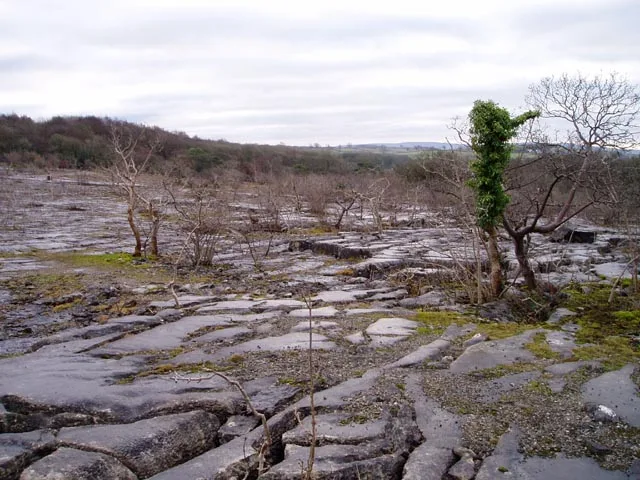
Hutton Roof Crags is a hill in southeastern Cumbria in northwest England, located near to the village of Hutton Roof. It has extensive areas of limestone pavement as well as grassland and woodland. The hill forms the Hutton Roof Crags Site of Special Scientific Interest and is part of the Morecambe Bay Pavements Special Area of Conservation. A significant proportion of the UK's 20 km2 (7.7 sq mi) of limestone pavement is to be found on Hutton Roof Crags and the neighbouring Farleton Knott. Although part of the hill is pasture grazed by sheep and part is forested, much remains open common land, and it is here that most of the limestone pavement is to be found. However, much has been removed over the years for many purposes including building, agricultural fertiliser, and production of millstones, but is now protected by law and it is an offence to remove any. The limestone is over 300 m (980 ft) thick, and was laid down during the Carboniferous period some 350 million years ago. The limestone pavements here occupy an intermediate position between the low-lying pavements of Gait Barrows some 8 km (5.0 mi) to the west, and those on Ingleborough, 19 km (12 mi) to the east. Hutton Roof National Nature Reserve is managed by Cumbria Wildlife Trust, which leases Park Wood and Hutton Roof Common from Natural England and Hutton Roof Parish Council respectively. Plants including angular Solomon's seal (Polygonatum odoratum), limestone fern (Gymnocarpium robertianum), and dark red helleborine (Epipactis atrorubens) are to be found on the pavement. The nationally scarce rigid buckler-fern (Dryopteris submontana) is abundant on Hutton Roof Crags. Blue moor-grass (Sesleria caerulea) is also nationally scarce but abundant here. The name Hutton Roof Crags is believed to derive from the Old English language, and means ‘crags on hill near farmstead of Rolf’. Access is possible via the public footpath running across the north of the fell, but is probably easier through the woods to…
Excerpt from Wikipedia under CC BY-SA 4.0. See the source article linked in Sources below.
- Coordinates
- 54.1909, -2.6820
- District
- Westmorland and Furness
- Parish
- Burton-in-Kendal
- Postcode
- LA6 1NN
- Parliamentary constituency
- Morecambe and Lunesdale
- Nearest railway station
- Silverdale — 8.3 km
Sources
- osm: n31361426 (ODbL)
- wikipedia: Hutton Roof Crags (CC BY-SA 4.0)
- commons: Limestone Pavement on Hutton Roof Crags.jpg (CC BY-SA 4.0)
Featured in this guide
Other places nearby
Loading nearby places…
Nearby
 📷 3
📷 3Cemeteries · North West England
Dalton Woodland Burial Ground
Dalton Woodland Burial Ground is a cemetery in the United Kingdom.
 📷 3
📷 3Memorials & monuments · North West England
Hutton Roof War Memorial
Hutton Roof War Memorial — Grade II listed building-listed memorial in england-north-west, United Kingdom.
 📷 3
📷 3Historic churches · North West England
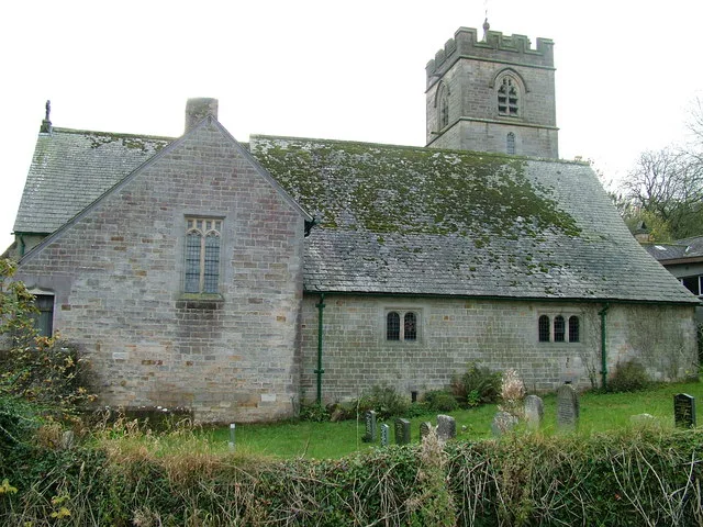
St John's Church, Hutton Roof
St John's Church, Hutton Roof — grade II listed church in Hutton Roof, Westmorland and Furness, Cumbria , England, UK.
 📷 3
📷 3Wildlife reserves · North West England
Clawthorpe Fell
Clawthorpe Fell — nature reserve in Cumbria, England.
 📷 3
📷 3Historic churches · North West England
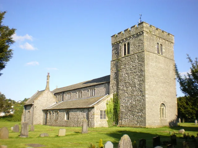
St James' Church, Burton-in-Kendal
St James' Church, Burton-in-Kendal — church in South Lakeland, UK.
Hotels · North West England
Kings Arms Hotel
Kings Arms Hotel — a hotel in england north west.
More mountains in this region
 📷 3
📷 3Mountains & hills · North West England
Allen Crags
Allen Crags — Named summit at 785 m.
 📷 3
📷 3Mountains & hills · North West England
Alum Pot
Alum Pot — Open shaft pothole in North Yorkshire.
 📷 3
📷 3Mountains & hills · North West England
Arnside Knott
Arnside Knott — Named summit at 159 m.
 📷 3
📷 3Mountains & hills · North West England
Aye Gill Pike
Aye Gill Pike — Named summit at 556.3 m.
Frequently asked questions
- Where is Hutton Roof Crags?
- Hutton Roof Crags is in North-West England, United Kingdom (postcode LA6 1NN), in the parish of Burton-in-Kendal.
- Is Hutton Roof Crags a protected site?
- Yes — Hutton Roof Crags is part of the Hutton Roof Crags SSSI Site of Special Scientific Interest and the HUTTON ROOF National Nature Reserve.
- Is Hutton Roof Crags free to visit?
- Yes, Hutton Roof Crags is free to enter.
- How do I get to Hutton Roof Crags?
- Drivers can navigate to postcode LA6 1NN. It sits within the Morecambe and Lunesdale parliamentary constituency.