Mountains & hills · Scottish Highlands
Lunderston Bay
Lunderston Bay — bay in Inverclyde, Scotland, UK.

Wikimedia Commons contributors — see linked file page for photographer and licence licence
Plan your visit
- Typical visit
- 3 h–8 h
- Best time of year
- Late spring – early autumn (May–Oct)
- Nearest railway station
- Inverkip · 1.7 km
- Free entry
- Dog-friendly
About
Lunderston Bay is a named summit in the United Kingdom. Wikidata describes it as: "bay in Inverclyde, Scotland, UK". Coordinates: 55.9209°, -4.8774°.
Photo gallery
From the Wikipedia article
Lunderston Bay is located on the east coast of the Firth of Clyde in Inverclyde, by the A770 road approximately midway between the town of Gourock and the village of Inverkip. The bay measures approximately one mile (1.5 kilometres) from north to south at its widest point. At low tide, most of the shore at the south end of the bay becomes exposed, revealing rocks and shingle. The tidal effect at the sandy beach at the north end of the bay is less visible. The Lunderston Burn enters the Firth of Clyde at the north end of the bay.
Excerpt from Wikipedia under CC BY-SA 4.0. See the source article linked in Sources below.
- Coordinates
- 55.9209, -4.8774
- District
- Inverclyde
- Postcode
- PA16 0DN
- Parliamentary constituency
- Inverclyde and Renfrewshire West
- Nearest railway station
- Inverkip — 1.7 km
Sources
- wikidata: Q3378751 (CC0)
- wikipedia: Lunderston Bay (CC BY-SA 4.0)
- commons: Lunderston Bay - geograph.org.uk - 811037.jpg (CC BY-SA 4.0)
Other places nearby
Loading nearby places…
Nearby
 📷 3
📷 3Castles · Scottish Highlands
Ardgowan Castle
Ardgowan Castle — a castle in scotland-highlands, United Kingdom.
 📷 5
📷 5Towns & cities · Scottish Highlands
Inverkip
Inverkip — village in Inverclyde, Scotland, UK.
 📷 5
📷 5Historic churches · Scottish Highlands
Inverkip Parish Church, Langhouse Road, Inverkip
Inverkip Parish Church, Langhouse Road, Inverkip — category B listed building-listed church in scotland-highlands, United Kingdom.
 📷 5
📷 5Historic churches · Scottish Highlands
burial vault 65m ENE of Kirkbrae House
burial vault 65m ENE of Kirkbrae House — scheduled monument-listed church in scotland-highlands, United Kingdom.
Caravan parks · Scottish Highlands
Cloch Holiday Park
Cloch Holiday Park — a caravan park in scotland highlands.
 📷 3
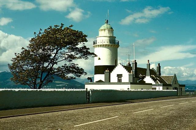
📷 3Lighthouses · Scottish Highlands
Cloch Lighthouse
Cloch Lighthouse — lighthouse on Cloch Point, Inverclyde, Scotland, UK.
More mountains in this region
 📷 3
📷 3Mountains & hills · Scottish Highlands
A' Bhuidheanach Bheag
A' Bhuidheanach Bheag — Named summit at 936 m.
 📷 3
📷 3Mountains & hills · Scottish Highlands
A' Chailleach
A' Chailleach — Named summit at 997 m.
 📷 3
📷 3Mountains & hills · Scottish Highlands
A' Chailleach
A' Chailleach — Named summit at 930 m.
 📷 3
📷 3Mountains & hills · Scottish Highlands
A' Chaoirnich
A' Chaoirnich — Named summit at 875 m.
Frequently asked questions
- Where is Lunderston Bay?
- Lunderston Bay is in the Scottish Highlands, United Kingdom (postcode PA16 0DN).
- Is Lunderston Bay free to visit?
- Yes, Lunderston Bay is free to enter.
- How do I get to Lunderston Bay?
- The nearest railway station is Inverkip, about 1.7 km away. Drivers can navigate to postcode PA16 0DN.