Hill forts · Central Scotland
Holyrood Park
Holyrood Park — park in Edinburgh, Scotland, UK.

Wikimedia Commons contributors — see linked file page for photographer and licence licence
Plan your visit
- Typical visit
- 1 h–2 h
- Nearest railway station
- Edinburgh Waverley · 1.4 km
- Free entry
- Dog-friendly
About
Holyrood Park is a hill fort in the United Kingdom. Records date its origin to 1541. It covers approximately 3 km². Wikidata describes it as: "park in Edinburgh, Scotland, UK". Coordinates: 55.9509°, -3.1680°.
Photo gallery
From Historic Environment Scotland
Holyrood Park’s dramatic hills and crags shape Edinburgh’s unforgettable skyline, and its history and archaeology span thousands of years, from Arthur
Read more on the official property page.
From the Wikipedia article
Holyrood Park (the official name since at least the 1950s, as outlined in the ‘Holyrood Park Regulations 1959’ but also colloquially called the King's Park or Queen's Park depending on the reigning monarch's gender) is a public park in central Edinburgh, Scotland about 1 mile (1.6 kilometres) to the east of Edinburgh Castle. It has an array of hills, lochs, glens, ridges, basalt cliffs, and patches of gorse, providing a wild piece of highland landscape within its 650-acre (260 ha) area. The park is associated with the Palace of Holyroodhouse and was formerly a royal hunting estate. The park was created in 1541 when James V had the ground "circulit about Arthurs Sett, Salisborie and Duddingston craggis" enclosed by a stone wall. Arthur's Seat, an extinct volcano and the highest point in Edinburgh, is at the centre of the park, with the cliffs of Salisbury Crags to the west. There are three lochs: St Margaret's Loch, Dunsapie Loch, and Duddingston Loch. The ruins of St Anthony's Chapel stand above St Margaret's Loch. Queen's Drive is the main route for motor traffic through the Park. St Margaret's Well and St Anthony's Well are both natural springs within the park. Holyrood Park is located to the south-east of the Old Town, at the edge of the city centre. Abbeyhill is to the north, and Duddingston village to the east. The University of Edinburgh's Pollock Halls of Residence are to the south-west, and Dumbiedykes is to the west. Holyrood Park is owned by the Scottish Ministers, apart from the roads which are classed as Crown Property, the whole being managed by Historic Environment Scotland. The whole of Holyrood Park with the exception of the occupied buildings, including the lodges, was made a scheduled monument in 2013. Various archaeological survey has taken place across the site, though findings are not yet fully understood.
Excerpt from Wikipedia under CC BY-SA 4.0. See the source article linked in Sources below.
- Coordinates
- 55.9509, -3.1680
- District
- City of Edinburgh
- Postcode
- EH8 8HG
- Parliamentary constituency
- Edinburgh East and Musselburgh
- Established
- 1541
- Nearest railway station
- Edinburgh Waverley — 1.4 km
- Official site
- www.historicenvironment.scot
Sources
- wikidata: Q2640532 (CC0)
- wikipedia: Holyrood Park (CC BY-SA 4.0)
- commons: Edinburgh Arthur Seat dsc06165.jpg (CC BY-SA 4.0)
Featured in this guide
Other places nearby
Loading nearby places…
Nearby
 📷 3
📷 3Natural landmarks · Central Scotland
Wentworth Elm
Wentworth Elm — a other in scotland-central, United Kingdom.
 ★ Iconic📷 5
Palaces · Central Scotland
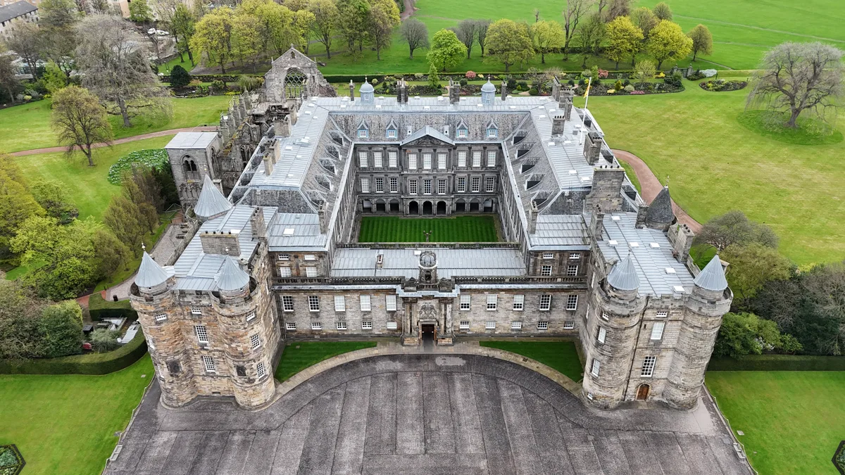
Holyrood Palace
Holyrood Palace — official residence of the British monarch in Scotland.
 📷 5
📷 5Memorials & monuments · Central Scotland
Elsie Inglis
Elsie Inglis — a memorial in scotland-central, United Kingdom.
 📷 3
📷 3Museums · Central Scotland
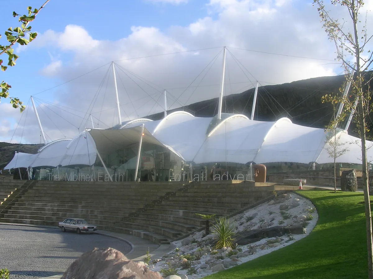
Dynamic Earth
Dynamic Earth — science center in Edinburgh, Scotland.
 📷 5
📷 5Historic churches · Central Scotland
Holyrood Free Church and School, Horse Wynd, Edinburgh
Holyrood Free Church and School, Horse Wynd, Edinburgh — category B listed building-listed church in scotland-central, United Kingdom.
 📷 4
📷 4Galleries · Central Scotland
King's Gallery
King's Gallery — art gallery in Holyrood Palace, Edinburgh.
Other places from this era
More places in this region
 📷 3
📷 3Hill forts · Central Scotland
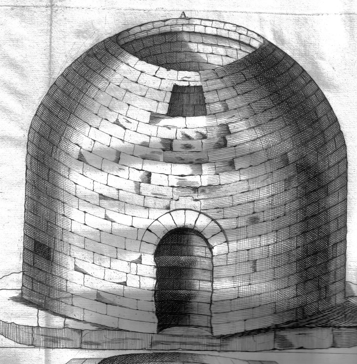
Arthur's O'on temple
Arthur's O'on temple — probable Roman temple near Falkirk, Scotland, destroyed in 1743.
 📷 5
📷 5Hill forts · Central Scotland
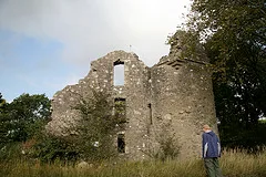
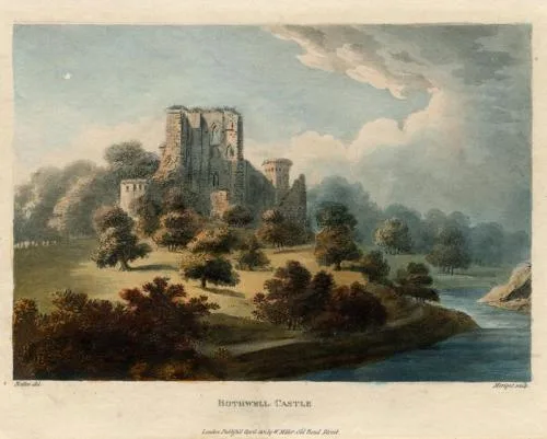
Bothwell Castle
Bothwell Castle — castle in South Lanarkshire, Scotland, UK.
 📷 3
📷 3Hill forts · Central Scotland
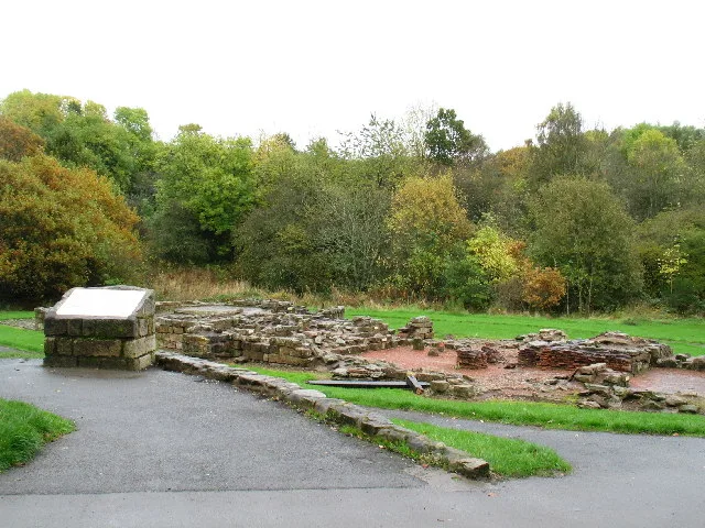
Bothwellhaugh Roman Fort
Bothwellhaugh Roman Fort — architectural structure in North Lanarkshire, Scotland, UK.
 📷 3
📷 3Hill forts · Central Scotland
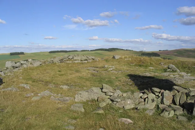
Bow Castle Broch
Bow Castle Broch — archaeological site in Stow, Scottish Borders, Scotland, UK.
Frequently asked questions
- Where is Holyrood Park?
- Holyrood Park is in central Scotland, United Kingdom (postcode EH8 8HG).
- When was Holyrood Park built?
- Built or established in 1541.
- Who owns Holyrood Park?
- Holyrood Park is owned by | status = Open all year.
- Is Holyrood Park free to visit?
- Yes, Holyrood Park is free to enter.
- How do I get to Holyrood Park?
- The nearest railway station is Edinburgh Waverley, about 1.4 km away. Drivers can navigate to postcode EH8 8HG.