Hill forts · Scottish Highlands
Castra Pinnata
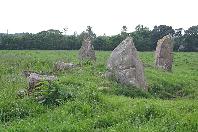
Castra Pinnata is a hill fort in the United Kingdom.

Wikimedia Commons contributors — see linked file page for photographer and licence licence
_p%C3%A5_tre_sidor..jpg)
Plan your visit
- Typical visit
- 1 h–2 h
- Nearest railway station
- Dunkeld and Birnam · 9.6 km
- Free entry
- Dog-friendly
About
Castra Pinnata is a hill fort in the United Kingdom. Part of Gask Ridge. Coordinates: 56.5410°, -3.4240°. This entry is part of The Great Britain Guide, a free, ad-free, open-data tourist directory.
Photo gallery
From the Wikipedia article
Inchtuthil is the site of a Roman legionary fortress situated on a natural platform overlooking the north bank of the River Tay southwest of Blairgowrie, Perth and Kinross, Scotland (Roman Caledonia). It was built in AD 82 or 83 as the advance headquarters for the forces of governor Gnaeus Julius Agricola in his campaign against the Caledonian tribes. Positioned at the head of one of the main routes in and out of the Scottish Highlands, it was occupied by Legion XX Valeria Victrix and covered a total area of 21.5 hectares (53 acres). Construction of the large fortress would have taken two or three seasons and a temporary camp was built nearby to house and protect the soldiers over the winter. Additional, smaller forts were built further north and south at the mouth of each nearby glen forming what are now referred to as the Glenblocker forts. The fort at Inchtuthil is thought to be part of the Glenblocker forts, as well as others in Strathmore, such as Cardean and Stracathro, formed a uniform system composed of several elements, the forts and watchtowers on the Roman road of the Gask Ridge, the Glenblockers and the Strathmore forts. Inchtuthil as the largest military base would have functioned as the lynch-pin and the only site large enough to launch an invasion into the Highlands and beyond.
Excerpt from Wikipedia under CC BY-SA 4.0. See the source article linked in Sources below.
Background
Architecture
Unlike other legionary fortresses in Britain, Inchtuthil was not later built over and its layout was still largely preserved when Sir Ian Richmond excavated it between 1952 and 1965. It is therefore notable as the site which provides the only complete plan of a legionary fortress anywhere in the Roman empire. Its defences consisted of a turf rampart faced with stone, with an outside ditch and gatehouses on each side, following the standard Roman plan. The legion it accommodated would have numbered 5,400 at full strength, though there would have been additional specialist troops accompanying them. Facilities included a hospital () that covered 5,000 m2, a workshop covering 3,500 m2, and 64…
Sourced from Wikipedia under CC BY-SA 4.0.
- Coordinates
- 56.5410, -3.4240
- District
- Perth and Kinross
- Postcode
- PH1 4LD
- Parliamentary constituency
- Angus and Perthshire Glens
- Nearest railway station
- Dunkeld and Birnam — 9.6 km
- Official site
- www.trove.scot
Sources
- wikidata: Q2309575 (CC0)
- wikipedia: Inchtuthil (CC BY-SA 4.0)
- commons: Den arkeologiske lämningen av fortet Inchtuthill med kant och upphöjt läge, floden Tay flyter (utanför bild) på tre sidor..jpg (CC BY-SA 4.0)
Other places nearby
Loading nearby places…
Nearby

Archaeological sites · Scottish Highlands
Inchtuthil
Inchtuthil — a archaeological in scotland-highlands, United Kingdom.
 📷 3
📷 3Archaeological sites · Scottish Highlands
The Redoubt
The Redoubt — a archaeological in scotland-highlands, United Kingdom.
Vineyards · Scottish Highlands
Inchtuthil
Inchtuthil — a UK vineyard in scotland highlands, producing English or Welsh wine from cool-climate grape varieties.
 📷 3
📷 3Archaeological sites · Scottish Highlands
Inchtuthil, Fort
Inchtuthil, Fort — a archaeological in scotland-highlands, United Kingdom.
 📷 3
📷 3Archaeological sites · Scottish Highlands
Derry Mill
Derry Mill — a archaeological in scotland-highlands, United Kingdom.
 📷 3
📷 3Memorials & monuments · Scottish Highlands
Sir Alexander Muir Mackenzie Memorial
Sir Alexander Muir Mackenzie Memorial — a memorial in scotland-highlands, United Kingdom.
More places in this region
 📷 3
📷 3Hill forts · Scottish Highlands
Aquhorthies stone circle
Aquhorthies stone circle — architectural structure in Aberdeenshire, Scotland, UK.
 📷 3
📷 3Hill forts · Scottish Highlands
Auchagallon Stone Circle
Auchagallon Stone Circle — archaeological site in North Ayrshire, Scotland, UK.
 📷 3
📷 3Hill forts · Scottish Highlands
Auchinhove
Auchinhove — archaeological site in Moray, Scotland, UK.
 📷 3
📷 3Hill forts · Scottish Highlands
Balbridie
Balbridie — Neolithic timber hall remains in Aberdeenshire, Scotland, UK.
Frequently asked questions
- Where is Castra Pinnata?
- Castra Pinnata is in the Scottish Highlands, United Kingdom (postcode PH1 4LD).
- Is Castra Pinnata free to visit?
- Yes, Castra Pinnata is free to enter.
- How do I get to Castra Pinnata?
- Drivers can navigate to postcode PH1 4LD. It sits within the Angus and Perthshire Glens parliamentary constituency.