Natural landmarks · North West England
Grain Pole Hill
Grain Pole Hill — mountain in United Kingdom.

Wikimedia Commons licence
Plan your visit
- Typical visit
- 1 h–2 h
- Nearest railway station
- Chorley · 3.8 km
- Free entry
- Dog-friendly
About
Grain Pole Hill is a named natural landmark in the United Kingdom. Wikidata describes it as: "mountain in United Kingdom". Coordinates: 53.6571°, -2.5704°.
Photo gallery
Protected designations
- Site of Special Scientific Interest: West Pennine Moors SSSI
Designations sourced from Natural England open data under OGL v3.
From the Wikipedia article
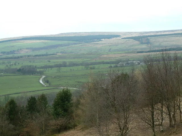
Grain Pole Hill is a location on Anglezarke Moor, near Chorley, within the West Pennine Moors of Lancashire, England. With a height of 285 metres (935 ft), the summit provides views towards the Irish Sea. It is located between Round Loaf and Pikestones, both of which are Neolithic remnants. Hurst Hill is less than half a mile away.
Excerpt from Wikipedia under CC BY-SA 4.0. See the source article linked in Sources below.
- Coordinates
- 53.6571, -2.5704
- County
- Lancashire
- District
- Chorley
- Parish
- Anglezarke
- Postcode
- PR6 9DG
- Parliamentary constituency
- Chorley
- Nearest railway station
- Chorley — 3.8 km
Sources
- wikidata: Q5593499 (CC0)
- wikipedia: Grain Pole Hill (CC BY-SA 4.0)
Other places nearby
Loading nearby places…
Nearby
 📷 3
📷 3Natural landmarks · North West England
Hurst Hill
Hurst Hill — mountain in United Kingdom.
 📷 3
📷 3Hill forts · North West England
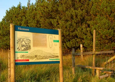
Pikestones
Pikestones — chambered cairn in Anglezarke, Lancashire, England, UK.
 📷 3
📷 3Follies · North West England
Pikestones
Pikestones — Historic tomb, BC 3400-2400.
 📷 3
📷 3Historic houses · North West England
Coppice Stile House
Coppice Stile House — a historic house in england-north-west, United Kingdom.
 📷 3
📷 3Reservoirs & lochs · North West England
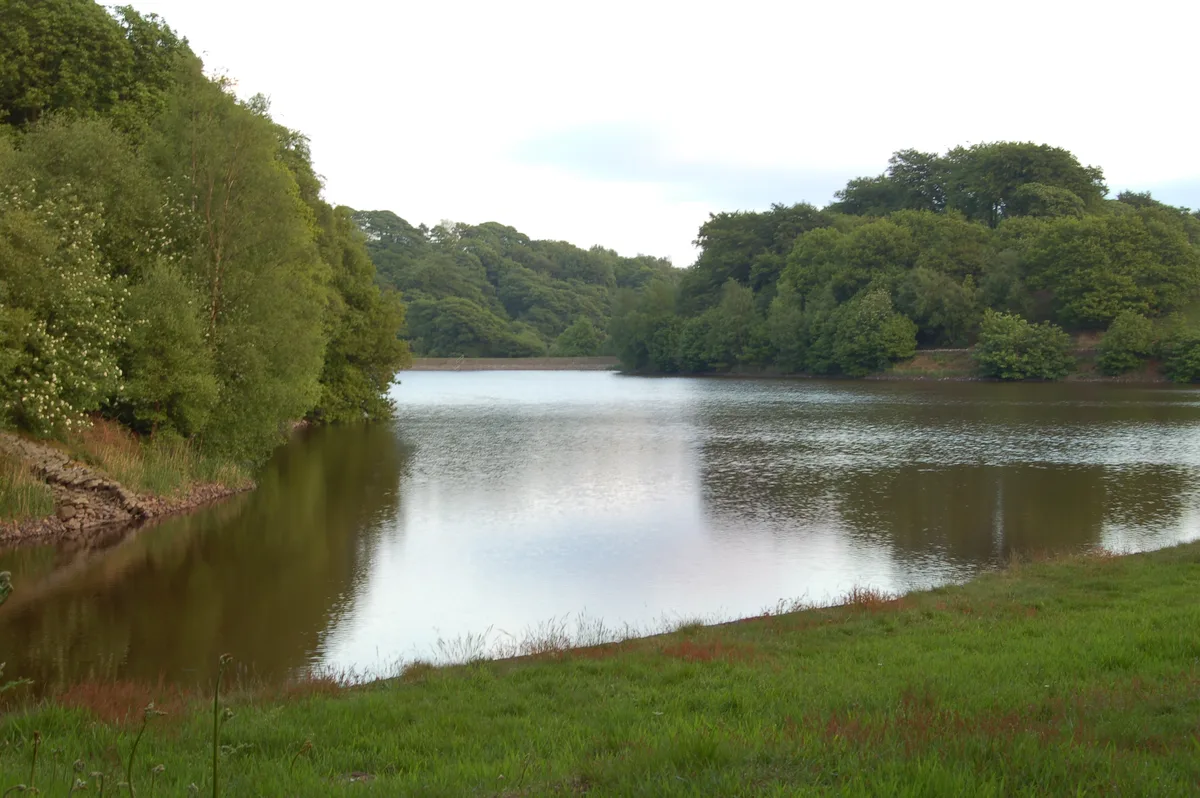
High Bullough Reservoir
High Bullough Reservoir — reservoir in Lancashire, England, UK.
 📷 3
📷 3Historic houses · North West England
Grimes
Grimes — a historic house in england-north-west, United Kingdom.
More natural landmarks in this region
 ★ Iconic📷 4
Natural landmarks · North West England
Coniston Water
Lake District lake — Swallows and Amazons setting and Donald Campbell water-speed history.
 📷 3
📷 3Natural landmarks · North West England
Elter Water
Elter Water — lake in the United Kingdom.
 📷 3
📷 3Natural landmarks · North West England
Esthwaite Water
Esthwaite Water — lake in the United Kingdom.
 Flagship📷 5
Natural landmarks · North West England
Semerwater
Semerwater — lake in North Yorkshire, England, UK.
Frequently asked questions
- Where is Grain Pole Hill?
- Grain Pole Hill is in Lancashire, North-West England, United Kingdom (postcode PR6 9DG), in the parish of Anglezarke.
- Is Grain Pole Hill a protected site?
- Yes — Grain Pole Hill is part of the West Pennine Moors SSSI Site of Special Scientific Interest.
- Is Grain Pole Hill free to visit?
- Yes, Grain Pole Hill is free to enter.
- How do I get to Grain Pole Hill?
- The nearest railway station is Chorley, about 3.8 km away. Drivers can navigate to postcode PR6 9DG.