Hill forts · North West England
Round Loaf
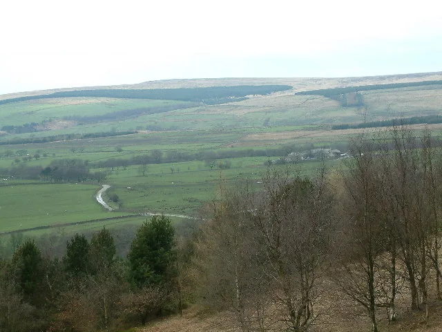
Round Loaf — bowl barrow in Anglezarke, Chorley, England, UK.

Wikimedia Commons contributors — see linked file page for photographer and licence licence
Plan your visit
- Typical visit
- 1 h–2 h
- Nearest railway station
- Chorley · 5.2 km
- Free entry
- Dog-friendly
About
Round Loaf is a hill fort in the United Kingdom. Heritage designation: scheduled monument. Wikidata describes it as: "bowl barrow in Anglezarke, Chorley, England, UK". Coordinates: 53.6592°, -2.5493°.
Photo gallery
Protected designations
- Site of Special Scientific Interest: West Pennine Moors SSSI
Designations sourced from Natural England open data under OGL v3.
From the Wikipedia article
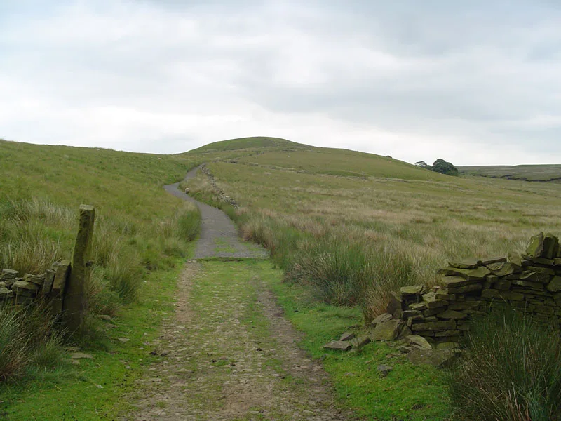
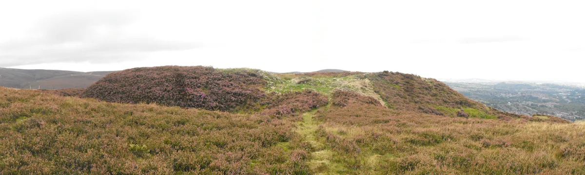
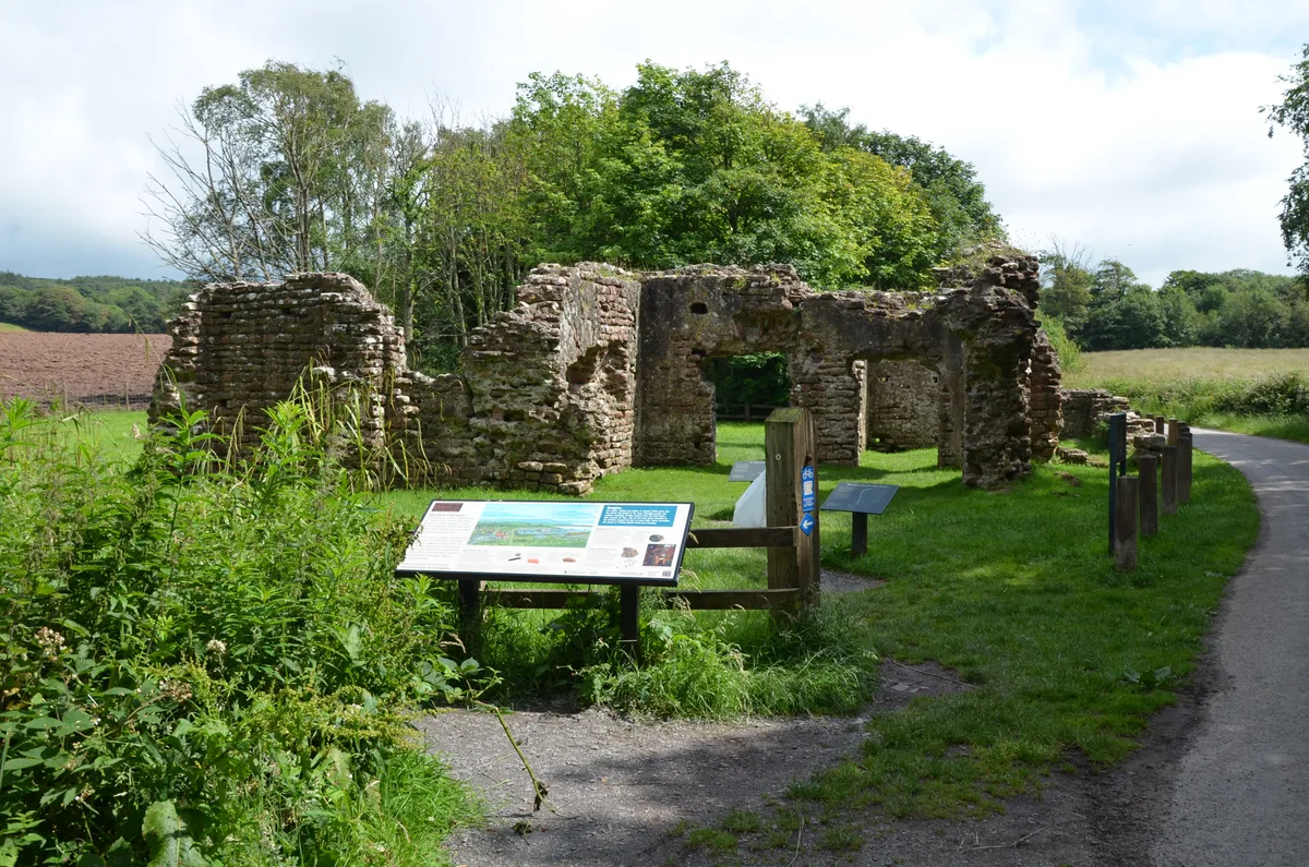
Round Loaf is a Late Neolithic or Bronze Age tumulus on Anglezarke Moor in the West Pennine Moors near Chorley in Lancashire, England. The bowl barrow is a scheduled monument considered to be of national importance. It was first scheduled in March 1954. The structure is aligned between Great Hill and Pikestones.
Excerpt from Wikipedia under CC BY-SA 4.0. See the source article linked in Sources below.
Background
History
Round Loaf is one of 10,000 bowl barrows constructed between the Late Neolithic period and the late-Bronze Age (2400 - 1500 BC). They are funerary monuments in the form of earth or rubble mounds covering single or multiple burials. Some were surrounded by a ditch. Some are in isolated locations as is Round Loaf and some are grouped in cemeteries. They vary in size and regional variations show a range of different burial practices.
Description
Round Loaf occupies a prominent landmark position on Anglezarke Moor. Some erosion has occurred on its summit. It has not been excavated and its archaeology is possibly undisturbed. The ancient monument includes an oval mound measuring 73 metres from north to south and 66 metres from east to west. It is constructed of earth and small stones to a height of from 3.6 to 5.5 metres. Flakes of flint have been found on the mound's summit.
Sourced from Wikipedia under CC BY-SA 4.0.
- Coordinates
- 53.6592, -2.5493
- Address
- Near Anglezarke and Chorley
- Nearest railway station
- Chorley — 5.2 km
- Official site
- historicengland.org.uk
Sources
- wikidata: Q4390932 (CC0)
- wikipedia: Round Loaf (CC BY-SA 4.0)
- commons: Roundloafcairn.jpg (CC BY-SA 4.0)
Other places nearby
Loading nearby places…
Nearby
 📷 3
📷 3Follies · North West England
Round Loaf
Round Loaf is a folly in the United Kingdom.
 📷 3
📷 3Natural landmarks · North West England
Hurst Hill
Hurst Hill — mountain in United Kingdom.
 📷 3
📷 3Historic houses · North West England
Grimes
Grimes — a historic house in england-north-west, United Kingdom.
 📷 3
📷 3Natural landmarks · North West England
Great Hill
Great Hill — mountain in United Kingdom.
 📷 3
📷 3Historic houses · North West England
Coppice Stile House
Coppice Stile House — a historic house in england-north-west, United Kingdom.
 📷 3
📷 3Natural landmarks · North West England
Grain Pole Hill
Grain Pole Hill — mountain in United Kingdom.
More places in this region
 📷 5
📷 5Hill forts · North West England
Buckton Castle
Buckton Castle — 12th-century castle in Mossley, Greater Manchester, England, UK.
 📷 3
📷 3Hill forts · North West England
Glannoventa
Glannoventa — Roman fort and settlement.
 📷 5
📷 5Hill forts · North West England
Hoghton Tower
Hoghton Tower — Grade I listed house in Hoghton, Lancashire, England, United Kingdom.
 📷 5
📷 5Hill forts · North West England
Ravenglass Roman Bath House
Ravenglass Roman Bath House — archaeological site at Ravenglass, United Kingdom.
Frequently asked questions
- Where is Round Loaf?
- Round Loaf is in North-West England, United Kingdom.
- Is Round Loaf a listed building?
- Round Loaf is officially recognised as scheduled monument listed.
- Is Round Loaf a protected site?
- Yes — Round Loaf is part of the West Pennine Moors SSSI Site of Special Scientific Interest.
- Is Round Loaf free to visit?
- Yes, Round Loaf is free to enter.
- How do I get to Round Loaf?
- The nearest railway station is Chorley, about 5.2 km away.