Mountains & hills · North Wales
Glyder Fawr
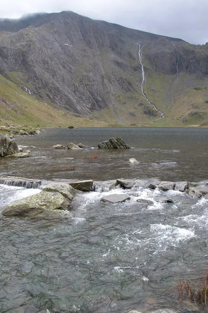
Glyder Fawr — Named summit at 1000.8 m.

Wikimedia Commons contributors — see linked file page for photographer and licence licence
Plan your visit
- Typical visit
- 3 h–8 h
- Best time of year
- Late spring – early autumn (May–Oct)
- Nearest railway station
- Rocky Valley Halt · 3.9 km
- Free entry
- Dog-friendly
About
Glyder Fawr is a named summit in the United Kingdom. Wikidata describes it as: "Named summit at 1000.8 m.". Coordinates: 53.1015°, -4.0291°.
Photo gallery
From the Wikipedia article
Glyder Fawr is a mountain in Snowdonia, Wales, the highest peak in the Glyderau range at just over 1,000 metres. It is the fifth-highest mountain in Wales and has several walking and scrambling routes leading to its summit. According to Sir Ifor Williams, the word "Glyder" derives from the Welsh word "Gludair", meaning a heap of stones.
Excerpt from Wikipedia under CC BY-SA 4.0. See the source article linked in Sources below.
- Coordinates
- 53.1015, -4.0291
- Address
- Gwynedd / Conwy, Wales
- Nearest railway station
- Rocky Valley Halt — 3.9 km
Sources
- osm: n29580545 (ODbL)
- wikipedia: Glyder Fawr (CC BY-SA 4.0)
- commons: Glyder Fawr - geograph.org.uk - 173767.jpg (CC BY-SA 4.0)
Other places nearby
Loading nearby places…
Nearby
 📷 3
📷 3Natural landmarks · North Wales
Glyder Fawr
Glyder Fawr — mountain (1000.9m) in Gwynedd.
 📷 3
📷 3Viewpoints · North Wales
Twll Du
Twll Du is a viewpoint in the United Kingdom.
 📷 5
📷 5Mountains & hills · North Wales
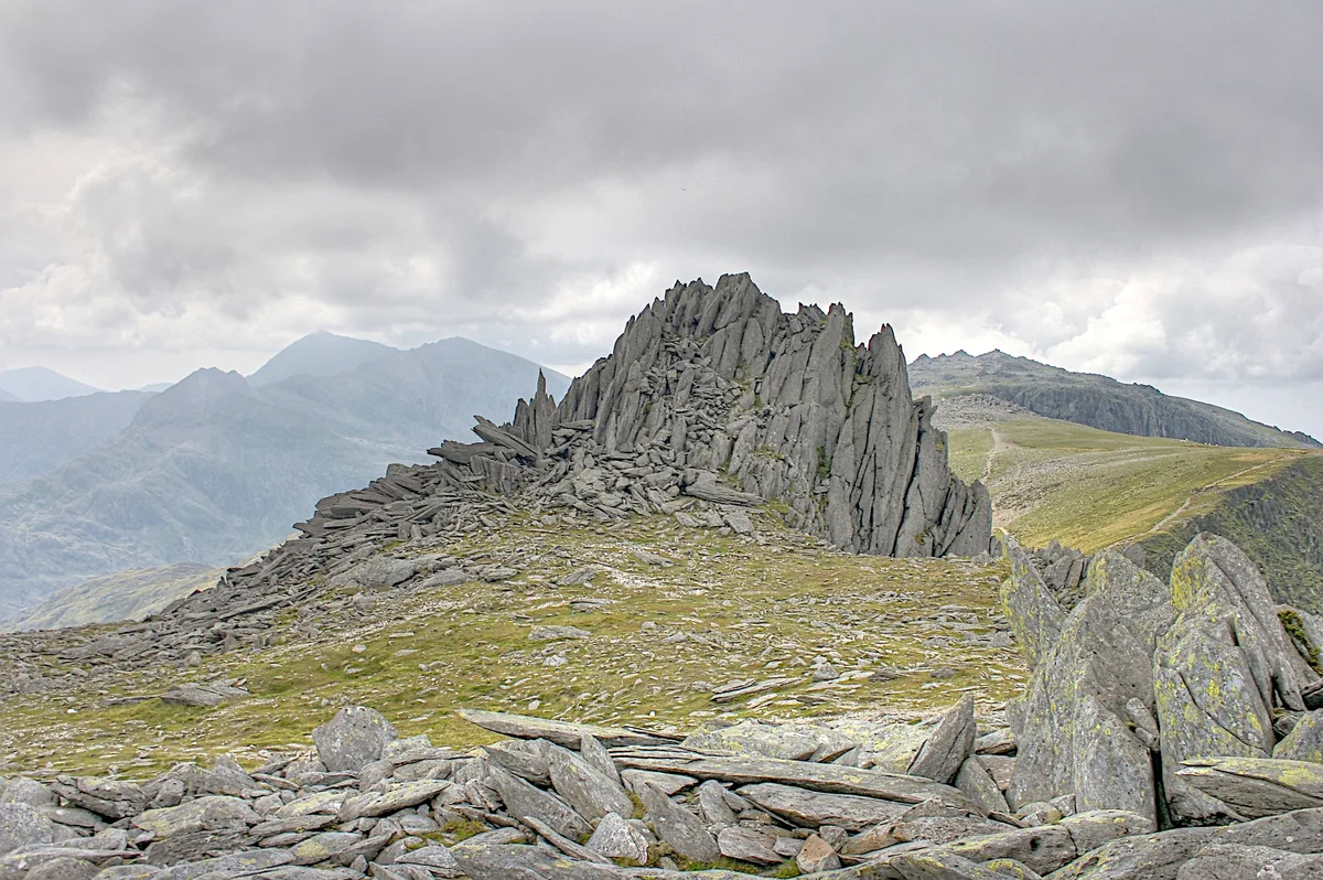
Castell Y Gwynt
Castell Y Gwynt — Named summit at 972 m.
 📷 5
📷 5Natural landmarks · North Wales
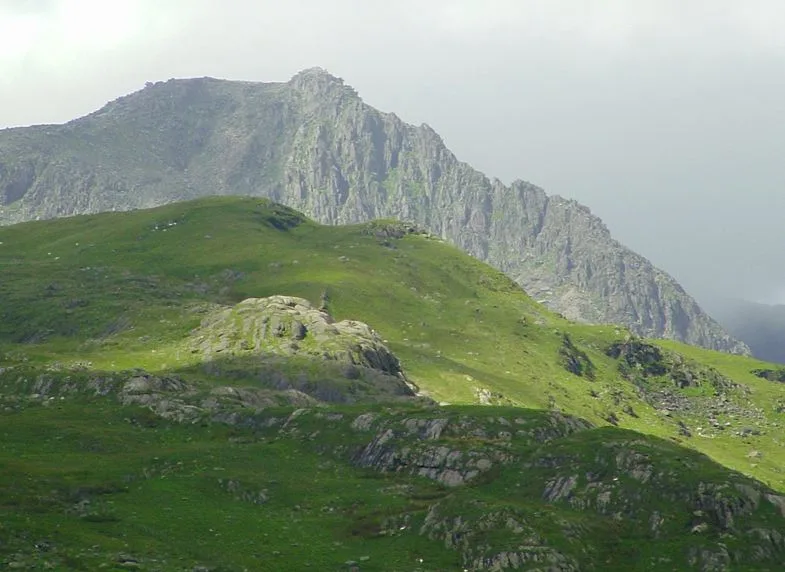
Glyder Fach
Glyder Fach — mountain (994.3m) in Conwy County Borough.
 📷 5
📷 5Mountains & hills · North Wales
Glyder Fach
Glyder Fach — Named summit at 994 m.
 📷 3
📷 3Natural landmarks · North Wales
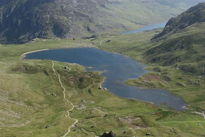
Llyn Idwal
Llyn Idwal — lake in Cwm Idwal, Conwy County Borough, Wales.
More mountains in this region
 📷 5
📷 5Mountains & hills · North Wales
Cemlyn Bay and lagoon
Cemlyn Bay and lagoon — Site of Special Scientific Interest in Wales.
 📷 3
📷 3Mountains & hills · North Wales
Aberffraw Bay
Aberffraw Bay — bay on the west coast of Anglesey, in Wales, UK.
 📷 3
📷 3Mountains & hills · North Wales
Allt-fawr
Allt-fawr — Named summit at 698 m.
 📷 3
📷 3Mountains & hills · North Wales
Aran Benllyn
Aran Benllyn — Named summit at 884 m.
Frequently asked questions
- Where is Glyder Fawr?
- Glyder Fawr is in North Wales, United Kingdom.
- Is Glyder Fawr free to visit?
- Yes, Glyder Fawr is free to enter.
- How do I get to Glyder Fawr?
- The nearest railway station is Rocky Valley Halt, about 3.9 km away.