Natural landmarks · North Wales
Glyder Fach
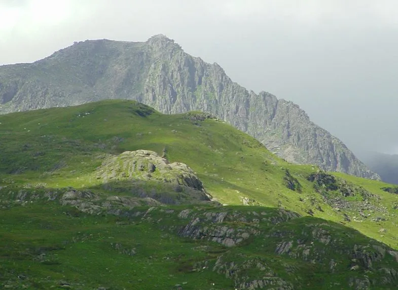
Glyder Fach — mountain (994.3m) in Conwy County Borough.

Wikimedia Commons contributors — see linked file page for photographer and licence licence
Plan your visit
- Typical visit
- 1 h–2 h
- Nearest railway station
- Clogwyn · 5.3 km
- Free entry
- Dog-friendly
About
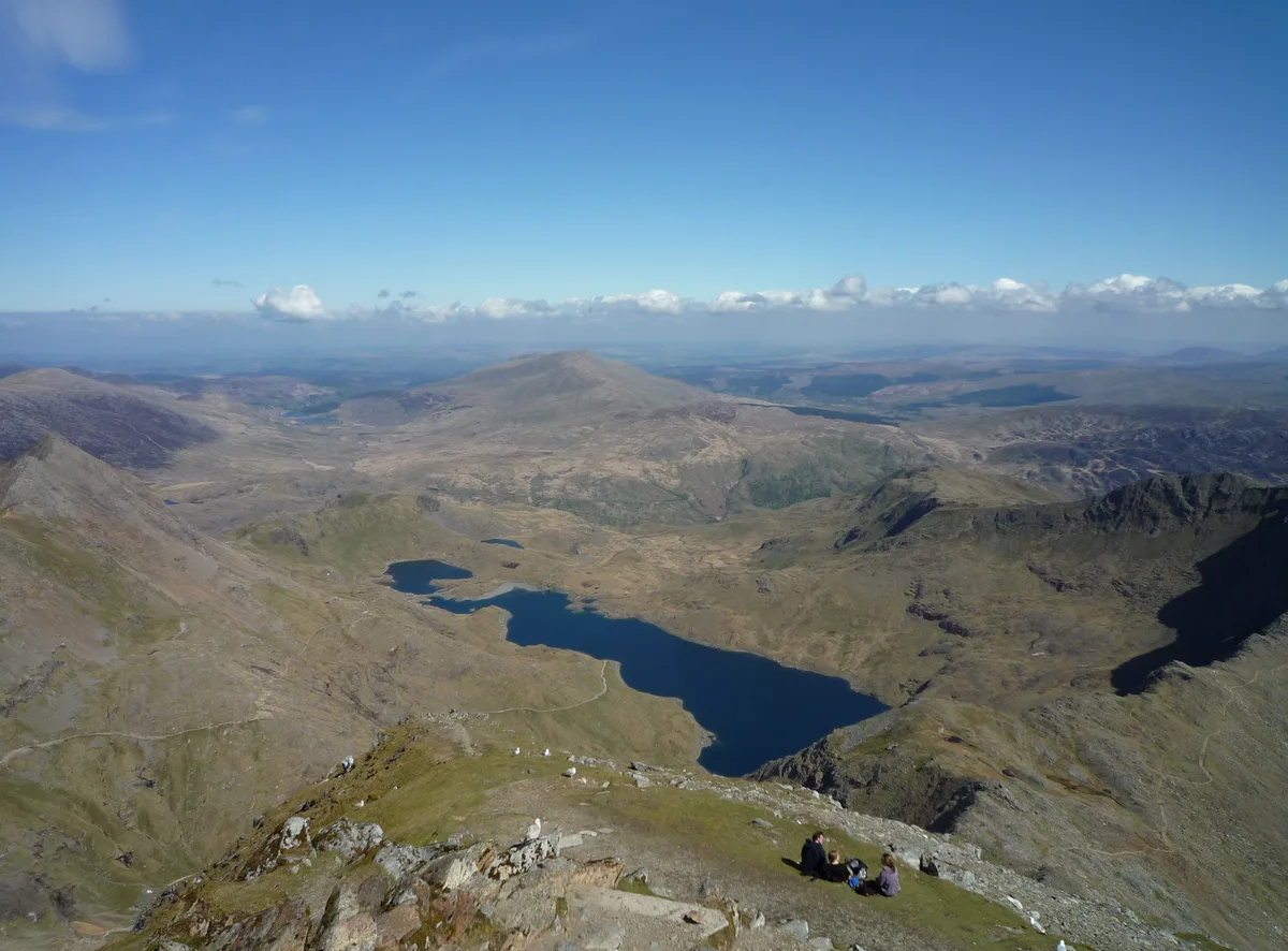
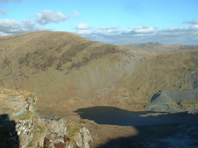
Glyder Fach is a named natural landmark in the United Kingdom. Wikidata describes it as: "mountain (994.3m) in Conwy County Borough". Coordinates: 53.1048°, -4.0084°.
Photo gallery
From the Wikipedia article
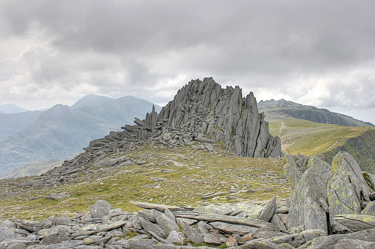
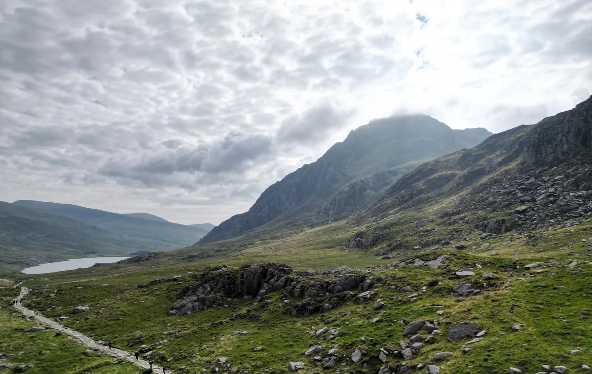
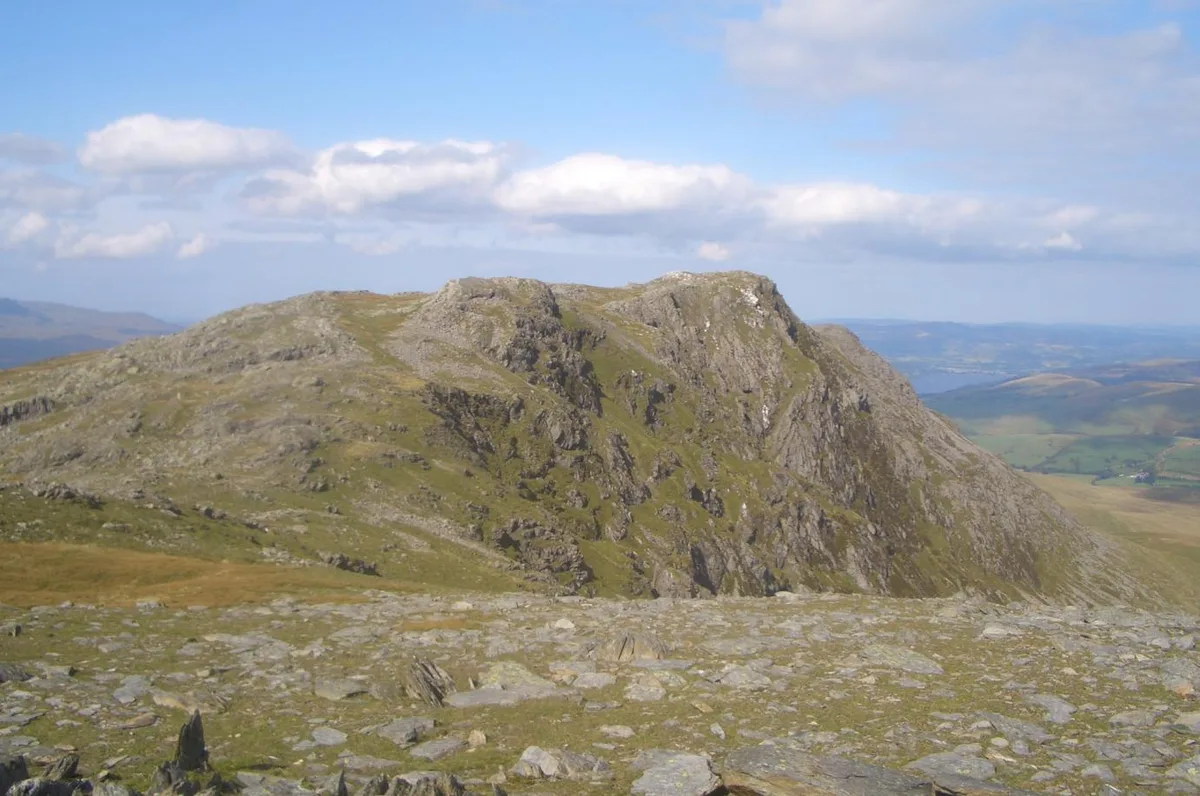
Glyder Fach is a mountain in Snowdonia, north-west Wales, and is the second highest of the Glyderau and the sixth highest in Wales. Routes to the summit lead from Tryfan and Bristly Ridge to the north, via Glyder Fawr from Pen-y-Pass to the south, and along the Glyder ridge to the east, towards Capel Curig. It is a popular spot for climbers. According to Sir Ifor Williams, the word "Glyder" derives from the Welsh word "Gludair", meaning a heap of stones. Situated near the summit is Y Gwyliwr, a large rock which from the correct angle appears to be precariously balanced, making it a popular place for photographs. (The name means 'The Sentinel', but is usually anglicised as The Cantilever.) Another notable feature, west of the summit, is Castell y Gwynt, a spiky rocky outcrop.
Excerpt from Wikipedia under CC BY-SA 4.0. See the source article linked in Sources below.
- Coordinates
- 53.1048, -4.0084
- Address
- Snowdonia, Wales
- Nearest railway station
- Clogwyn — 5.3 km
Sources
- wikidata: Q5572805 (CC0)
- wikipedia: Glyder Fach (CC BY-SA 4.0)
- commons: Glyder Fach from Gallt yr Ogof.jpg (CC BY-SA 4.0)
Other places nearby
Loading nearby places…
Nearby
 📷 5
📷 5Mountains & hills · North Wales
Glyder Fach
Glyder Fach — Named summit at 994 m.
 📷 5
📷 5Mountains & hills · North Wales
Castell Y Gwynt
Castell Y Gwynt — Named summit at 972 m.
 📷 4
📷 4Mountains & hills · North Wales
Tryfan
Tryfan — Named summit at 917.5 m.
 📷 4
📷 4Natural landmarks · North Wales
Tryfan
Tryfan — mountain (917.5m) in Conwy County Borough.
 📷 3
📷 3Mountains & hills · North Wales
Glyder Fawr
Glyder Fawr — Named summit at 1000.8 m.
 📷 3
📷 3Natural landmarks · North Wales
Glyder Fawr
Glyder Fawr — mountain (1000.9m) in Gwynedd.
More natural landmarks in this region
 Flagship📷 5
Natural landmarks · North Wales
Llyn Llydaw
Llyn Llydaw is a natural landmark in the United Kingdom.
 📷 5
📷 5Natural landmarks · North Wales
Llyn Tegid
Llyn Tegid is a natural landmark in the United Kingdom.
 📷 3
📷 3Natural landmarks · North Wales
Allt-fawr
Allt-fawr — mountain (698m) in Gwynedd, Wales.
 📷 3
📷 3Natural landmarks · North Wales
Aran Benllyn
Aran Benllyn — mountain (885m) in Gwynedd.
Frequently asked questions
- Where is Glyder Fach?
- Glyder Fach is in North Wales, United Kingdom.
- Is Glyder Fach free to visit?
- Yes, Glyder Fach is free to enter.
- How do I get to Glyder Fach?
- The nearest railway station is Clogwyn, about 5.3 km away.