Museums · South West England
Glastonbury
Glastonbury ( GLAST-ən-bər-ee, UK also GLAHST-) is a town and civil parish in Somerset, England, situated at a dry point on the low-lying Somerset Levels, 23 miles (37 km) south of Bristol. The town

Anthony Parkes — CC BY-SA 2.0 via Wikimedia Commons licence
Plan your visit
- Typical visit
- 1.5 h–3 h
- Best time of year
- Year-round
- Family-friendly
- Limited wheelchair access
About
Glastonbury ( GLAST-ən-bər-ee, UK also GLAHST-) is a town and civil parish in Somerset, England, situated at a dry point on the low-lying Somerset Levels, 23 miles (37 km) south of Bristol. The town had a population of 8,932 in the 2011 census. The town is less than 1 mile (2 km) across the River Brue from Street, a village which is now larger than Glastonbury. Evidence from timber trackways such as the Sweet Track show that the town has been inhabited since Neolithic times. Glastonbury Lake Village was an Iron Age village, close to the old course of the River Brue and Sharpham Park approximately 2 miles (3 km) west of Glastonbury, that dates back to the Bronze Age. Centwine was the first Saxon patron of Glastonbury Abbey, which dominated the town for the next 700 years. One of the most important abbeys in England, it was the site of Edmund Ironside's coronation as King of England in 1016. Many of the oldest surviving buildings in the town, including the Tribunal, George Hotel and Pilgrims' Inn and the Somerset Rural Life Museum, which is based at the site of a 14th-century abbey manor barn, often referred to as a tithe barn, are associated with the abbey. The Church of St John the Baptist dates from the 15th century. The town became a centre for commerce, which led to the construction of the market cross, Glastonbury Canal and the Glastonbury and Street railway station, the largest station on the original Somerset and Dorset Railway. The Brue Valley Living Landscape is a co
Photo gallery
From the Wikipedia article
Glastonbury ( GLAST-ən-bər-ee, UK also GLAHST-) is a town and civil parish in Somerset, England, situated at a dry point on the low-lying Somerset Levels, 23 miles (37 km) south of Bristol. The town had a population of 8,932 in the 2011 census. The town is less than 1 mile (2 km) across the River Brue from Street, a village which is now larger than Glastonbury. Evidence from timber trackways such as the Sweet Track show that the town has been inhabited since Neolithic times. Glastonbury Lake Village was an Iron Age village, close to the old course of the River Brue and Sharpham Park approximately 2 miles (3 km) west of Glastonbury, that dates back to the Bronze Age. Centwine was the first Saxon patron of Glastonbury Abbey, which dominated the town for the next 700 years. One of the most important abbeys in England, it was the site of Edmund Ironside's coronation as King of England in 1016. Many of the oldest surviving buildings in the town, including the Tribunal, George Hotel and Pilgrims' Inn and the Somerset Rural Life Museum, which is based at the site of a 14th-century abbey manor barn, often referred to as a tithe barn, are associated with the abbey. The Church of St John the Baptist dates from the 15th century. The town became a centre for commerce, which led to the construction of the market cross, Glastonbury Canal and the Glastonbury and Street railway station, the largest station on the original Somerset and Dorset Railway. The Brue Valley Living Landscape is a conservation project managed by the Somerset Wildlife Trust and nearby is the Ham Wall National Nature Reserve. Glastonbury has been described as having a New Age community, and possibly being where New Age beliefs originated at the turn of the twentieth century. It is notable for myths and legends often related to Glastonbury Tor, concerning Joseph of Arimathea, the Holy Grail and King Arthur. Joseph is said to have arrived in Glastonbury and stuck his staff into the ground, when it flowered mira
Excerpt from Wikipedia under CC BY-SA 4.0. See the source article linked in Sources below.
Background
History
By the middle of the 19th century, the Glastonbury Canal drainage problems and competition from the new railways caused a decline in trade, and the town's economy became depressed. The lower sections of the canal were given to the Commissioners for Sewers, for use as a drainage ditch. The final section was retained to provide a wharf for the railway company, which was used until 1936, when it passed to the Commissioners of Sewers and was filled in. The main line to Glastonbury closed in 1966. developed in conjunction with the growth of C&J Clark in Street. Clarks still has its headquarters in Street, but shoes are no longer manufactured there. Instead, in 1993, redundant factory buildings…
Description
This award was created in 2022 by the Glastonbury Town Council. The first recipient was Prem Rawat, international peace advocate and author, who spoke at the Glastonbury Festival in 1971.
Sourced from Wikipedia under CC BY-SA 4.0.
- Coordinates
- 51.1475, -2.7175
- District
- Somerset
- Parish
- Glastonbury
- Postcode
- BA6 9HW
- Parliamentary constituency
- Glastonbury and Somerton
- Official site
- www.english-heritage.org.uk
Sources
- wikipedia: Glastonbury (CC BY-SA 4.0)
Featured in this guide
Other places nearby
Loading nearby places…
Nearby
 📷 5
📷 5Historic houses · South West England
The George & Pilgrim's Hotel
The George & Pilgrim's Hotel — a Grade I-listed historic house in england-south-west, United Kingdom.
 📷 5
📷 5Historic houses · South West England
The Tribunal
The Tribunal — a Grade I-listed historic house in england-south-west, United Kingdom.
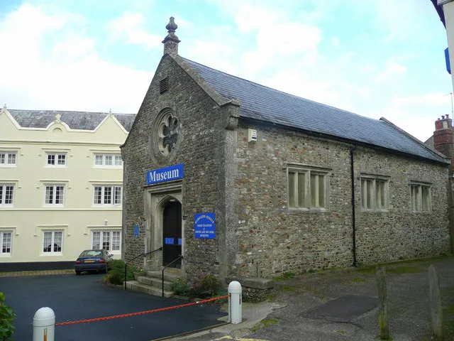
📷 3Museums · South West England
Glastonbury Tribunal
Glastonbury Tribunal — a museum in england-south-west, United Kingdom.
 📷 5
📷 5Memorials & monuments · South West England
Market Cross
Market Cross is a memorial in the United Kingdom.
 📷 3
📷 3Natural landmarks · South West England
Glastonbury Thorn Tree
Glastonbury Thorn Tree — a other in england-south-west, United Kingdom.
 📷 3
📷 3Memorials & monuments · South West England
Glastonbury Peace Pole
Glastonbury Peace Pole — a memorial in england-south-west, United Kingdom.
More museums in this region
 📷 5
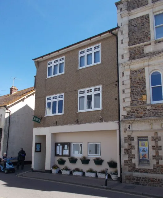
📷 5Museums · South West England
Allhallows Museum
Allhallows Museum — museum in Honiton, Devon, England, United Kingdom.
 📷 5
📷 5Museums · South West England
Axe Valley Heritage Museum
Axe Valley Heritage Museum — museum in Seaton, England, UK.
 📷 5
📷 5Museums · South West England
Bakelite Museum
Bakelite Museum is a museum in the United Kingdom.
 📷 5
📷 5Museums · South West England
Barometer World
Barometer World — former museum in Devon, England.
Frequently asked questions
- Where is Glastonbury?
- Glastonbury is in South West England, in the United Kingdom — coordinates 51.1475°, -2.7175°.
- Is Glastonbury wheelchair accessible?
- Partially — OpenStreetMap notes limited wheelchair access at Glastonbury. Check ahead for specific facilities.