Towns & cities · South West England
Street
Also known as: Street, Gwlad yr Haf
Street — large village and civil parish in the county of Somerset, England.

Wikimedia Commons contributors — see linked file page for photographer and licence licence
Plan your visit
- Typical visit
- 3 h–6 h
- Free entry
- Family-friendly
- Dog-friendly
About
Street is a town, city, village or settlement in the United Kingdom. Recent population estimates put it at around 11,066 people. Address: BA16. Wikidata describes it as: "large village and civil parish in the county of Somerset, England". Coordinates: 51.1235°, -2.7381°.
Photo gallery
From the Wikipedia article
Street is a large village and civil parish in Somerset, England, with a population of 12,709 in 2021. On a dry spot in the Somerset Levels, at the end of the Polden Hills, it is two miles (three kilometres) southwest of Glastonbury. There is evidence of Roman occupation. Much of the history of the village is dominated by Glastonbury Abbey, and a 12th-century causeway from Glastonbury built to transport local Blue Lias stone to it. The Society of Friends was established there by the mid-17th century. One Quaker family, the Clarks, started a business in sheepskin rugs, woollen slippers and, later, boots and shoes. This became C&J Clark which still has its headquarters in Street. In 1993, redundant factory buildings were converted to form Clarks Village, the first purpose-built factory outlet in the United Kingdom. The Shoe Museum provides information about the history of Clarks and footwear manufacture in general. The Clark family's former mansion and its estate at the edge of the village are now owned by Millfield School, an independent co-educational boarding school. Street is also home to Crispin School and Strode College. To the north of Street is the River Brue, which marks the boundary with Glastonbury. South of Street are the Walton and Ivythorn Hills and East Polden Grasslands biological Sites of Special Scientific Interest. Strode Theatre provides a venue for films, exhibitions and live performances. The Anglican Parish Church of The Holy Trinity dates from the 14th century and has been designated by English Heritage as a Grade I listed building.
Excerpt from Wikipedia under CC BY-SA 4.0. See the source article linked in Sources below.
Background
History
The settlement's earliest known name is Lantokay, meaning the Llan (a sacred enclosure) of Kea, a Celtic saint. The place-name 'Street' is first attested in Anglo-Saxon charters from 725 and 971, where it appears as Stret. It appears as Strete juxta Glastone in a charter from 1330 formerly in the British Museum. The word is the Old English straet meaning 'Roman road'. The centre of Street is where Lower Leigh hamlet was, and the road called Middle Leigh and the community called Overleigh are to the south of the village. In the 12th century, a causeway from Glastonbury was built to transport stone from what is now Street for rebuilding Glastonbury Abbey after a major fire in 1184. Quarries…
Sourced from Wikipedia under CC BY-SA 4.0.
- Coordinates
- 51.1235, -2.7381
- District
- Somerset
- Parish
- Street
- Postcode
- BA16
- Parliamentary constituency
- Glastonbury and Somerton
- Population
- 11,066
- Official site
- www.street-pc.gov.uk
Sources
- wikidata: Q1249656 (CC0)
- wikipedia: Street, Somerset (CC BY-SA 4.0)
- commons: Holy Trinity church Street.jpg (CC BY-SA 4.0)
Other places nearby
Loading nearby places…
Nearby
 📷 3
📷 3Memorials & monuments · South West England
Street War Memorial
Street War Memorial — Grade II listed building-listed memorial in england-south-west, United Kingdom.
 📷 3
📷 3Museums · South West England
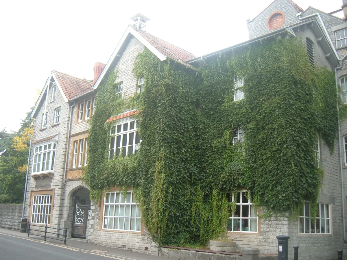
The Shoe Museum
The Shoe Museum — former museum of Clark's shoes.
 📷 5
📷 5Theatres · South West England
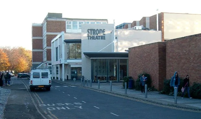
Strode Theatre
Strode Theatre is a theatre in the United Kingdom.
 📷 5
📷 5Historic churches · South West England
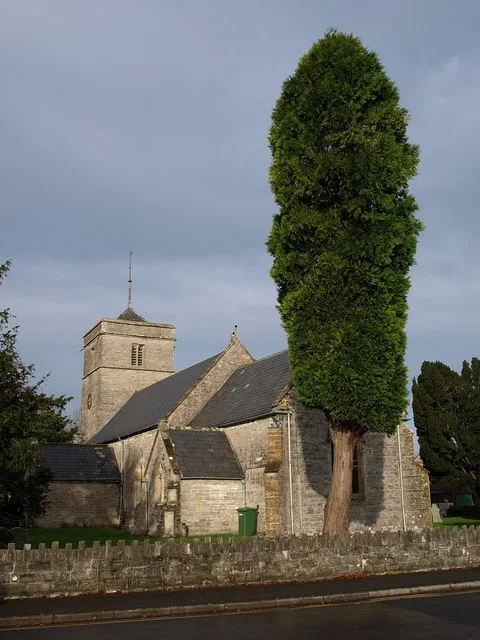
Church of the Holy Trinity, Street
Church of the Holy Trinity, Street — church in Street, Somerset, England, UK.
 📷 3
📷 3Follies · South West England
St Stephens Folly
St Stephens Folly — Folly or eyecatcher.
Hostels · South West England
YHA Hostel Street
YHA Hostel Street — a hostel in england south west.
More towns in this region
 Flagship📷 10
Towns & cities · South West England
All Saints
All Saints — village and civil parish in Devon, England, UK.
 Flagship📷 10
Towns & cities · South West England
Axmouth
Axmouth — village and civil parish in Devon, England, UK.
 ★ Iconic📷 10
Towns & cities · South West England
Beer
Beer — village and civil parish in Devon, UK.
 Flagship📷 10
Towns & cities · South West England
Branscombe
Branscombe — village and civil parish in Devon, UK.
Frequently asked questions
- Where is Street?
- Street is in South-West England, United Kingdom (postcode BA16), in the parish of Street.
- Is Street free to visit?
- Yes, Street is free to enter.
- How do I get to Street?
- Drivers can navigate to postcode BA16. It sits within the Glastonbury and Somerton parliamentary constituency.