Mountains & hills · North East England
Flat Fell
Flat Fell — Named summit at 272 m.

Wikimedia Commons contributors — see linked file page for photographer and licence licence
Plan your visit
- Typical visit
- 3 h–8 h
- Best time of year
- Late spring – early autumn (May–Oct)
- Nearest railway station
- Corkickle · 8.3 km
- Free entry
- Dog-friendly
About
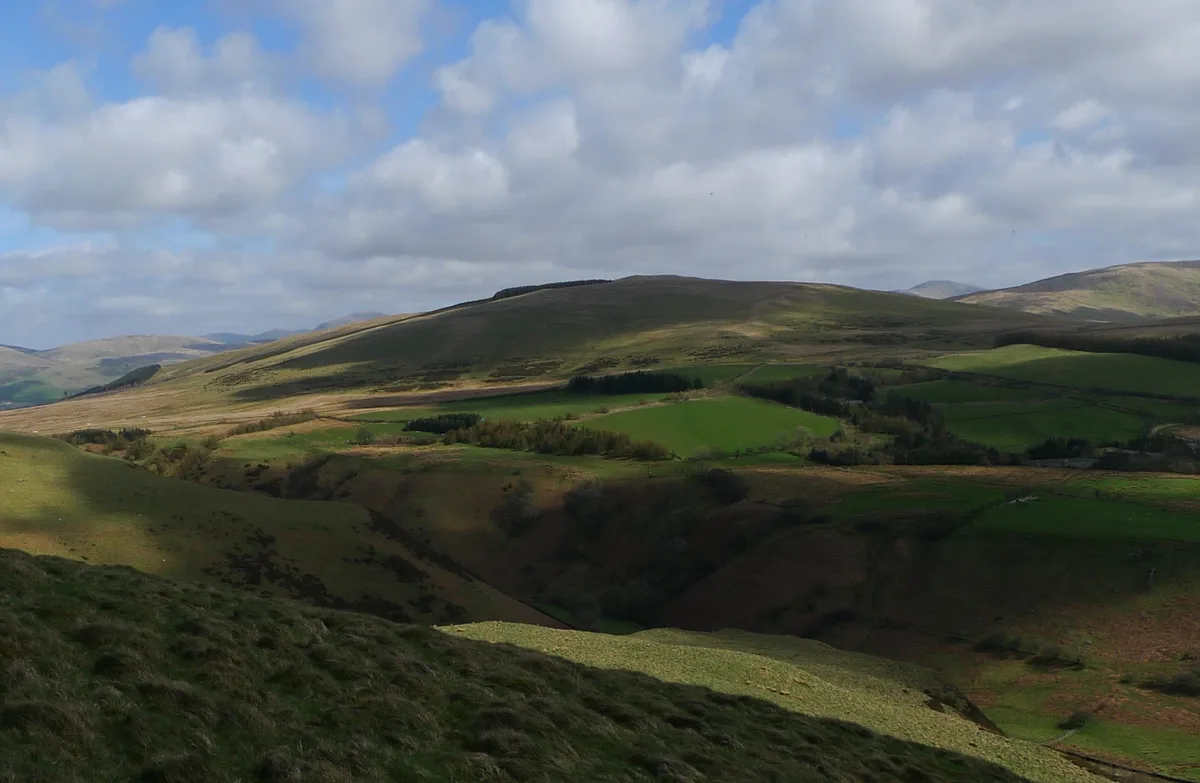
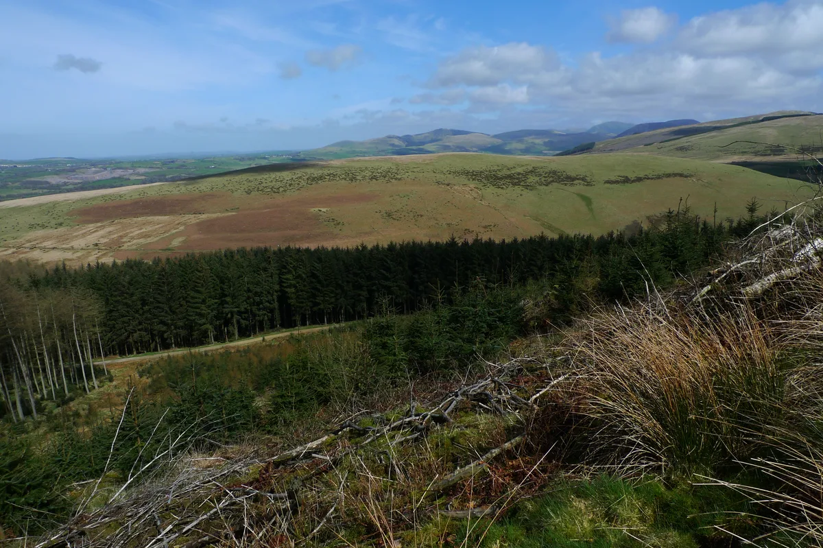
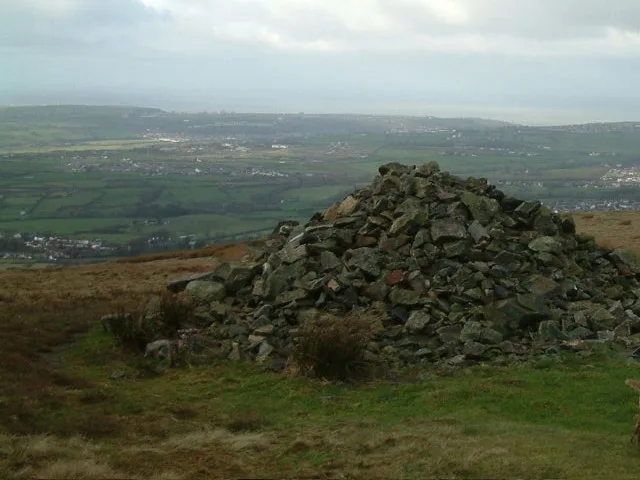
Flat Fell is a named summit in the United Kingdom. Wikidata describes it as: "Named summit at 272 m.". Coordinates: 54.5099°, -3.4649°.
Photo gallery
Protected designations
- Site of Special Scientific Interest: River Derwent and Tributaries SSSI
- Site of Special Scientific Interest: River Ehen (Ennerdale Water to Keekle Confluence) SSSI
Designations sourced from Natural England open data under OGL v3.
From the Wikipedia article
Flat Fell is a hill located on the edge of the English Lake District, standing at 272m. It is included in Alfred Wainwright's Outlying Fells of Lakeland book, sharing a chapter with Dent. Wainwright's clockwise route to the two summits starts at Wath Brow.
Excerpt from Wikipedia under CC BY-SA 4.0. See the source article linked in Sources below.
- Coordinates
- 54.5099, -3.4649
- District
- Cumberland
- Parish
- Ennerdale and Kinniside
- Postcode
- CA23 3AQ
- Parliamentary constituency
- Whitehaven and Workington
- Nearest railway station
- Corkickle — 8.3 km
Sources
- osm: n443667034 (ODbL)
- wikipedia: Flat Fell (CC BY-SA 4.0)
- commons: Flatfell2.JPG (CC BY-SA 4.0)
Other places nearby
Loading nearby places…
Nearby
 📷 3
📷 3Natural landmarks · North East England
Blakeley Raise
Blakeley Raise — mountain in United Kingdom.
 📷 3
📷 3Natural landmarks · North East England
Flat Fell
Flat Fell — mountain in United Kingdom.
 📷 2
📷 2Reservoirs & lochs · North East England
Meadley Reservoir
Meadley Reservoir — reservoir in Cumbria, England, UK.
 📷 3
📷 3Stone circles · North East England
Blakeley Raise Stone Circle
Blakeley Raise Stone Circle — a stone circle in england-north-east, United Kingdom.
 📷 3
📷 3Mountains & hills · North East England
Dent
Dent — Named summit at 351.4 m.
 📷 3
📷 3Natural landmarks · North East England
Dent
Dent — mountain in the United Kingdom.
More mountains in this region
 📷 3
📷 3Mountains & hills · North East England
Angletarn Pikes
Angletarn Pikes — Named summit at 566 m.
 📷 3
📷 3Mountains & hills · North East England
Angletarn Pikes South Top
Angletarn Pikes South Top — Named summit at 563.6 m.
 📷 3
📷 3Mountains & hills · North East England
Ard Crags
Ard Crags — Named summit at 581 m.
 📷 3
📷 3Mountains & hills · North East England
Arnison Crag
Arnison Crag — Named summit at 433 m.
Frequently asked questions
- Where is Flat Fell?
- Flat Fell is in North-East England, United Kingdom (postcode CA23 3AQ), in the parish of Ennerdale and Kinniside.
- Is Flat Fell a protected site?
- Yes — Flat Fell is part of the River Derwent and Tributaries SSSI Site of Special Scientific Interest and the River Ehen (Ennerdale Water to Keekle Confluence) SSSI Site of Special Scientific Interest.
- Is Flat Fell free to visit?
- Yes, Flat Fell is free to enter.
- How do I get to Flat Fell?
- Drivers can navigate to postcode CA23 3AQ. It sits within the Whitehaven and Workington parliamentary constituency.