Natural landmarks · North East England
Blakeley Raise
Blakeley Raise — mountain in United Kingdom.

Wikimedia Commons contributors — see linked file page for photographer and licence licence
Plan your visit
- Typical visit
- 1 h–2 h
- Nearest railway station
- Corkickle · 8.4 km
- Free entry
- Dog-friendly
About
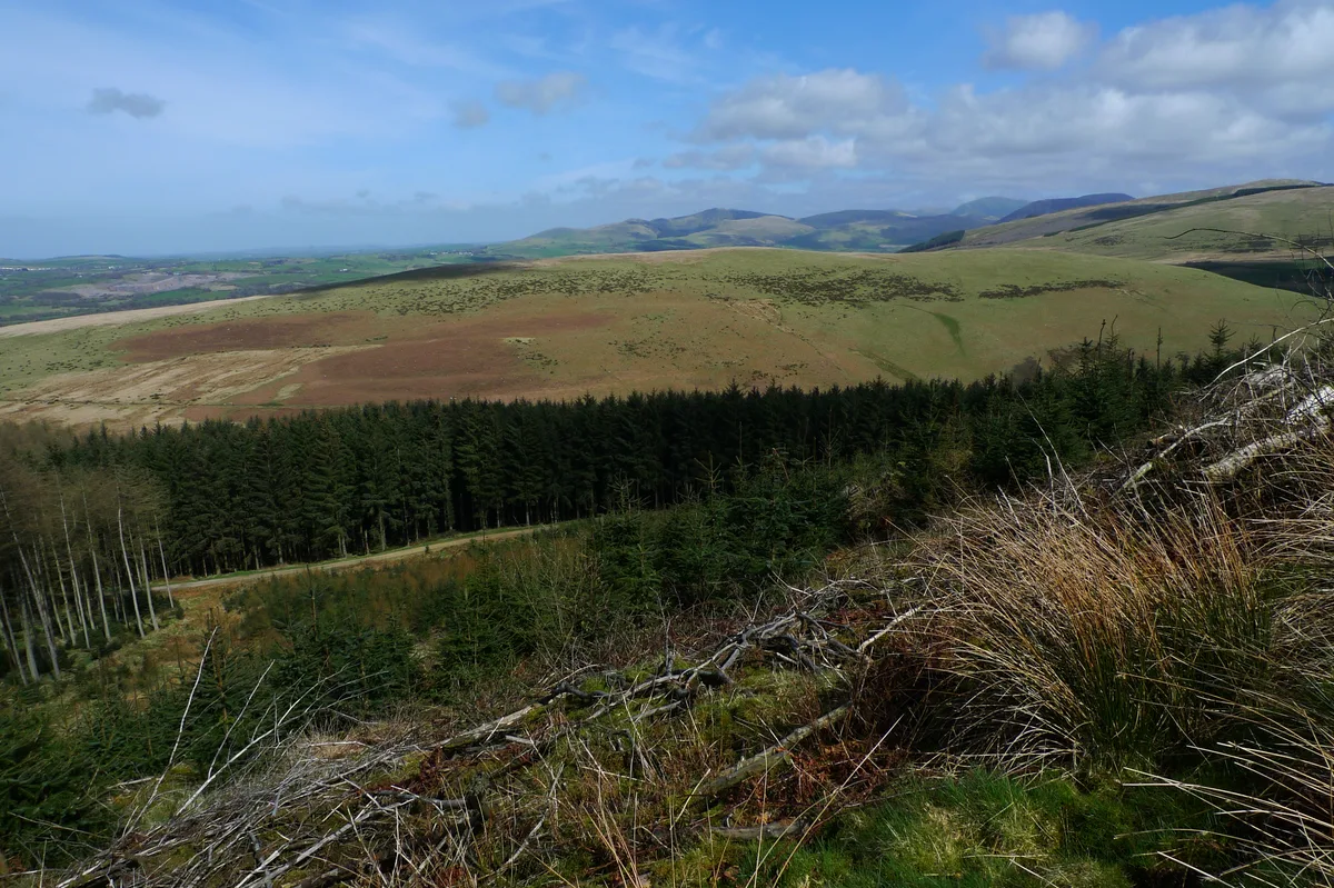
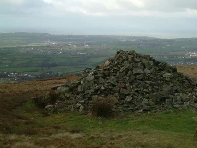
Blakeley Raise is a named natural landmark in the United Kingdom. Wikidata describes it as: "mountain in United Kingdom". Coordinates: 54.5100°, -3.4647°.
Photo gallery
Protected designations
- Site of Special Scientific Interest: River Derwent and Tributaries SSSI
- Site of Special Scientific Interest: River Ehen (Ennerdale Water to Keekle Confluence) SSSI
Designations sourced from Natural England open data under OGL v3.
From the Wikipedia article
Blakeley Raise is a fell in the English Lake District, standing at 389m. Unlike its neighbours Grike, Crag Fell and Lank Rigg it is not listed as a Wainwright. Despite this lack of status, Blakeley Raise is a worthy climb, providing extensive views over West Cumbria, Southern Scotland and the Isle of Man, including the towns of Whitehaven and Cleator Moor and the Sellafield nuclear processing site.
Excerpt from Wikipedia under CC BY-SA 4.0. See the source article linked in Sources below.
- Coordinates
- 54.5100, -3.4647
- District
- Cumberland
- Parish
- Ennerdale and Kinniside
- Postcode
- CA23 3AQ
- Parliamentary constituency
- Whitehaven and Workington
- Nearest railway station
- Corkickle — 8.4 km
Sources
- wikidata: Q4924580 (CC0)
- wikipedia: Blakeley Raise (CC BY-SA 4.0)
- commons: Blakeleyraise1.JPG (CC BY-SA 4.0)
Other places nearby
Loading nearby places…
Nearby
 📷 3
📷 3Mountains & hills · North East England
Flat Fell
Flat Fell — Named summit at 272 m.
 📷 3
📷 3Natural landmarks · North East England
Flat Fell
Flat Fell — mountain in United Kingdom.
 📷 3
📷 3Stone circles · North East England
Blakeley Raise Stone Circle
Blakeley Raise Stone Circle — a stone circle in england-north-east, United Kingdom.
 📷 2
📷 2Reservoirs & lochs · North East England
Meadley Reservoir
Meadley Reservoir — reservoir in Cumbria, England, UK.
 📷 3
📷 3Mountains & hills · North East England
Dent
Dent — Named summit at 351.4 m.
 📷 3
📷 3Natural landmarks · North East England
Dent
Dent — mountain in the United Kingdom.
More natural landmarks in this region
 Flagship📷 5
Natural landmarks · North East England
Brothers Water
Brothers Water — lake in Cumbria, England, UK.
 📷 5
📷 5Natural landmarks · North East England
Angle Tarn
Angle Tarn — lake near Patterdale, Cumbria, England, United Kingdom.
 📷 3
📷 3Natural landmarks · North East England
Angletarn Pikes
Angletarn Pikes — mountain in United Kingdom.
 📷 3
📷 3Natural landmarks · North East England
Ard Crags
Ard Crags — mountain in United Kingdom.
Frequently asked questions
- Where is Blakeley Raise?
- Blakeley Raise is in North-East England, United Kingdom (postcode CA23 3AQ), in the parish of Ennerdale and Kinniside.
- Is Blakeley Raise a protected site?
- Yes — Blakeley Raise is part of the River Derwent and Tributaries SSSI Site of Special Scientific Interest and the River Ehen (Ennerdale Water to Keekle Confluence) SSSI Site of Special Scientific Interest.
- Is Blakeley Raise free to visit?
- Yes, Blakeley Raise is free to enter.
- How do I get to Blakeley Raise?
- Drivers can navigate to postcode CA23 3AQ. It sits within the Whitehaven and Workington parliamentary constituency.