Viewpoints · South East England
Farthing Common
Farthing Common is a viewpoint in the United Kingdom.

David Anstiss — CC BY-SA 2.0 via Wikimedia Commons licence
Plan your visit
- Typical visit
- 20 min–45 min
- Best time of year
- Clear days year-round
- Nearest railway station
- Westenhanger · 3.2 km
- Free entry
- Dog-friendly
About
Farthing Common is a named viewpoint in Kent, South-East England, marked on Ordnance Survey maps for its outlook. The site is within the Kent Downs National Landscape (AONB). It sits within the Ashford parliamentary constituency. The nearest railway station is Westenhanger, about 3.2 km away. Postcode area CT18.
Photo gallery
Protected designations
- Area of Outstanding Natural Beauty: Kent Downs
Designations sourced from Natural England open data under OGL v3.
From the Wikipedia article
Farthing Common is an area of common land about 10 km northwest of Folkestone in East Kent. It is one of the highest points of the North Downs at 185 metres above sea level, and was the junction of the ancient trackway along the Downs from Folkestone, with the Roman road (now the B2068 Stone Street) between Lympne and Canterbury. From the common there are extensive views across Kent and on a clear day it is possible to see as far as the Cliffs at Fairlight in Sussex and even the South Downs. Just east of Farthing Common are Postling Downs which is a rich area of semi-improved chalk grassland with a variety of plant species including orchids. Farthing Common saw the final King of the Mountains climb during the first stage of the 2007 Tour de France, which was held in Kent. The climb was taken by Stéphane Augé.
Excerpt from Wikipedia under CC BY-SA 4.0. See the source article linked in Sources below.
- Coordinates
- 51.1227, 1.0513
- County
- Kent
- District
- Folkestone and Hythe
- Parish
- Lyminge
- Postcode
- CT18 8DH
- Parliamentary constituency
- Ashford
- Nearest railway station
- Westenhanger — 3.2 km
Sources
- osm: n4346093912 (ODbL)
- wikipedia: Farthing Common (CC BY-SA 4.0)
Other places nearby
Loading nearby places…
Nearby
.jpg?width=1200) 📷 5
📷 5Historic churches · South East England
Church of St Mary and St Radegund
Church of St Mary and St Radegund — church in Postling, Kent, England, UK.
 📷 5
📷 5Castles · South East England
Stowting
Stowting is a village and civil parish in the English county of Kent. It is 6 miles (9.7 km) east of Ashford, 7 miles (11 km) north-west of Folkestone and 10 miles (16 km) south of Canterbury.
 Flagship📷 5
Stately homes · South East England
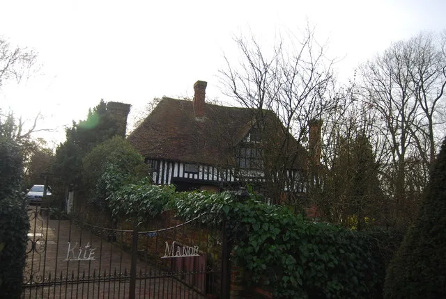
Kite Manor
Kite Manor — manor house in Monks Horton, Kent, England, UK.
 📷 5
📷 5Manor houses · South East England
Hayton Manor
Hayton Manor — Grade II listed building-listed manor in england-south-east, United Kingdom.
Campsites · South East England
The Drum Inn
The Drum Inn — a campsite in england south east.
 📷 5
📷 5Castles · South East England
Stowting castle mound
Stowting castle mound — a castle in england-south-east, United Kingdom.
More viewpoints in this region
 📷 5
📷 5Viewpoints · South East England
A
A is a viewpoint in the United Kingdom.
 📷 5
📷 5Viewpoints · South East England
Acres Down South
Acres Down South is a viewpoint in the United Kingdom.
 📷 5
📷 5Viewpoints · South East England
airplane take off viewing point
airplane take off viewing point is a viewpoint in the United Kingdom.
 📷 5
📷 5Viewpoints · South East England
Ancient Oak Tree
Ancient Oak Tree is a viewpoint in the United Kingdom.
Frequently asked questions
- Where is Farthing Common?
- Farthing Common is in Kent, South-East England, United Kingdom (postcode CT18 8DH), in the parish of Lyminge.
- Is Farthing Common a protected site?
- Yes — Farthing Common is part of the Kent Downs National Landscape (AONB).
- Is Farthing Common free to visit?
- Yes, Farthing Common is free to enter.
- How do I get to Farthing Common?
- The nearest railway station is Westenhanger, about 3.2 km away. Drivers can navigate to postcode CT18 8DH.