Mountains & hills · North Wales
Craigysgafn
Craigysgafn — Named summit at 689 m.

Wikimedia Commons contributors — see linked file page for photographer and licence licence
_uwch_ben_Llyn_Stwlan%2C_above_Llyn_Stwlan%2C_Ffestiniog%2C_Gwynedd%2C_Wales_23.jpg)
Plan your visit
- Typical visit
- 3 h–8 h
- Best time of year
- Late spring – early autumn (May–Oct)
- Nearest railway station
- Tanygrisiau · 2.4 km
- Free entry
- Dog-friendly
About
Craigysgafn is a named summit in the United Kingdom. Wikidata describes it as: "Named summit at 689 m.". Coordinates: 52.9807°, -3.9980°.
Photo gallery
From the Wikipedia article
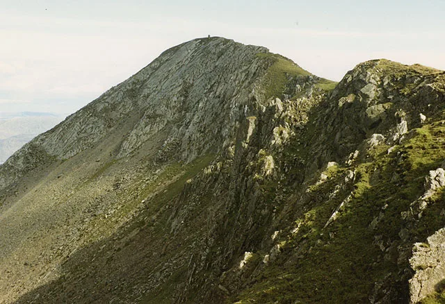
Craigysgafn is a rocky ridge and a top of Moelwyn Mawr that leads south from Moelwyn Mawr to Moelwyn Bach in Snowdonia, North Wales. It has several gullies which lead directly down to the scree slopes above Llyn Stwlan. Some scrambling is needed in places.
Excerpt from Wikipedia under CC BY-SA 4.0. See the source article linked in Sources below.
- Coordinates
- 52.9807, -3.9980
- District
- Gwynedd
- Parish
- Ffestiniog
- Postcode
- LL41 3TP
- Parliamentary constituency
- Dwyfor Meirionnydd
- Nearest railway station
- Tanygrisiau — 2.4 km
Sources
- osm: n3486947883 (ODbL)
- wikipedia: Craigysgafn (CC BY-SA 4.0)
- commons: Craigysgafn (rhan o'r Moelwyn Mawr) uwch ben Llyn Stwlan, above Llyn Stwlan, Ffestiniog, Gwynedd, Wales 23.jpg (CC BY-SA 4.0)
Other places nearby
Loading nearby places…
Nearby
 📷 3
📷 3Natural landmarks · North Wales
Moelwyn Mawr
Moelwyn Mawr — mountain (770m) in Gwynedd.
 📷 4
📷 4Mountains & hills · North Wales
Moelwyn Mawr North Ridge Top
Moelwyn Mawr North Ridge Top — a mountain in wales-north, United Kingdom, 640 m.
 📷 3
📷 3Mountains & hills · North Wales
Moelwyn Mawr
Moelwyn Mawr — Named summit at 770 m.
 📷 3
📷 3Reservoirs & lochs · North Wales
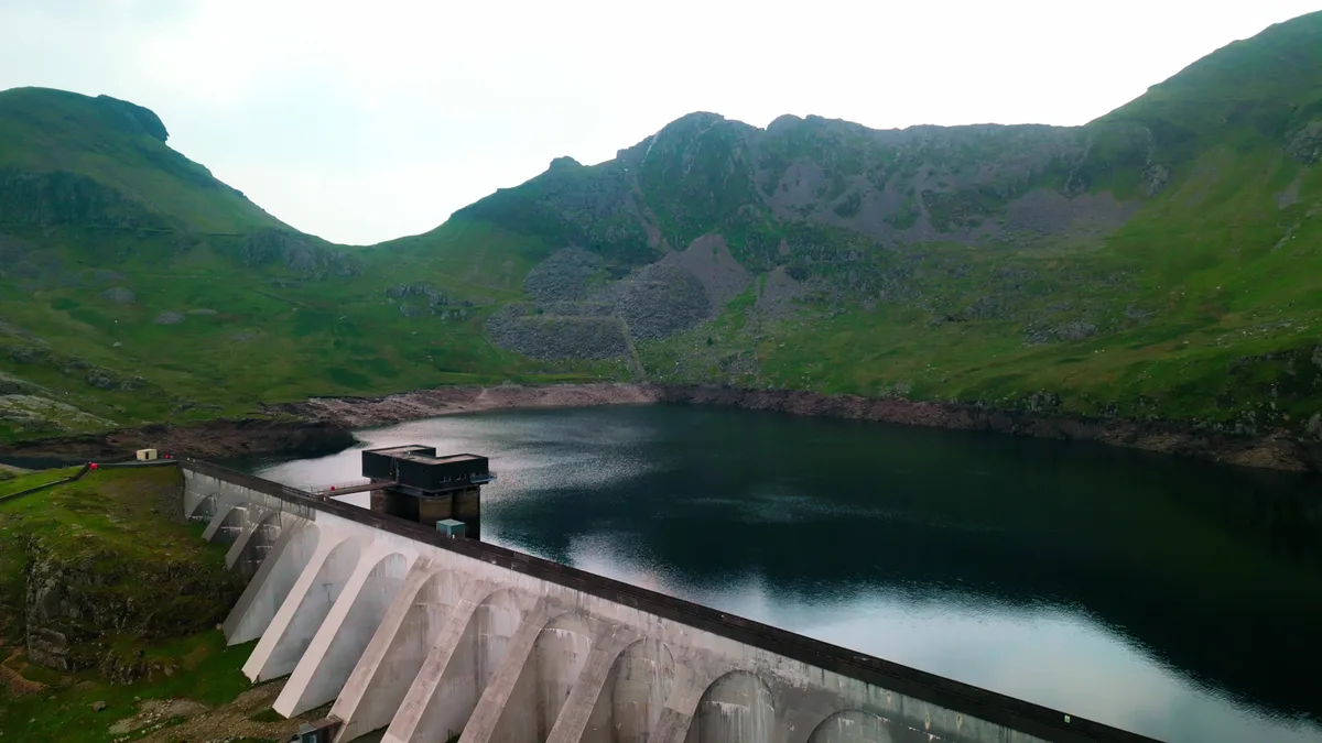
Llyn Stwlan
Llyn Stwlan — reservoir lake in Gwynedd, Wales which produces hydroelectric power.
 📷 3
📷 3Historic houses · North Wales
Pant-mawr Mine Slate Mill
Pant-mawr Mine Slate Mill — a historic house in wales-north, United Kingdom.
 📷 3
📷 3Mountains & hills · North Wales
Moelwyn Bach
Moelwyn Bach — Named summit at 710 m.
More mountains in this region
 📷 5
📷 5Mountains & hills · North Wales
Cemlyn Bay and lagoon
Cemlyn Bay and lagoon — Site of Special Scientific Interest in Wales.
 📷 3
📷 3Mountains & hills · North Wales
Aberffraw Bay
Aberffraw Bay — bay on the west coast of Anglesey, in Wales, UK.
 📷 3
📷 3Mountains & hills · North Wales
Allt-fawr
Allt-fawr — Named summit at 698 m.
 📷 3
📷 3Mountains & hills · North Wales
Aran Benllyn
Aran Benllyn — Named summit at 884 m.
Frequently asked questions
- Where is Craigysgafn?
- Craigysgafn is in North Wales, United Kingdom (postcode LL41 3TP), in the parish of Ffestiniog.
- Is Craigysgafn free to visit?
- Yes, Craigysgafn is free to enter.
- How do I get to Craigysgafn?
- The nearest railway station is Tanygrisiau, about 2.4 km away. Drivers can navigate to postcode LL41 3TP.