Mountains & hills · South Wales
Craig-Gwaun-Taf
Craig-Gwaun-Taf — Named summit at 826 m.

Wikimedia Commons contributors — see linked file page for photographer and licence licence
Plan your visit
- Typical visit
- 3 h–8 h
- Best time of year
- Late spring – early autumn (May–Oct)
- Nearest railway station
- Torpantau · 5.9 km
- Free entry
- Dog-friendly
About
Craig-Gwaun-Taf is a named summit in the United Kingdom. Wikidata describes it as: "Named summit at 826 m.". Coordinates: 51.8753°, -3.4459°.
Photo gallery
From the Wikipedia article
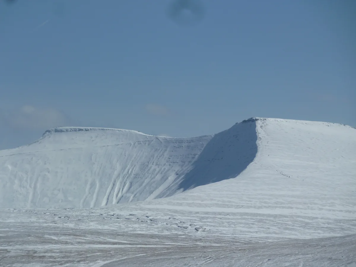
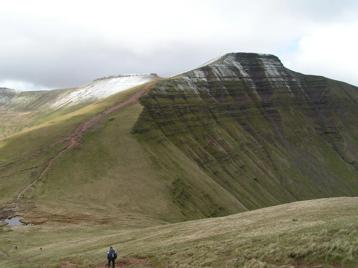
Craig Gwaun Taf, also known as Duwynt, is a mountain in the Brecon Beacons with a height of 826.4 m (2,711 ft). It is within the wider Brecon Beacons National Park in Powys, Wales. The mountain takes the form of a long ridge which runs north-west to south-east and falls away steeply to the north-east. The summit is at the north-west end of the ridge and marked by a small cairn; the ridge then turns north and drops into a very shallow col called Bwlch Duwynt before climbing to the adjacent peak of Corn Du.
Excerpt from Wikipedia under CC BY-SA 4.0. See the source article linked in Sources below.
- Coordinates
- 51.8753, -3.4459
- Address
- Powys, Wales
- Nearest railway station
- Torpantau — 5.9 km
Sources
- osm: n3526108429 (ODbL)
- wikipedia: Craig Gwaun Taf (CC BY-SA 4.0)
- commons: Bwlch Duwynt from end of Craig Gwaun Taf - geograph.org.uk - 1120570.jpg (CC BY-SA 4.0)
Other places nearby
Loading nearby places…
Nearby
 📷 5
📷 5Mountains & hills · South Wales
Corn Du
Corn Du — Named summit at 873 m.
 📷 5
📷 5Mountains & hills · South Wales
Pen y Fan
Pen y Fan — Named summit at 886 m.
 📷 5
📷 5Natural landmarks · South Wales
Pen y Fan
Pen y Fan — mountain (886m) in Powys.
 📷 3
📷 3Memorials & monuments · South Wales
Tommy Jones Memorial
Tommy Jones Memorial — a memorial in wales-south, United Kingdom.
 📷 3
📷 3Natural landmarks · South Wales
Llyn Cwm Llwch
Llyn Cwm Llwch — lake in the United Kingdom.
 📷 3
📷 3Mountains & hills · South Wales
Y Gyrn
Y Gyrn — Named summit at 619 m.
More mountains in this region
 Flagship📷 3
Mountains & hills · South Wales
Milford Haven Waterway
Milford Haven Waterway — ria, or flooded valley, in Pembrokeshire, south-west Wales, UK.
 📷 5
📷 5Mountains & hills · South Wales
Ogof Ffynnon Ddu
Ogof Ffynnon Ddu — cave in the Upper Swansea Valley in South Wales.
 📷 3
📷 3Mountains & hills · South Wales
Abereiddi Bay
Abereiddi Bay — bay in the United Kingdom.
 📷 3
📷 3Mountains & hills · South Wales
Allt Lwyd
Allt Lwyd — Named summit at 653 m.
Frequently asked questions
- Where is Craig-Gwaun-Taf?
- Craig-Gwaun-Taf is in South Wales, United Kingdom.
- Is Craig-Gwaun-Taf free to visit?
- Yes, Craig-Gwaun-Taf is free to enter.
- How do I get to Craig-Gwaun-Taf?
- The nearest railway station is Torpantau, about 5.9 km away.