Mountains & hills · South Wales
Cribyn
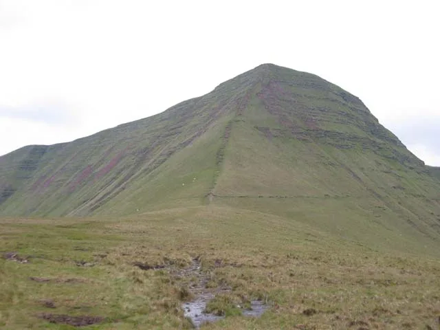
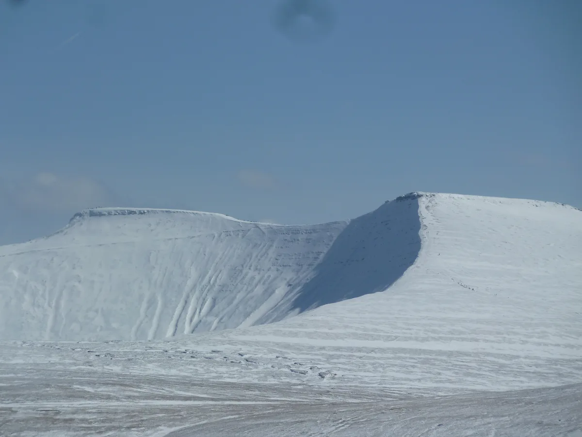
Cribyn — Named summit at 795 m.

Wikimedia Commons contributors — see linked file page for photographer and licence licence
Plan your visit
- Typical visit
- 3 h–8 h
- Best time of year
- Late spring – early autumn (May–Oct)
- Nearest railway station
- Torpantau · 5.3 km
- Free entry
- Dog-friendly
About
Cribyn is a named summit in the United Kingdom. Wikidata describes it as: "Named summit at 795 m.". Coordinates: 51.8818°, -3.4196°.
Photo gallery
From the Wikipedia article
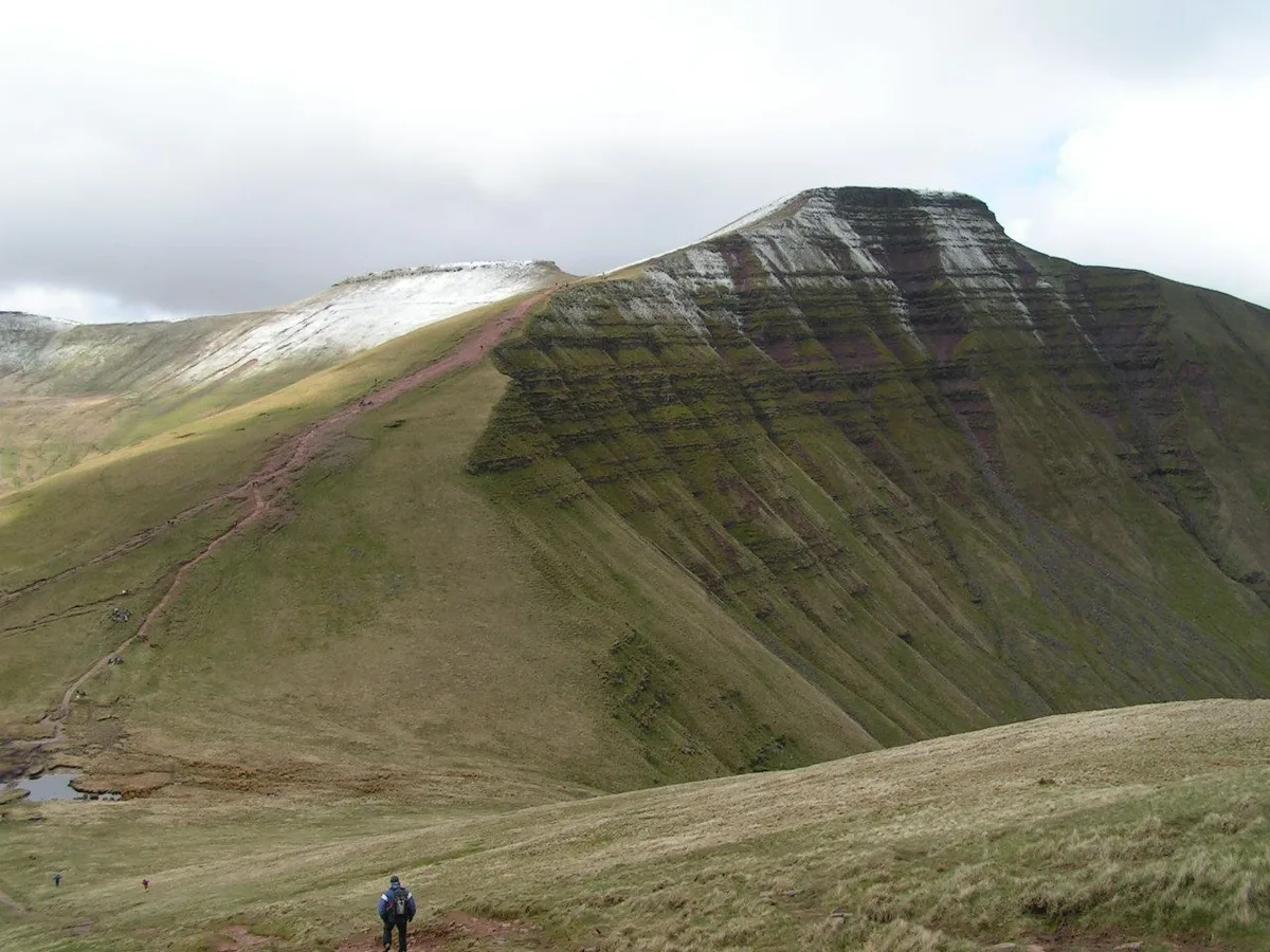
Cribyn (Welsh pronunciation: [ˈkrɪbɪn]) is a mountain in the Brecon Beacons (Bannau Brycheiniog) with an elevation of 2608 feet (or 795 metres), about 300 feet lower than the neighbouring peaks of Pen y Fan and Corn Du. It is a prominent peak in the long and impressive escarpment facing north and running roughly east–west of the central section of the Brecon Beacons. The summit lies on a ridge stretching from Talybont Reservoir in the east, to the A470 road. The ridge line to the west connects Cribyn with the peak of Pen y Fan. To the east, the ridge line descends to Bwlch ar y Fan, a col crossed by an ancient trail sometimes known as 'The Gap Road' before ascending again to the peak of Fan y Big.
Excerpt from Wikipedia under CC BY-SA 4.0. See the source article linked in Sources below.
Background
Visiting
The Brecon Beacons are classed as open country, so the visitor can walk anywhere in the highland zone. Trails and footpaths are well marked, and owing to frequent use, are also well trodden. The National Trust owns much of the land and the paths are well maintained and reinforced where wear and tear is heavy. The main paths are intensively used by individual walkers and groups, but also by the British Army for troop training, and by charity walks. The peak is adjacent to Pen y Fan so is often chosen for circular walks along the main escarpment. When the weather is clear, the views to the north are especially impressive towards Mynydd Epynt, Brecon and the Cambrian Mountains beyond.
Sourced from Wikipedia under CC BY-SA 4.0.
- Coordinates
- 51.8818, -3.4196
- Address
- Powys, Wales
- Nearest railway station
- Torpantau — 5.3 km
Sources
- osm: n16347060 (ODbL)
- wikipedia: Cribyn (mountain) (CC BY-SA 4.0)
- commons: Cribyn.jpg (CC BY-SA 4.0)
Other places nearby
Loading nearby places…
Nearby
 📷 5
📷 5Natural landmarks · South Wales
Cribyn
Cribyn — mountain (795m) in Powys.
 📷 5
📷 5Natural landmarks · South Wales
Pen y Fan
Pen y Fan — mountain (886m) in Powys.
 📷 5
📷 5Mountains & hills · South Wales
Pen y Fan
Pen y Fan — Named summit at 886 m.
 Flagship📷 3
National parks · South Wales
Bannau Brycheiniog (Brecon Beacons)
Bannau Brycheiniog (Brecon Beacons) is a National park in Wales.
 📷 3
📷 3Mountains & hills · South Wales
Fan y Big
Fan y Big — Named summit at 719 m.
 📷 5
📷 5Mountains & hills · South Wales
Corn Du
Corn Du — Named summit at 873 m.
More mountains in this region
 Flagship📷 3
Mountains & hills · South Wales
Milford Haven Waterway
Milford Haven Waterway — ria, or flooded valley, in Pembrokeshire, south-west Wales, UK.
 📷 5
📷 5Mountains & hills · South Wales
Ogof Ffynnon Ddu
Ogof Ffynnon Ddu — cave in the Upper Swansea Valley in South Wales.
 📷 3
📷 3Mountains & hills · South Wales
Abereiddi Bay
Abereiddi Bay — bay in the United Kingdom.
 📷 3
📷 3Mountains & hills · South Wales
Allt Lwyd
Allt Lwyd — Named summit at 653 m.
Frequently asked questions
- Where is Cribyn?
- Cribyn is in South Wales, United Kingdom.
- Is Cribyn free to visit?
- Yes, Cribyn is free to enter.
- How do I get to Cribyn?
- The nearest railway station is Torpantau, about 5.3 km away.