Towns & cities · North West England
Claughton
Also known as: Claughton, Caerhirfryn
Claughton — village and civil parish in the district of Lancaster, Lancashire, England.

Wikimedia Commons contributors — see linked file page for photographer and licence licence
Plan your visit
- Typical visit
- 3 h–6 h
- Nearest railway station
- Wennington · 6.3 km
- Free entry
- Family-friendly
- Dog-friendly
About
Claughton is a town, city, village or settlement in the United Kingdom. Recent population estimates put it at around 126 people. Wikidata describes it as: "village and civil parish in the district of Lancaster, Lancashire, England". Coordinates: 54.0920°, -2.6680°.
Photo gallery
Protected designations
- Area of Outstanding Natural Beauty: Forest Of Bowland
Designations sourced from Natural England open data under OGL v3.
From the Wikipedia article
Claughton ( KLAF-tən) is a small village and civil parish in the City of Lancaster in Lancashire, England. The village is on the A683 road east of Lancaster and at the time of the 2001 census had a population of 132. In the 2011 census Claughton was grouped with Roeburndale (2001 pop. 76) to give a total of 223. In the 2021 census, it had a population of 199. North of the village is the River Lune, and to the south is Claughton Moor and the fells of the Forest of Bowland.
Excerpt from Wikipedia under CC BY-SA 4.0. See the source article linked in Sources below.
- Coordinates
- 54.0920, -2.6680
- County
- Lancashire
- District
- Lancaster
- Parish
- Claughton
- Postcode
- LA2 9LT
- Parliamentary constituency
- Morecambe and Lunesdale
- Population
- 126
- Nearest railway station
- Wennington — 6.3 km
Sources
- wikidata: Q604146 (CC0)
- wikipedia: Claughton, Lancaster (CC BY-SA 4.0)
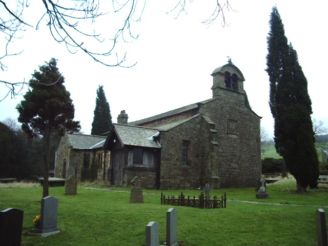
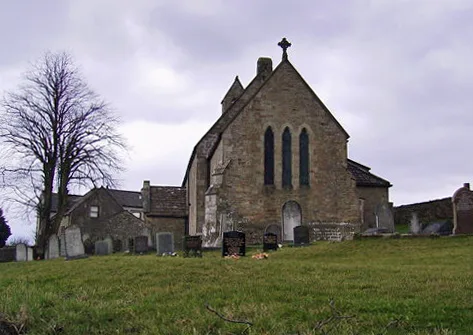
- commons: St Chad's Church, Claughton.jpg (CC BY-SA 4.0)
Other places nearby
Loading nearby places…
Nearby
 📷 3
📷 3Historic bridges · North West England
Claughton Aerial Ropeway
Claughton Aerial Ropeway is a historic bridge in the United Kingdom.
 📷 3
📷 3Historic churches · North West England
St Chad's Church, Claughton
St Chad's Church, Claughton — grade II listed church in Claughton, Lancaster, Lancashire, England, UK.
 📷 3
📷 3Historic churches · North West England
St Saviour's Church, Aughton
St Saviour's Church, Aughton — church in Aughton, Lancaster, Lancashire, England, UK.
 📷 3
📷 3Viewpoints · North West England
Caton Moor Picnic Site
Caton Moor Picnic Site is a viewpoint in the United Kingdom.
Caravan parks · North West England
Sandbeds Caravan Site
Sandbeds Caravan Site — a caravan park in england north west.
 📷 4
📷 4Historic houses · North West England
Hornby Village Institute
Hornby Village Institute — a Grade II*-listed historic house in england-north-west, United Kingdom.
More towns in this region
 Flagship📷 5
Towns & cities · North West England
Aughton
Aughton — village and civil parish within the West Lancashire district of Lancashire, England.
 Flagship📷 5
Towns & cities · North West England
Haigh
Haigh — village and civil parish of the Metropolitan Borough of Wigan in Greater Manchester, England.
 Flagship📷 5
Towns & cities · North West England
Lancaster
Lancaster — county town of Lancashire, England.
 Flagship📷 3
Towns & cities · North West England
Preston
Preston — city and the administrative centre of Lancashire, England.
Frequently asked questions
- Where is Claughton?
- Claughton is in Lancashire, North-West England, United Kingdom (postcode LA2 9LT), in the parish of Claughton.
- Is Claughton a protected site?
- Yes — Claughton is part of the Forest Of Bowland National Landscape (AONB).
- Is Claughton free to visit?
- Yes, Claughton is free to enter.
- How do I get to Claughton?
- The nearest railway station is Wennington, about 6.3 km away. Drivers can navigate to postcode LA2 9LT.