Mountains & hills · South Wales
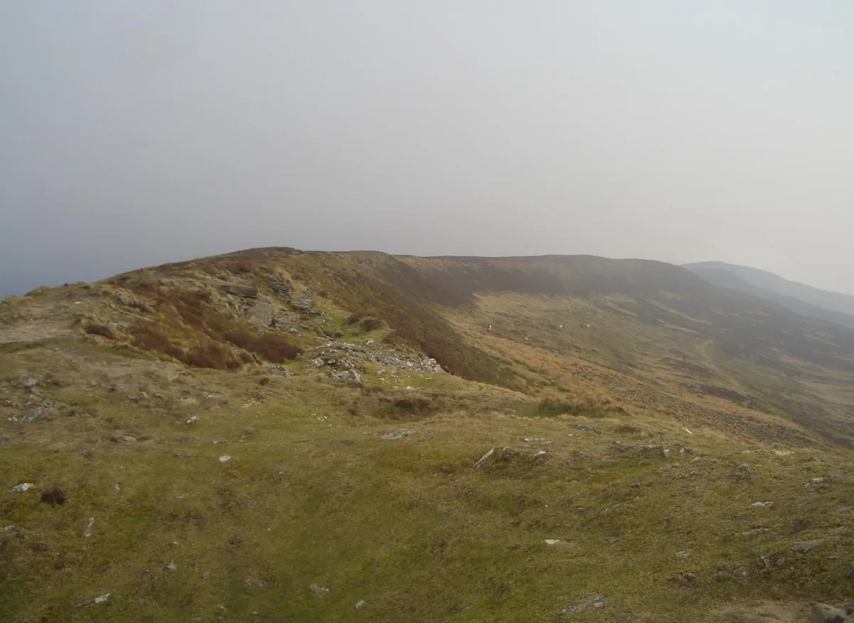
Chwarel y Fan
Chwarel y Fan — Named summit at 679 m.

Wikimedia Commons contributors — see linked file page for photographer and licence licence
Plan your visit
- Typical visit
- 3 h–8 h
- Best time of year
- Late spring – early autumn (May–Oct)
- Free entry
- Dog-friendly
About
Chwarel y Fan is a named summit in the United Kingdom. Wikidata describes it as: "Named summit at 679 m.". Coordinates: 51.9583°, -3.0810°.
Photo gallery
Protected designations
- Site of Special Scientific Interest: Black Mountains SSSI
- Site of Special Scientific Interest: River Wye SSSI
Designations sourced from Natural England open data under OGL v3.
From the Wikipedia article
Chwarel y Fan is a peak in the Black Mountains in south-eastern Wales. It is the highest rise on the long ridge which extends southeastwards from Rhos Dirion. The ridge continues southeastwards to the lesser summit of Bal-Mawr whose top is adorned by a trig point at 607 metres (1,991 ft) above sea level. About one km (0.62 mi) southeast along the ridge is the lesser top of Bal-Bach at a height of just over 520 metres (1,710 ft). Chwarel y Fan is the county top of the historic county of Monmouthshire, and is also the highest point in the current local government area of Monmouthshire. The summit is on a thin ridge and is crowned by a cairn. On the other sides of the valleys: to the west is Pen Twyn Mawr and to the east is Black Mountain.
Excerpt from Wikipedia under CC BY-SA 4.0. See the source article linked in Sources below.
- Coordinates
- 51.9583, -3.0810
- District
- Monmouthshire
- Parish
- Crucorney
- Postcode
- NP7 7NW
- Parliamentary constituency
- Monmouthshire
Sources
- osm: n3295147786 (ODbL)
- wikipedia: Chwarel y Fan (CC BY-SA 4.0)
- commons: Chwarelyfan.JPG (CC BY-SA 4.0)
Other places nearby
Loading nearby places…
Nearby
 📷 3
📷 3Natural landmarks · South Wales
Chwarel y Fan
Chwarel y Fan — mountain (679m) in Monmouthshire.
 📷 3
📷 3Memorials & monuments · South Wales
Anvil Stone
Anvil Stone is a memorial in the United Kingdom.
 📷 3
📷 3Archaeological sites · South Wales
Tarren Yr Esgob, Stone Spread
Tarren Yr Esgob, Stone Spread — a archaeological in wales-south, United Kingdom.
 📷 3
📷 3Abbeys & priories · South Wales
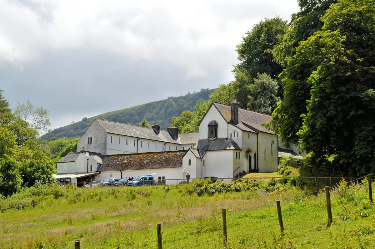
The Monastery Church, Capel-y-Ffin
The Monastery Church, Capel-y-Ffin — a abbey in wales-south, United Kingdom.
 📷 3
📷 3Abbeys & priories · South Wales
Capel-y-ffin Monastery
Capel-y-ffin Monastery — Grade II listed building in Capel-y-Ffin.
 📷 3
📷 3Memorials & monuments · South Wales
Father Ignatius
Father Ignatius — a memorial in wales-south, United Kingdom.
More mountains in this region
 Flagship📷 3
Mountains & hills · South Wales
Milford Haven Waterway
Milford Haven Waterway — ria, or flooded valley, in Pembrokeshire, south-west Wales, UK.
 📷 5
📷 5Mountains & hills · South Wales
Ogof Ffynnon Ddu
Ogof Ffynnon Ddu — cave in the Upper Swansea Valley in South Wales.
 📷 3
📷 3Mountains & hills · South Wales
Abereiddi Bay
Abereiddi Bay — bay in the United Kingdom.
 📷 3
📷 3Mountains & hills · South Wales
Allt Lwyd
Allt Lwyd — Named summit at 653 m.
Frequently asked questions
- Where is Chwarel y Fan?
- Chwarel y Fan is in South Wales, United Kingdom (postcode NP7 7NW), in the parish of Crucorney.
- Is Chwarel y Fan a protected site?
- Yes — Chwarel y Fan is part of the Black Mountains SSSI Site of Special Scientific Interest and the River Wye SSSI Site of Special Scientific Interest.
- Is Chwarel y Fan free to visit?
- Yes, Chwarel y Fan is free to enter.
- How do I get to Chwarel y Fan?
- Drivers can navigate to postcode NP7 7NW. It sits within the Monmouthshire parliamentary constituency.