Mountains & hills · North Wales
Cyfrwy
Also known as: The Saddle
Cyfrwy — Named summit at 811 m.

Wikimedia Commons contributors — see linked file page for photographer and licence licence
Plan your visit
- Typical visit
- 3 h–8 h
- Best time of year
- Late spring – early autumn (May–Oct)
- Nearest railway station
- Nant Gwernol · 7.0 km
- Free entry
- Dog-friendly
About
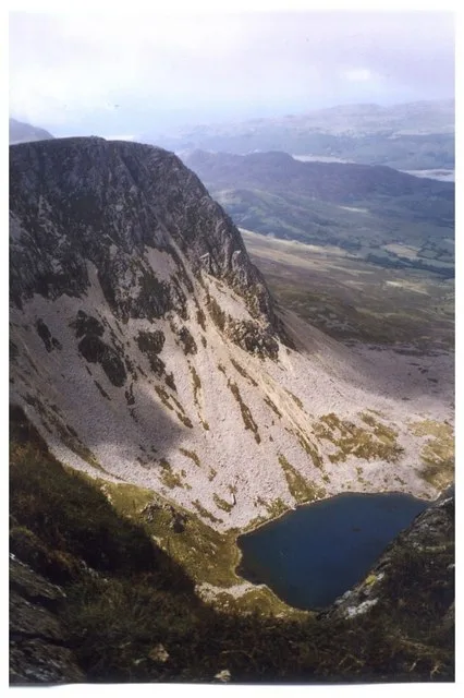
Cyfrwy is a named summit in the United Kingdom. Also known as: The Saddle. Wikidata describes it as: "Named summit at 811 m.". Coordinates: 52.7022°, -3.9197°.
Photo gallery
From the Wikipedia article
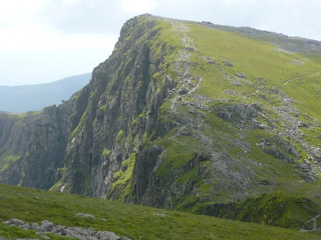
Cyfrwy is a subsidiary summit of Cadair Idris in the Snowdonia National Park, in Gwynedd, northwest Wales. It lies to the west of Cadair Idris and is often climbed with Cadair Idris by taking the Pony Path. The summit is bare and rocky and marked with a cairn. The north and east face has large cliffs. A rock climb/extreme scramble known as the Cyfrwy Arete is found here. This arete is very steep and rope and rock climbing skills will be needed. To the west is Tyrrau Mawr and Craig-y-llyn, while to the south is Craig Cwm Amarch.
Excerpt from Wikipedia under CC BY-SA 4.0. See the source article linked in Sources below.
- Coordinates
- 52.7022, -3.9197
- District
- Gwynedd
- Parish
- Arthog
- Postcode
- LL40 1TN
- Parliamentary constituency
- Dwyfor Meirionnydd
- Nearest railway station
- Nant Gwernol — 7 km
Sources
- osm: n8737045289 (ODbL)
- wikipedia: Cyfrwy (CC BY-SA 4.0)
- commons: Cyfrwy and Llyn y Gadair below - geograph.org.uk - 1017967.jpg (CC BY-SA 4.0)
Other places nearby
Loading nearby places…
Nearby
 📷 3
📷 3Natural landmarks · North Wales
Cyfrwy
Cyfrwy — mountain (811m) in Gwynedd.
 📷 5
📷 5Natural landmarks · Mid Wales
Cadair Idris
Cadair Idris is a natural landmark in the United Kingdom.
 📷 5
📷 5Mountains & hills · Mid Wales
Cadair Idris
Cadair Idris — Named summit at 893 m.
 📷 3
📷 3Mountains & hills · Mid Wales
Penygadair
Penygadair — a mountain in wales-mid, United Kingdom, 893 m.
 📷 3
📷 3Natural landmarks · Mid Wales
Craig Cwm Amarch
Craig Cwm Amarch — mountain (791.9m) in Gwynedd.
 📷 3
📷 3Mountains & hills · Mid Wales
Craig Cwm Amarch
Craig Cwm Amarch — Named summit at 791 m.
More mountains in this region
 📷 5
📷 5Mountains & hills · North Wales
Cemlyn Bay and lagoon
Cemlyn Bay and lagoon — Site of Special Scientific Interest in Wales.
 📷 3
📷 3Mountains & hills · North Wales
Aberffraw Bay
Aberffraw Bay — bay on the west coast of Anglesey, in Wales, UK.
 📷 3
📷 3Mountains & hills · North Wales
Allt-fawr
Allt-fawr — Named summit at 698 m.
 📷 3
📷 3Mountains & hills · North Wales
Aran Benllyn
Aran Benllyn — Named summit at 884 m.
Frequently asked questions
- Where is Cyfrwy?
- Cyfrwy is in North Wales, United Kingdom (postcode LL40 1TN), in the parish of Arthog.
- Is Cyfrwy free to visit?
- Yes, Cyfrwy is free to enter.
- How do I get to Cyfrwy?
- The nearest railway station is Nant Gwernol, about 7.0 km away. Drivers can navigate to postcode LL40 1TN.