Mountains & hills · North Wales
Carnedd Gwenllian
Also known as: Y Garnedd Uchaf
Carnedd Gwenllian — Named summit at 926 m.

Wikimedia Commons contributors — see linked file page for photographer and licence licence
Plan your visit
- Typical visit
- 3 h–8 h
- Best time of year
- Late spring – early autumn (May–Oct)
- Nearest railway station
- Llanfairfechan · 8.3 km
- Free entry
- Dog-friendly
About
Carnedd Gwenllian is a named summit in the United Kingdom. Also known as: Y Garnedd Uchaf. Wikidata describes it as: "Named summit at 926 m.". Coordinates: 53.1830°, -3.9663°.
Photo gallery
From the Wikipedia article
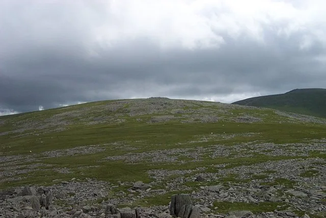
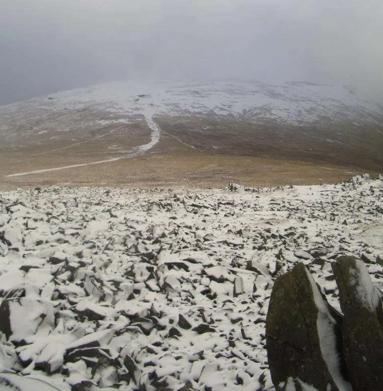
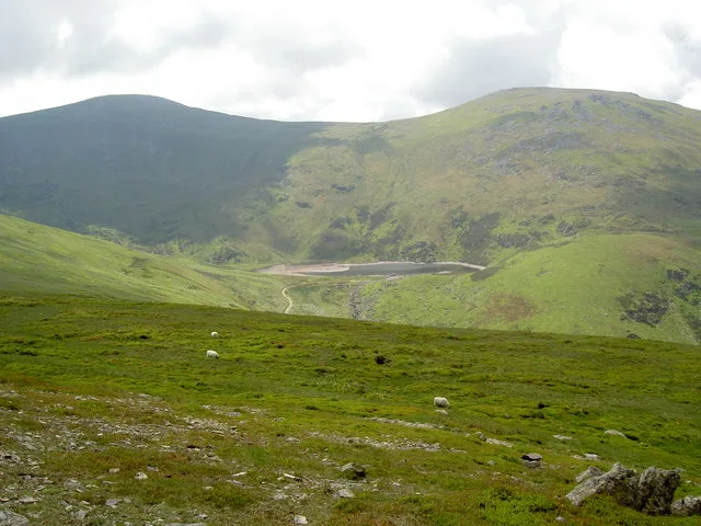
Carnedd Gwenllian, previously known as Carnedd Uchaf until 2009, is a minor summit of the Carneddau range in Snowdonia, Wales, and included in the Welsh 3000s. From the summit, distant views to the north can extend as far as Ireland and the Isle of Man, and to the South as far as the Berwyn Ranges. It lies between Foel Fras and Foel Grach, but is not always included in the Welsh 3000s, as its summit rises only slightly above the ridge. However, it is classed as a Hewitt. Its slopes, like all those in the northern Carneddau, are largely grassy, although they are steep. The slopes can receive significant accumulations of snow-drifts during blizzards in winter. In the past, snow beds have survived on the mountain as far as June. The annual average temperature on Carnedd Uchaf is relatively cold, ranging between 4-5 degrees Celsius. For some years there was a campaign by the Princess Gwenllian Society to have the name of this peak changed from Carnedd Uchaf to Carnedd Gwenllian. Gwenllian of Wales (1282–1337) was the only daughter of Llywelyn ap Gruffudd. After her father's death, and when still an infant, she was taken to a nunnery at Sempringham in Lincolnshire and held captive there until she died. In September 2009, the summit was renamed Carnedd Gwenllian, and the Ordnance Survey agreed to use the dual name Carnedd Uchaf/Carnedd Gwenllian on its maps from 2010 onwards.
Excerpt from Wikipedia under CC BY-SA 4.0. See the source article linked in Sources below.
- Coordinates
- 53.1830, -3.9663
- Address
- Snowdonia, Wales
- Nearest railway station
- Llanfairfechan — 8.3 km
Sources
- osm: n104406794 (ODbL)
- wikipedia: Carnedd Gwenllian (CC BY-SA 4.0)
- commons: Garnedd Uchaf from the Summit of Yr Aryg - geograph.org.uk - 223089.jpg (CC BY-SA 4.0)
Other places nearby
Loading nearby places…
Nearby
 📷 3
📷 3Natural landmarks · North Wales
Garnedd Uchaf
Garnedd Uchaf — mountain (925m) in Gwynedd.
 📷 3
📷 3Mountains & hills · North Wales
Y Foel Grach
Y Foel Grach — Named summit at 976 m.
 📷 3
📷 3Natural landmarks · North Wales
Foel Grach
Foel Grach — mountain (975.4m) in Gwynedd.
 📷 5
📷 5Reservoirs & lochs · North Wales
Llyn Dulyn
Llyn Dulyn — reservoir in Conwy, Wales.
 📷 3
📷 3Mountains & hills · North Wales
Foel Fras
Foel Fras — Named summit at 942 m.
 📷 3
📷 3Mountains & hills · North Wales
Bera Bach
Bera Bach — Named summit at 807 m.
More mountains in this region
 📷 5
📷 5Mountains & hills · North Wales
Cemlyn Bay and lagoon
Cemlyn Bay and lagoon — Site of Special Scientific Interest in Wales.
 📷 3
📷 3Mountains & hills · North Wales
Aberffraw Bay
Aberffraw Bay — bay on the west coast of Anglesey, in Wales, UK.
 📷 3
📷 3Mountains & hills · North Wales
Allt-fawr
Allt-fawr — Named summit at 698 m.
 📷 3
📷 3Mountains & hills · North Wales
Aran Benllyn
Aran Benllyn — Named summit at 884 m.
Frequently asked questions
- Where is Carnedd Gwenllian?
- Carnedd Gwenllian is in North Wales, in the United Kingdom — coordinates 53.1830°, -3.9663°. The nearest railway station is Llanfairfechan, around 8.3 km away.
- Is Carnedd Gwenllian free to visit?
- Yes — admission to Carnedd Gwenllian is free.