Mountains & hills · North Wales
Carnedd Dafydd
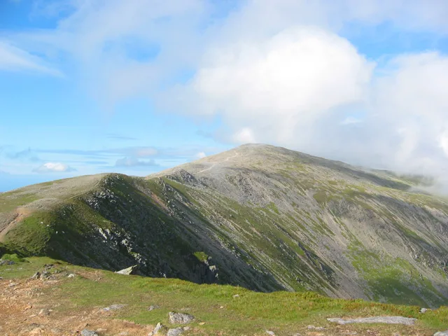
Carnedd Dafydd — Named summit at 1044 m.

Wikimedia Commons contributors — see linked file page for photographer and licence licence
Plan your visit
- Typical visit
- 3 h–8 h
- Best time of year
- Late spring – early autumn (May–Oct)
- Nearest railway station
- Gilfach Ddu · 8.1 km
- Free entry
- Dog-friendly
About
Carnedd Dafydd is a named summit in the United Kingdom. Wikidata describes it as: "Named summit at 1044 m.". Coordinates: 53.1477°, -4.0008°.
Photo gallery
From the Wikipedia article
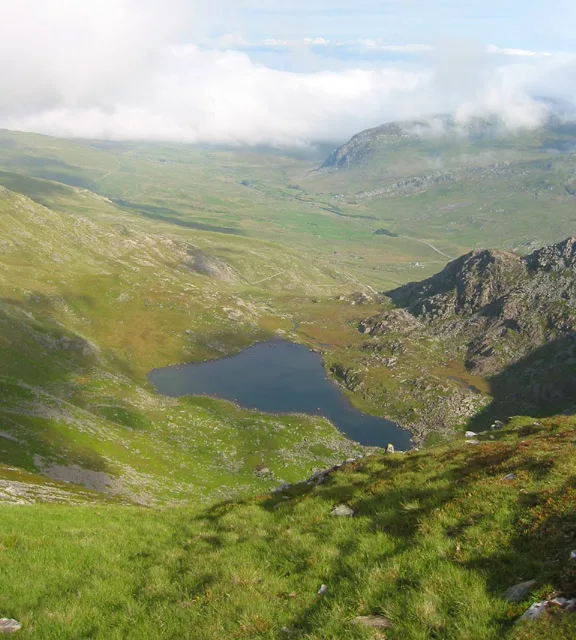
Carnedd Dafydd is a mountain peak in the Carneddau range in Snowdonia, Wales, and is the fourth highest peak in Wales. Situated south-west of Carnedd Llewelyn and north of Pen yr Ole Wen, Carnedd Dafydd is on the main ridge of the Carneddau, and on the border between Gwynedd and Conwy. The average annual temperature of the mountain is around 3–4 °C (37–39 °F). Carnedd Dafydd rises to height of 1,044 m (according to OS maps detail) and is usually climbed by first ascending Pen yr Ole Wen and then following the ridge along to Carnedd Dafydd, though it is also possible to make a direct ascent from Tal y Llyn Ogwen, first following the stream, Afon Lloer, to the mountain lake of Ffynnon Lloer then climbing up the slope to the summit. Like most of the summits in the southern Carneddau, it has a flat, boulder-strewn summit plateau. Immediately to the north lie the crags of Ysgolion Duon, well known to climbers. The origin of its name, which translates as Dafydd's (or David's) cairn, like that of its neighbouring peak, Carnedd Llewelyn (Llywelyn's cairn), are named after Llywelyn ap Gruffudd, the last independent prince of Wales, and his younger brother, Dafydd ap Gruffudd. The nearby peak Carnedd Lladron, commonly known as Carnedd Uchaf, has now been renamed by O.S. Carnedd Gwenllian in memory of Llywelyn's daughter Lady Gwenllian. Dafydd was captured at Nanhysglain, near Bera Mawr, on 21 June 1283; taken to Shrewsbury, he was hanged, drawn and quartered.
Excerpt from Wikipedia under CC BY-SA 4.0. See the source article linked in Sources below.
- Coordinates
- 53.1477, -4.0008
- Address
- Gwynedd / Conwy, Wales
- Nearest railway station
- Gilfach Ddu — 8.1 km
Sources
- osm: n330434704 (ODbL)
- wikipedia: Carnedd Dafydd (CC BY-SA 4.0)
- commons: Carnedd Dafydd.jpg (CC BY-SA 4.0)
Other places nearby
Loading nearby places…
Nearby
 📷 3
📷 3Natural landmarks · North Wales
Carnedd Dafydd
Carnedd Dafydd — mountain (1044m) in Gwynedd.
 📷 4
📷 4Mountains & hills · North Wales
Foel Meirch
Foel Meirch — a mountain in wales-north, United Kingdom, 800 m.
 📷 3
📷 3Natural landmarks · North Wales
Ffynnon Lloer
Ffynnon Lloer — lake in Conwy County Borough, Wales, UK.
 📷 3
📷 3Natural landmarks · North Wales
Pen yr Ole Wen
Pen yr Ole Wen — mountain (978m) in Gwynedd.
 📷 3
📷 3Mountains & hills · North Wales
Pen Yr Ole Wen
Pen Yr Ole Wen — Named summit at 978 m.
 📷 3
📷 3Mountains & hills · North Wales
Yr Elen
Yr Elen — Named summit at 962 m.
More mountains in this region
 📷 5
📷 5Mountains & hills · North Wales
Cemlyn Bay and lagoon
Cemlyn Bay and lagoon — Site of Special Scientific Interest in Wales.
 📷 3
📷 3Mountains & hills · North Wales
Aberffraw Bay
Aberffraw Bay — bay on the west coast of Anglesey, in Wales, UK.
 📷 3
📷 3Mountains & hills · North Wales
Allt-fawr
Allt-fawr — Named summit at 698 m.
 📷 3
📷 3Mountains & hills · North Wales
Aran Benllyn
Aran Benllyn — Named summit at 884 m.
Frequently asked questions
- Where is Carnedd Dafydd?
- Carnedd Dafydd is in North Wales, in the United Kingdom — coordinates 53.1477°, -4.0008°. The nearest railway station is Gilfach Ddu, around 8.1 km away.
- Is Carnedd Dafydd free to visit?
- Yes — admission to Carnedd Dafydd is free.