Towns & cities · North Wales
Caldy
Caldy — village in Wirral, Merseyside, United Kingdom.

Wikimedia Commons contributors — see linked file page for photographer and licence licence
Plan your visit
- Typical visit
- 3 h–6 h
- Nearest railway station
- West Kirby · 2.1 km
- Free entry
- Family-friendly
- Dog-friendly
About
Caldy is a town, city, village or settlement in the United Kingdom. Recent population estimates put it at around 1,290 people. Address: CH48. Wikidata describes it as: "village in Wirral, Merseyside, United Kingdom". Coordinates: 53.3590°, -3.1640°.
Photo gallery
Protected designations
- Site of Special Scientific Interest: Dee Estuary SSSI
- Ramsar wetland: The Dee Estuary
Designations sourced from Natural England open data under OGL v3.
From the Wikipedia article
Caldy (historically spelt Calday) is a small, affluent village on the Wirral Peninsula, Merseyside, England, south-east of West Kirby. It is part of the West Kirby & Thurstaston Ward of the Metropolitan Borough of Wirral, and is in the parliamentary constituency of Wirral West. At the time of the 2001 Census, Caldy had 1,290 inhabitants, of a total ward population of 12,869.
Excerpt from Wikipedia under CC BY-SA 4.0. See the source article linked in Sources below.
Background
History
It was first mentioned in the Domesday Book in 1086 as being owned by Hugh of Mere and being named ‘Calders’. Nearby is a large area of National Trust land called Caldy Hill. Many of the houses and walls in the village centre are built from the local red sandstone. Caldy was a township in the West Kirby parish of the Wirral Hundred. The population was 92 in 1801, 142 in 1851, 202 in 1901 and 607 in 1951. Until the twentieth century, Caldy was effectively a farming and agricultural village. However, The Caldy Manor Estates Company divided the land into smaller building plots, and from this one of the north of England's most exclusive residential villages emerged. In 1866 Caldy became a…
Sourced from Wikipedia under CC BY-SA 4.0.
- Coordinates
- 53.3590, -3.1640
- District
- Wirral
- Parish
- Wirral, unparished area
- Postcode
- CH48
- Parliamentary constituency
- Wirral West
- Population
- 1,290
- Nearest railway station
- West Kirby — 2.1 km
- Official site
- boulter.com
Sources
- wikidata: Q604423 (CC0)
- wikipedia: Caldy (CC BY-SA 4.0)
- commons: Caldy - geograph.org.uk - 2480.jpg (CC BY-SA 4.0)
Other places nearby
Loading nearby places…
Nearby
 Flagship📷 3
Stately homes · North Wales
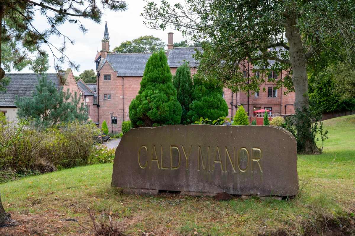
Caldy Manor
Caldy Manor — manor house in Wirral, Merseyside, England, UK.
 📷 3
📷 3Historic churches · North Wales
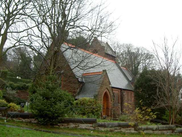
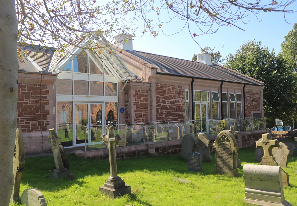
Church of the Resurrection and All Saints, Caldy
Church of the Resurrection and All Saints, Caldy — grade II listed church in Caldy, Wirral, Merseyside, England, UK.
 📷 3
📷 3Parks · North Wales
Caldy Hill
Caldy Hill — park in Caldy, United Kingdom.
 📷 3
📷 3Museums · North Wales
West Kirby Museum
West Kirby Museum — museum in West Kirby, England, UK.
 📷 3
📷 3Memorials & monuments · North Wales
West Kirby War Memorial
West Kirby War Memorial — Grade II listed building-listed memorial in wales-north, United Kingdom.
 📷 5
📷 5Historic churches · North Wales
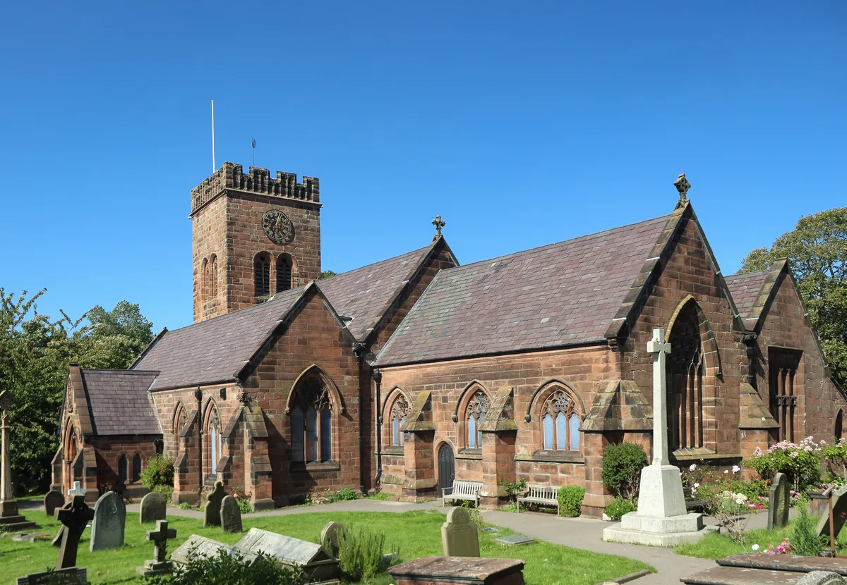
St Bridget's Church, West Kirby
St Bridget's Church, West Kirby — grade II listed church in West Kirby, Wirral, United Kingdom.
More towns in this region
 📷 5
📷 5Towns & cities · North Wales
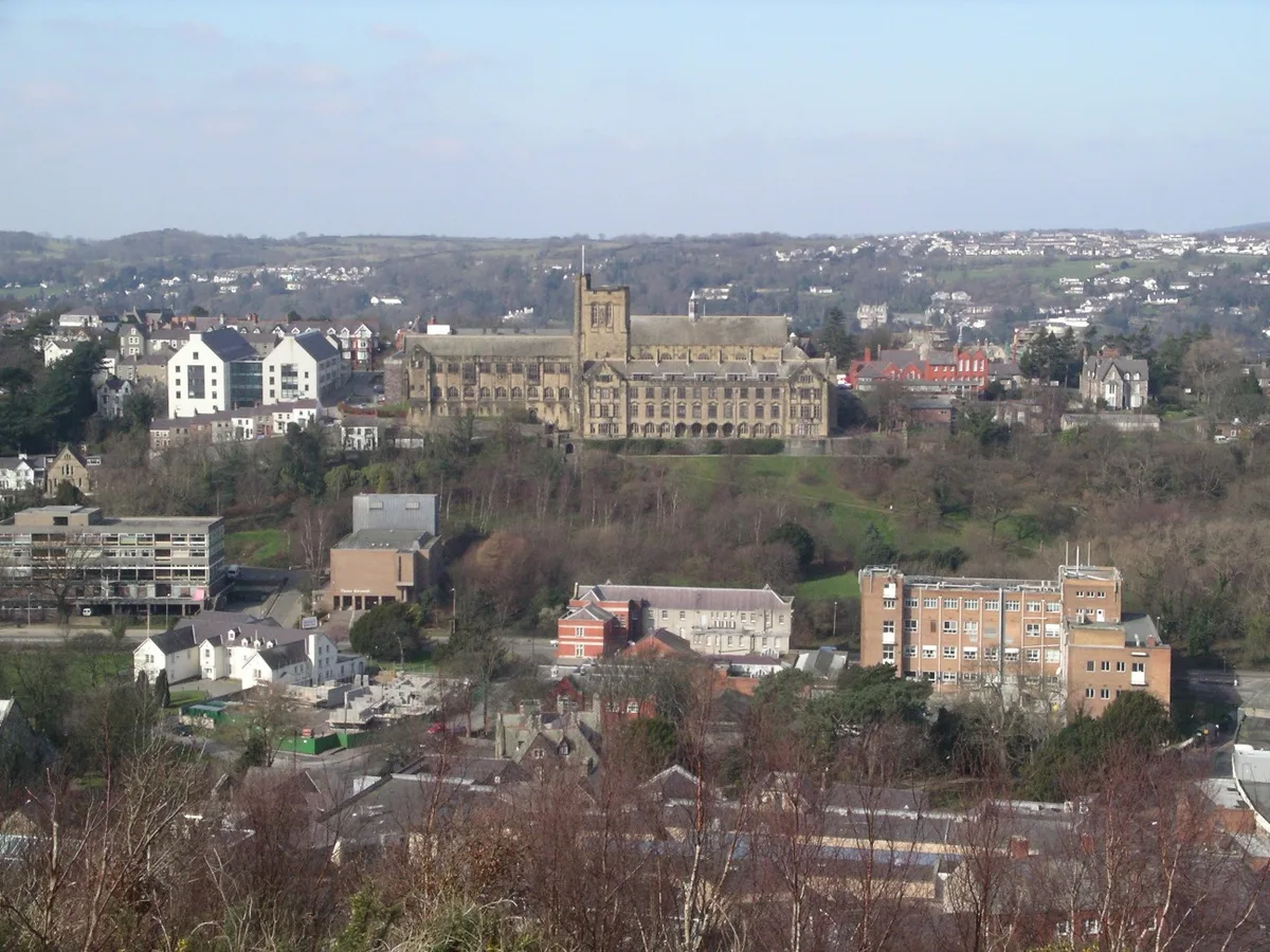
Bangor
Bangor — city in Gwynedd, Wales.
 Flagship📷 3
Towns & cities · North Wales
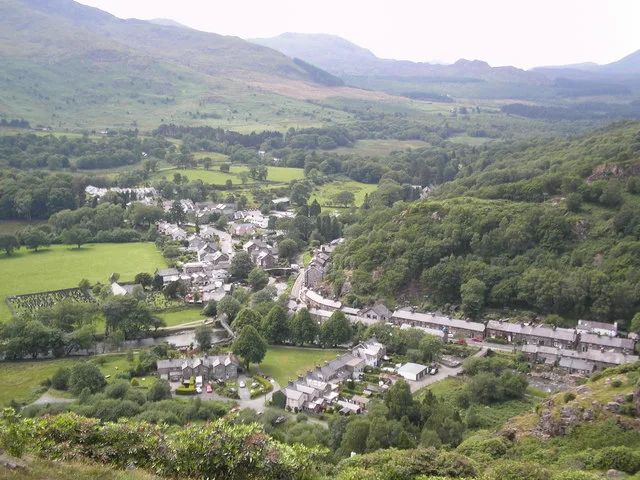
Beddgelert
Beddgelert — village and community in Gwynedd, Wales.
 Flagship📷 5
Towns & cities · North Wales
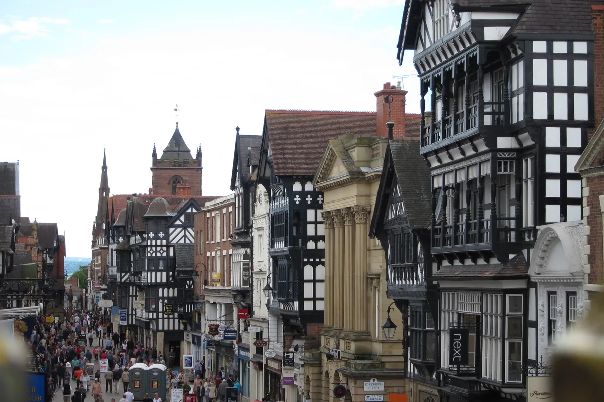
Chester
Chester — city in Cheshire, England.
 Flagship📷 3
Towns & cities · North Wales
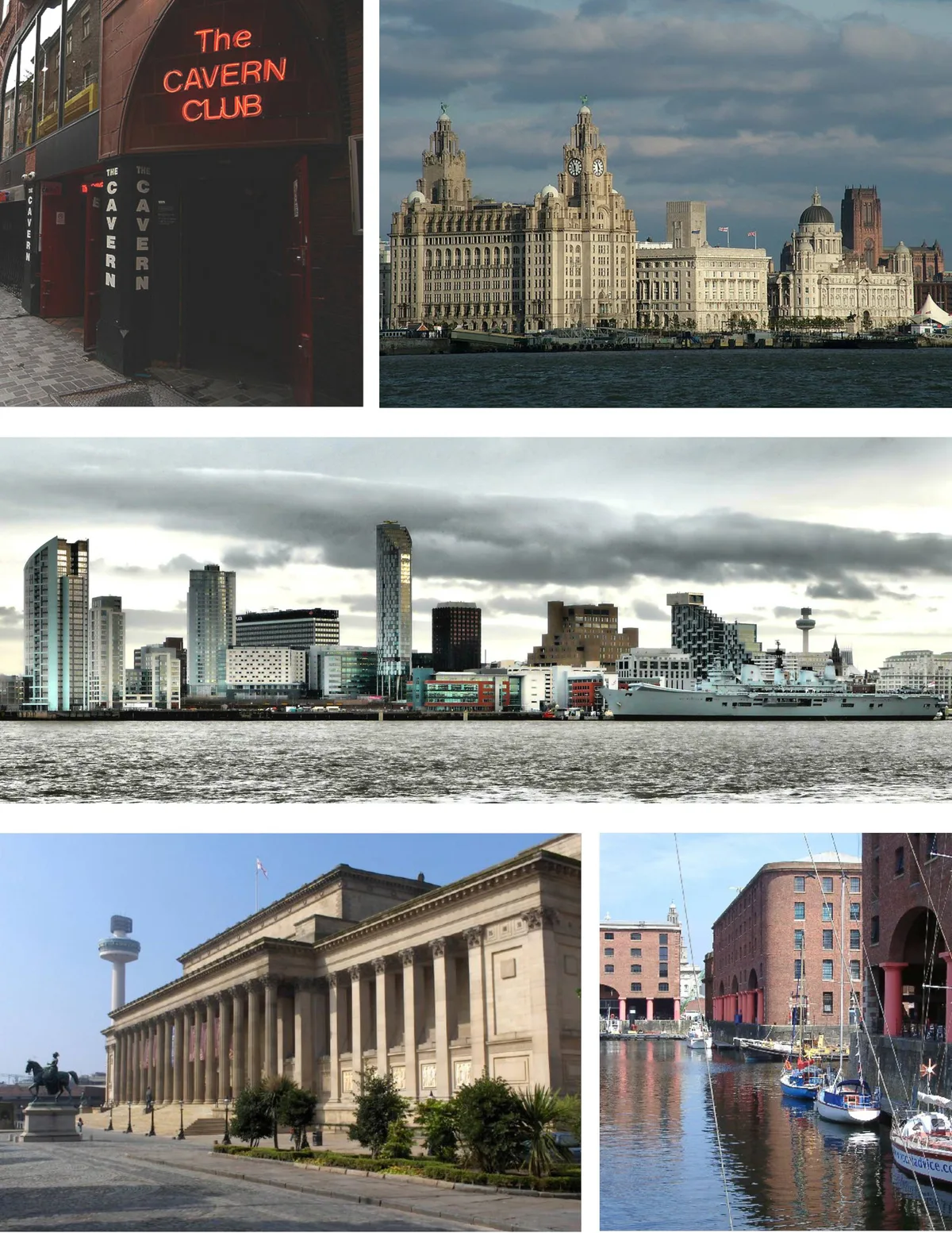
Liverpool
Liverpool — city in Merseyside, England, United Kingdom.
Frequently asked questions
- Where is Caldy?
- Caldy is in North Wales, United Kingdom (postcode CH48), in the parish of Wirral, unparished area.
- Is Caldy a protected site?
- Yes — Caldy is part of the Dee Estuary SSSI Site of Special Scientific Interest and the The Dee Estuary Ramsar wetland.
- Is Caldy free to visit?
- Yes, Caldy is free to enter.
- How do I get to Caldy?
- The nearest railway station is West Kirby, about 2.1 km away. Drivers can navigate to postcode CH48.