Forests & woodlands · North Wales
Thurstaston Common
Thurstaston Common is a forest or woodland in the United Kingdom.
.jpg?width=1200)
Wikimedia Commons contributors — see linked file page for photographer and licence licence
.jpg)
Plan your visit
- Typical visit
- 1 h–3 h
- Nearest railway station
- Royden Park Minature Railway · 0.8 km
- Free entry
- Family-friendly
- Dog-friendly
About
Thurstaston Common is a named forest, woodland or nature reserve in the United Kingdom. Coordinates: 53.3563°, -3.1356°. This entry is part of The Great Britain Guide, a free, ad-free, open-data tourist directory.
Photo gallery
Protected designations
- Site of Special Scientific Interest: Dee Estuary SSSI
- Site of Special Scientific Interest: Thurstaston Common SSSI
- Ramsar wetland: The Dee Estuary
Designations sourced from Natural England open data under OGL v3.
From the Wikipedia article
Thurstaston Common is an area of almost 250 acres (100 ha) of parklands, wood and heath between Frankby and Thurstaston, on the Wirral Peninsula in North West England. The common is jointly owned by the National Trust and the Metropolitan Borough of Wirral. Royden Country Park is nearby and offers additional facilities. The Common is a Site of Special Scientific Interest (SSSI) and a local nature reserve. From the top of the 298 ft (91 m) Thurstaston Hill there are views of the Dee Estuary (itself an SSSI) and across to the Clwydian Hills of North Wales. The area is popular with walkers and families.
Excerpt from Wikipedia under CC BY-SA 4.0. See the source article linked in Sources below.
- Coordinates
- 53.3563, -3.1356
- District
- Wirral
- Parish
- Wirral, unparished area
- Postcode
- CH61 0HH
- Parliamentary constituency
- Wirral West
- Nearest railway station
- Royden Park Minature Railway — 0.8 km
Sources
- osm: w26528065 (ODbL)
- wikipedia: Thurstaston Common (CC BY-SA 4.0)
- commons: Direction Marker, Thurstaston Hill (geograph 2990383).jpg (CC BY-SA 4.0)
Other places nearby
Loading nearby places…
Nearby
 📷 3
📷 3Viewpoints · North Wales
Thor's Rock
Thor's Rock is a viewpoint in the United Kingdom.
 📷 5
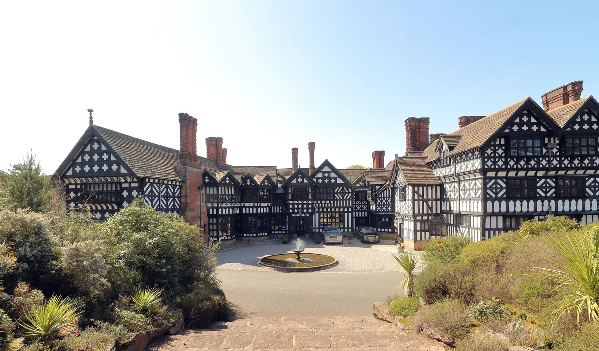
📷 5Historic houses · North Wales
Hill Bark
Hill Bark — historic site in Merseyside, England, UK.
 📷 5
📷 5Parks · North Wales
Royden Park
Royden Park is a park in Frankby, Wirral, England, managed by Wirral Council. The grounds of the park were originally part of an estate owned by Ernest Royden which comprised the park, Hill Bark house
 📷 3
📷 3Memorials & monuments · North Wales
Thurstaston War Memorial
Thurstaston War Memorial — Grade II listed building-listed memorial in wales-north, United Kingdom.
 📷 3
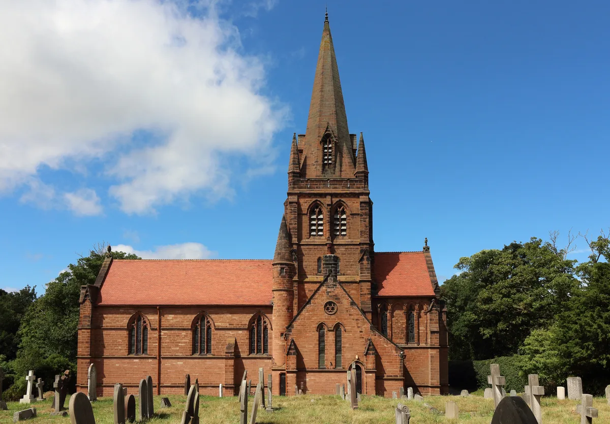
📷 3Historic churches · North Wales
St. Bartholomew's Church, Thurstaston
St. Bartholomew's Church, Thurstaston — church in Wirral, UK.
 📷 4
📷 4Farms (open to visitors) · North Wales
Hill Bark Farmhouse
Hill Bark Farmhouse — a Grade II*-listed farm in wales-north, United Kingdom.
More forests in this region
 📷 4
📷 4Forests & woodlands · North Wales
Ceunant Llennyrch National Nature Reserve
Ceunant Llennyrch National Nature Reserve is a forest or woodland in the United Kingdom.
 📷 3
📷 3Forests & woodlands · North Wales
Coed Camlyn National Nature Reserve
Coed Camlyn National Nature Reserve is a forest or woodland in the United Kingdom.
 📷 3
📷 3Forests & woodlands · North Wales
Coed Ganllwyd National Nature Reserve
Coed Ganllwyd National Nature Reserve is a forest or woodland in the United Kingdom.
 📷 3
📷 3Forests & woodlands · North Wales
Coed Ganllwyd National Nature Reserve
Coed Ganllwyd National Nature Reserve is a forest or woodland in the United Kingdom.
Frequently asked questions
- Where is Thurstaston Common?
- Thurstaston Common is in North Wales, United Kingdom (postcode CH61 0HH), in the parish of Wirral, unparished area.
- Is Thurstaston Common a protected site?
- Yes — Thurstaston Common is part of the Dee Estuary SSSI Site of Special Scientific Interest and the Thurstaston Common SSSI Site of Special Scientific Interest.
- Is Thurstaston Common free to visit?
- Yes, Thurstaston Common is free to enter.
- How do I get to Thurstaston Common?
- The nearest railway station is Royden Park Minature Railway, about 0.8 km away. Drivers can navigate to postcode CH61 0HH.