Harbours & ports · South Wales
Burry Port Harbour
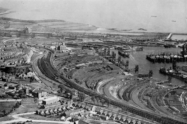
Burry Port Harbour — industrial port for coal industry.

Wikimedia Commons licence
Plan your visit
- Typical visit
- 45 min–1.5 h
- Nearest railway station
- Pembrey and Burry Port · 0.4 km
- Family-friendly
- Dog-friendly
About
Burry Port Harbour is a harbour in the United Kingdom. Wikidata describes it as: "industrial port for coal industry". Coordinates: 51.6809°, -4.2531°.
Photo gallery
From the Wikipedia article
Burry Port Harbour is a former industrial harbour which mainly served the coal industry, on the Loughor estuary (Moryd Llwchwr). It is now converted into a marina. The town of Burry Port grew around the harbour.
Excerpt from Wikipedia under CC BY-SA 4.0. See the source article linked in Sources below.
Background
History
| related_legislation = | status = repealed | legislation_history = | theyworkforyou = | millbankhansard = | original_text = | revised_text = | use_new_UK-LEG = | UK-LEG_title = | collapsed = yes }} The town of Burry Port dates from the nineteenth century although the neighbouring village of Pembrey has a history dating back to the medieval period. From the late eighteenth century, the development of small collieries in the area led to the building of a network of canals and then tramways to carry coal from inland mines to the sea. The first of these canals was built by Thomas Kymer and reached the sea at Kidwelly and another was built in 1798 by the Earl of Ashburnham to serve his…
Sourced from Wikipedia under CC BY-SA 4.0.
- Coordinates
- 51.6809, -4.2531
- District
- Carmarthenshire
- Parish
- Pembrey and Burry Port Town
- Postcode
- SA16 0FE
- Parliamentary constituency
- Llanelli
- Established
- 1832
- Nearest railway station
- Pembrey and Burry Port — 0.4 km
Sources
- wikidata: Q97657081 (CC0)
- wikipedia: Burry Port Harbour (CC BY-SA 4.0)
Other places nearby
Loading nearby places…
Nearby
Caravan parks · South Wales
Shoreline Caravan Park
Shoreline Caravan Park — a caravan park in wales south.
 📷 5
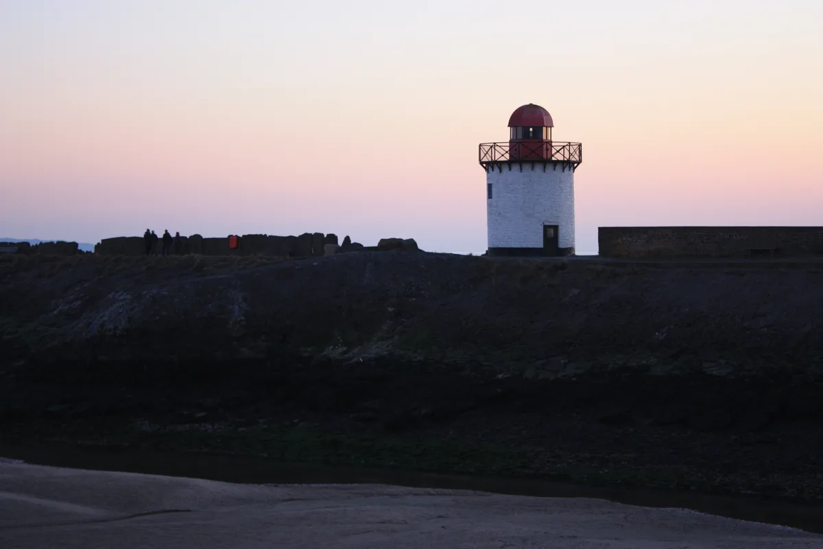
📷 5Lighthouses · South Wales
Burry Port Lighthouse
Burry Port Lighthouse — lighthouse, Grade II listed building in Carmarthenshire, Wales; on the W breakwater of Burry Port harbour.
 📷 4
📷 4Memorials & monuments · South Wales
Amelia Earhart
Amelia Earhart is a memorial in the United Kingdom.
 📷 5
📷 5Memorials & monuments · South Wales
Monument to Amelia Earhart
Monument to Amelia Earhart — Grade II listed building-listed memorial in wales-south, United Kingdom.
Vineyards · South Wales
Y Gaer Hillfort, Burry Port
Y Gaer Hillfort, Burry Port — a UK vineyard in wales south, producing English or Welsh wine from cool-climate grape varieties.
 📷 5
📷 5Historic bridges · South Wales
Former canal overbridge
Former canal overbridge — Grade II listed building-listed bridge in wales-south, United Kingdom.
More places in this region
 Flagship📷 5
Harbours & ports · South Wales
Barry Docks
Barry Docks is a harbour in the United Kingdom.
 📷 5
📷 5Harbours & ports · South Wales
Avonmouth
Avonmouth — port, suburb and former electoral ward in Bristol, England.
 📷 3
📷 3Harbours & ports · South Wales
Barry Harbour
Barry Harbour — former harbour in Barry, Vale of Glamorgan.
 📷 5
📷 5Harbours & ports · South Wales
Bristol Harbour
Bristol Harbour — harbour in the city of Bristol, England.
Frequently asked questions
- Where is Burry Port Harbour?
- Burry Port Harbour is in South Wales, United Kingdom (postcode SA16 0FE), in the parish of Pembrey and Burry Port Town.
- When was Burry Port Harbour built?
- Built or established in 1832.
- Who owns Burry Port Harbour?
- Burry Port Harbour is owned by The Marine Group.
- How do I get to Burry Port Harbour?
- The nearest railway station is Pembrey and Burry Port, about 0.4 km away. Drivers can navigate to postcode SA16 0FE.