Towns & cities · North East England
Brotton
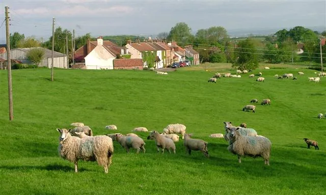
Brotton — village in North Yorkshire, England, UK.

Wikimedia Commons contributors — see linked file page for photographer and licence licence
Plan your visit
- Typical visit
- 3 h–6 h
- Nearest railway station
- Forest Halt · 2.5 km
- Free entry
- Family-friendly
- Dog-friendly
About
Brotton is a town, city, village or settlement in the United Kingdom. Recent population estimates put it at around 5,394 people. Wikidata describes it as: "village in North Yorkshire, England, UK". Coordinates: 54.5680°, -0.9370°.
Photo gallery
From the Wikipedia article
Brotton is a village in the civil parish of Skelton and Brotton, in the Redcar and Cleveland district, in the ceremonial county of North Yorkshire, England It is situated approximately 2.5 miles (4 km) south-east of Saltburn-by-the-Sea, 9 miles from Redcar, 12 miles (19 km) east of Middlesbrough and 14 miles (23 km) north-west of Whitby. East Cleveland Hospital operates in the village.
Excerpt from Wikipedia under CC BY-SA 4.0. See the source article linked in Sources below.
Background
History
The name of the village (known in medieval times as 'Broctune') means Brook Farm (settlement by a stream), being derived from the Old English brōc and tūn. The village is listed in the Domesday Book, and used to be in the Langbaurgh Wapentake. Warsett Hill tops the large Huntcliffe which was the site of one of the many Roman signal stations built along the east coast to defend against Anglo-Saxon attack. Brotton was one of a number of manors granted by William the Conqueror to Robert de Brus, Lord of Skelton. Over recent years Brotton has become somewhat isolated because of a bypass which was opened in stages between 1998 and 2001 connecting the town of Skelton-in-Cleveland and village of…
Sourced from Wikipedia under CC BY-SA 4.0.
- Coordinates
- 54.5680, -0.9370
- District
- Redcar and Cleveland
- Parish
- Skelton and Brotton
- Postcode
- TS12 2PN
- Parliamentary constituency
- Middlesbrough South and East Cleveland
- Population
- 5,394
- Nearest railway station
- Forest Halt — 2.5 km
Sources
- wikidata: Q1622799 (CC0)
- wikipedia: Brotton (CC BY-SA 4.0)
- commons: Brotton.jpg (CC BY-SA 4.0)
Other places nearby
Loading nearby places…
Nearby
 📷 3
📷 3Memorials & monuments · North East England
Boulby Potash Shaft Grab
Boulby Potash Shaft Grab — a memorial in england-north-east, United Kingdom.
 📷 3
📷 3Public art & sculpture · North East England
From Beneath
From Beneath — a public art in england-north-east, United Kingdom.
 📷 3
📷 3Mines & mining heritage · North East England
North Skelton Mine
North Skelton Mine — disused ironstone mine in Cleveland, England.
 📷 4
📷 4Public art & sculpture · North East England
Charm Bracelet
Charm Bracelet — a public art in england-north-east, United Kingdom.
Vineyards · North East England
Medieval settlement and open field system at Kilton Thorpe
Medieval settlement and open field system at Kilton Thorpe — a UK vineyard in england north east, producing English or Welsh wine from cool-climate grape varieties.
 📷 3
📷 3Beaches · North East England
Cattersty Sands
Cattersty Sands is a beach in the United Kingdom.
More towns in this region
 Flagship📷 3
Towns & cities · North East England
Newby
Newby — village and civil parish in Hambleton, North Yorkshire, England, UK.
 📷 5
📷 5Towns & cities · North East England
Archdeacon Newton
Archdeacon Newton — village and civil parish in County Durham, England, UK.
 📷 3
📷 3Towns & cities · North East England
Bampton
Bampton — village and civil parish in Eden, Cumbria, England.
 📷 3
📷 3Towns & cities · North East England
Bomby
Bomby — village in Cumbria, UK.
Frequently asked questions
- Where is Brotton?
- Brotton is in North-East England, United Kingdom (postcode TS12 2PN), in the parish of Skelton and Brotton.
- Is Brotton free to visit?
- Yes, Brotton is free to enter.
- How do I get to Brotton?
- The nearest railway station is Forest Halt, about 2.5 km away. Drivers can navigate to postcode TS12 2PN.