Natural landmarks · North East England
Brock Crags
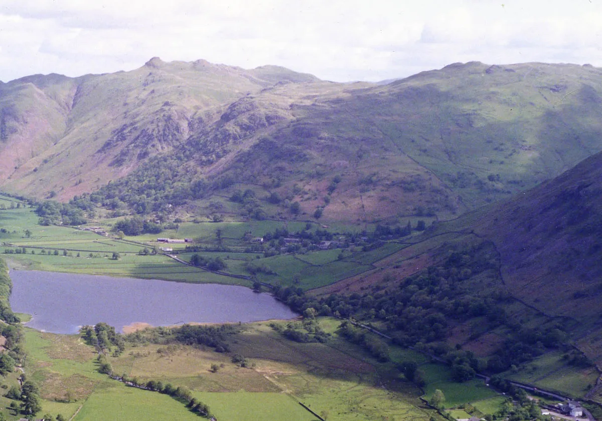
Brock Crags — mountain in United Kingdom.

Wikimedia Commons contributors — see linked file page for photographer and licence licence
Plan your visit
- Typical visit
- 1 h–2 h
- Free entry
- Dog-friendly
About
Brock Crags is a named natural landmark in the United Kingdom. Wikidata describes it as: "mountain in United Kingdom". Coordinates: 54.5153°, -2.8990°.
Photo gallery
Protected designations
- Site of Special Scientific Interest: River Eden and Tributaries SSSI
Designations sourced from Natural England open data under OGL v3.
From the Wikipedia article
Brock Crags is a fell in the English Lake District, standing above Hartsop in the Far Eastern Fells. It forms part of the perimeter of Martindale, lying on the long ridge from Rampsgill Head to Place Fell.
Excerpt from Wikipedia under CC BY-SA 4.0. See the source article linked in Sources below.
- Coordinates
- 54.5153, -2.8990
- District
- Westmorland and Furness
- Parish
- Patterdale
- Postcode
- CA11 0NY
- Parliamentary constituency
- Westmorland and Lonsdale
Sources
- wikidata: Q4972705 (CC0)
- wikipedia: Brock Crags (CC BY-SA 4.0)
- commons: Brock Crags and Angle Tarn Pikes.jpg (CC BY-SA 4.0)
Other places nearby
Loading nearby places…
Nearby
 📷 3
📷 3Mountains & hills · North East England
Brock Crags (Wainwright)
Brock Crags (Wainwright) — Named summit at 561.2 m.
 📷 5
📷 5Natural landmarks · North East England
Angle Tarn
Angle Tarn — lake near Patterdale, Cumbria, England, United Kingdom.
 📷 3
📷 3Viewpoints · North East England
Myers Head Lead Mine
Myers Head Lead Mine is a viewpoint in the United Kingdom.
 📷 3
📷 3Mountains & hills · North East England
Angletarn Pikes South Top
Angletarn Pikes South Top — Named summit at 563.6 m.
 📷 3
📷 3Historic bridges · North East England
Pasture Beck Bridge
Pasture Beck Bridge — Grade II listed building-listed bridge in england-north-east, United Kingdom.
 📷 3
📷 3Viewpoints · North East England
Dubhow Copper Mine
Dubhow Copper Mine is a viewpoint in the United Kingdom.
More natural landmarks in this region
 Flagship📷 5
Natural landmarks · North East England
Brothers Water
Brothers Water — lake in Cumbria, England, UK.
📷 5Natural landmarks · North East England
Angle Tarn
Angle Tarn — lake near Patterdale, Cumbria, England, United Kingdom.
 📷 3
📷 3Natural landmarks · North East England
Angletarn Pikes
Angletarn Pikes — mountain in United Kingdom.
 📷 3
📷 3Natural landmarks · North East England
Ard Crags
Ard Crags — mountain in United Kingdom.
Frequently asked questions
- Where is Brock Crags?
- Brock Crags is in North-East England, United Kingdom (postcode CA11 0NY), in the parish of Patterdale.
- Is Brock Crags a protected site?
- Yes — Brock Crags is part of the River Eden and Tributaries SSSI Site of Special Scientific Interest.
- Is Brock Crags free to visit?
- Yes, Brock Crags is free to enter.
- How do I get to Brock Crags?
- Drivers can navigate to postcode CA11 0NY. It sits within the Westmorland and Lonsdale parliamentary constituency.