Natural landmarks · North East England
Angle Tarn
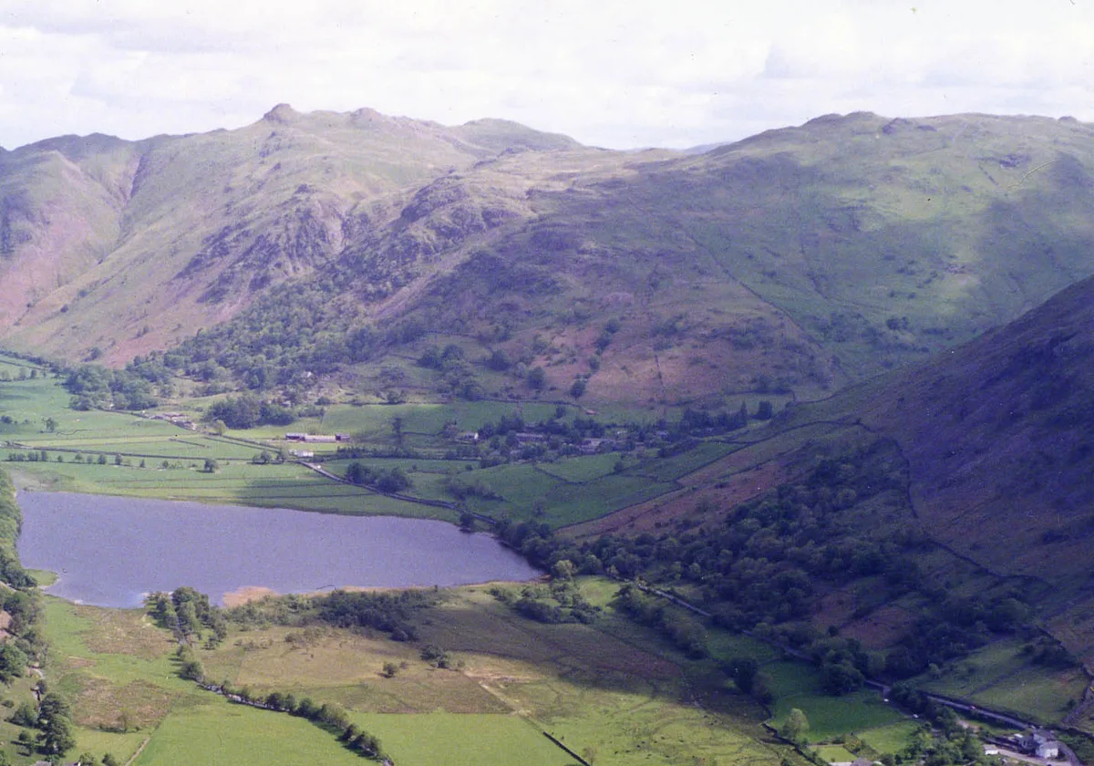
Angle Tarn — lake near Patterdale, Cumbria, England, United Kingdom.

Wikimedia Commons contributors — see linked file page for photographer and licence licence
Plan your visit
- Typical visit
- 1 h–2 h
- Free entry
- Dog-friendly
About
Angle Tarn is a named natural landmark in the United Kingdom. Wikidata describes it as: "lake near Patterdale, Cumbria, England, United Kingdom". Coordinates: 54.5197°, -2.9006°.
Photo gallery
Protected designations
- Site of Special Scientific Interest: River Eden and Tributaries SSSI
Designations sourced from Natural England open data under OGL v3.
From the Wikipedia article
Angle Tarn is a tarn in Cumbria, England, within the Lake District National Park, about a mile north-east of Hartsop. Located at an altitude of 479 m (1,572 ft), the lake has an area of 5.9 hectares (15 acres), measures 385 by 260 m (1,263 by 853 ft), with a maximum depth of 9 m (30 ft). The lake is very distinctive in that it resembles a fish hook in shape. It contains two rocky islets and a small broken peninsula. It is located on the Angletarn Pikes, which are named after it. This should not be confused with Angle Tarn (Langstrath), a smaller lake with the same name about 18.5 km to the northeast near Bowfell, also within the Lake District National Park. Angle Tarn is a popular spot for overnight wild camping, especially on weekends and in the summer months. The tarn has been described by Alfred Wainwright as among the best of Lakeland tarns.
Excerpt from Wikipedia under CC BY-SA 4.0. See the source article linked in Sources below.
- Coordinates
- 54.5197, -2.9006
- District
- Westmorland and Furness
- Parish
- Patterdale
- Postcode
- CA11 0NY
- Parliamentary constituency
- Westmorland and Lonsdale
Sources
- wikidata: Q4763352 (CC0)
- wikipedia: Angle Tarn (Patterdale) (CC BY-SA 4.0)
- commons: Angle Tarn.JPG (CC BY-SA 4.0)
Other places nearby
Loading nearby places…
Nearby
 📷 3
📷 3Natural landmarks · North East England
Brock Crags
Brock Crags — mountain in United Kingdom.
 📷 3
📷 3Mountains & hills · North East England
Brock Crags (Wainwright)
Brock Crags (Wainwright) — Named summit at 561.2 m.
 📷 3
📷 3Mountains & hills · North East England
Angletarn Pikes South Top
Angletarn Pikes South Top — Named summit at 563.6 m.
 📷 3
📷 3Mountains & hills · North East England
Angletarn Pikes
Angletarn Pikes — Named summit at 566 m.
 📷 3
📷 3Natural landmarks · North East England
Angletarn Pikes
Angletarn Pikes — mountain in United Kingdom.
 📷 3
📷 3Viewpoints · North East England
Dubhow Copper Mine
Dubhow Copper Mine is a viewpoint in the United Kingdom.
More natural landmarks in this region
 Flagship📷 5
Natural landmarks · North East England
Brothers Water
Brothers Water — lake in Cumbria, England, UK.
📷 3Natural landmarks · North East England
Angletarn Pikes
Angletarn Pikes — mountain in United Kingdom.
 📷 3
📷 3Natural landmarks · North East England
Ard Crags
Ard Crags — mountain in United Kingdom.
 📷 3
📷 3Natural landmarks · North East England
Armboth Fell
Armboth Fell — mountain in United Kingdom.
Frequently asked questions
- Where is Angle Tarn?
- Angle Tarn is in North-East England, United Kingdom (postcode CA11 0NY), in the parish of Patterdale.
- Is Angle Tarn a protected site?
- Yes — Angle Tarn is part of the River Eden and Tributaries SSSI Site of Special Scientific Interest.
- Is Angle Tarn free to visit?
- Yes, Angle Tarn is free to enter.
- How do I get to Angle Tarn?
- Drivers can navigate to postcode CA11 0NY. It sits within the Westmorland and Lonsdale parliamentary constituency.