Harbours & ports · South Wales
Bristol Harbour
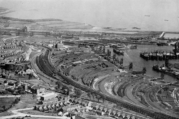
Bristol Harbour — harbour in the city of Bristol, England.

Wikimedia Commons contributors — see linked file page for photographer and licence licence
Plan your visit
- Typical visit
- 45 min–1.5 h
- Nearest railway station
- Princes Wharf · 0.3 km
- Family-friendly
- Dog-friendly
- Wheelchair accessible
About
Bristol Harbour is a harbour in the United Kingdom. Wikidata describes it as: "harbour in the city of Bristol, England". Coordinates: 51.4500°, -2.6000°.
Photo gallery
Protected designations
- Site of Special Scientific Interest: Severn Estuary SSSI
Designations sourced from Natural England open data under OGL v3.
From the Wikipedia article
Bristol Harbour is the harbour in the city of Bristol, England. The harbour covers an area of 70 acres (28 hectares). It is the former natural tidal river Avon through the city but was made into its current form in 1809 when the tide was prevented from going out permanently. A tidal by-pass was dug for 2 miles through the fields of Bedminster for the river, known as the "River Avon New Cut", "New Cut", or simply "The Cut". It is often called the Floating Harbour as the water level remains constant and it is not affected by the state of the tide on the river in the Avon Gorge, The New Cut or the natural river southeast of Temple Meads to its source. Netham Lock at the east end of the 1809 Feeder Canal is the upstream limit of the floating harbour. Beyond the lock is a junction: on one arm the navigable River Avon continues upstream to Bath, and on the other arm is the tidal natural River Avon. The first 1 mile (1.6 kilometres) of the floating harbour, downstream from Netham Lock to Totterdown Basin, is an artificial canal known as the Feeder Canal, while the tidal River Avon follows its original route. Downstream of Totterdown Basin, the floating harbour occupies the former natural course of the River Avon, whilst the tidal River Avon flows through an artificial channel known as the New Cut. This separation of the floating harbour and the tidal River Avon allows boats in the harbour to remain floating at low tide, reduces currents and silting and prevents flooding. Between Bristol Temple Meads railway station and Hotwells, the harbour and the River Avon run parallel at a distance of no more than 5⁄8 mile (1 kilometre) apart. Downstream of Bristol Temple Meads railway station, the floating harbour meanders through Bristol city centre, Canon's Marsh and Hotwells. At Hotwells, the floating harbour rejoins the tidal River Avon, via a series of locks, and flows into the Avon Gorge. Bristol Harbour was the original Port of Bristol, but as ships and their cargo have…
Excerpt from Wikipedia under CC BY-SA 4.0. See the source article linked in Sources below.
Background
History
, St Augustine the Less Church and Bristol Cathedral, published c. 1850. The view shows the historic harbour with ten sailing ships and rowing boats before the channel was filled in 1892–1938.]] Bristol grew up on the banks of the Rivers Avon and Frome. Since the 13th century, the rivers have been modified for use as docks including the diversion of the River Frome in the 1240s into an artificial deep channel known as "Saint Augustine's Reach", which flowed into the River Avon. Saint Augustine's Reach became the heart of Bristol's docks with its quays and wharfs. in the Cumberland lock, Hotwells, during the 2004 Harbour Festival]] As early as 1420, vessels from Bristol were regularly…
Architecture
]] In the 18th century, the docks in Liverpool grew larger and so increased competition with Bristol for the tobacco trade. Coastal trade was also important, with the area called "Welsh Back" concentrating on trows with cargoes from the slate industry in Wales, stone, timber and coal. The limitations of Bristol's docks were causing problems to business, so in 1802 William Jessop proposed installing a dam and lock at Hotwells to create the harbour. The £530,000 scheme was approved by Parliament, and construction began in May 1804. The scheme included the construction of the Cumberland Basin, a large wide stretch of the harbour in Hotwells where the Quay walls and bollards have listed…
Description
]] The harbour is now a tourist attraction with museums, galleries, exhibitions, bars and nightclubs. Former workshops and warehouses have now largely been converted or replaced by cultural venues, such as the Arnolfini art gallery, Watershed media and arts centre, M Shed museum, Antlers Gallery and the We The Curious science exhibition centre, as well as a number of fashionable apartment buildings. The Bristol Harbour Railway, operated by M Shed, runs between the museum and the CREATE Centre on some weekends and bank holidays. Historic boats are permanently berthed in the harbour. These include Isambard Kingdom Brunel's , which was the first iron-hulled and propeller-driven ocean liner; A…
Sourced from Wikipedia under CC BY-SA 4.0.
- Coordinates
- 51.4500, -2.6000
- District
- Bristol, City of
- Parish
- Bristol, City of, unparished area
- Postcode
- BS1 5DB
- Parliamentary constituency
- Bristol Central
- Phone
- +44 117 915 1000
- Nearest railway station
- Princes Wharf — 0.3 km
- Opening
- Mo-Fr 10:00-17:00, Sa-Su 10:00-18:00
- Official site
- www.wethecurious.org
Sources
- wikidata: Q26874 (CC0)
- wikipedia: Bristol Harbour (CC BY-SA 4.0)
- commons: 20050319 046 bristol arnolfini.jpg (CC BY-SA 4.0)
Other places nearby
Loading nearby places…
Nearby
 📷 5
📷 5Museums · South Wales
Canon's Marsh
Canon's Marsh (sometimes written Canons Marsh) is an inner city area of Bristol, England. Canon's Marsh occupies low-lying land on the north side of the Floating Harbour, immediately to the west of th
📷 5Museums · South Wales
Bristol Harbour Festival
The Bristol Harbour Festival is a free festival held annually in the English city of Bristol, which celebrates the city's maritime heritage and the importance of Bristol's docks and harbour. Most of t
 📷 5
📷 5Museums · South Wales
Millennium Square, Bristol
Millennium Square is a city square in the Canon's Marsh area of Bristol, England. It was built in the late 1990s as part of the harbourside regeneration and We The Curious (then named @Bristol) develo
 📷 3
📷 3Public art & sculpture · South Wales
Aquarena
Aquarena in Wales South, United Kingdom.
 📷 3
📷 3Natural landmarks · South Wales
BBC Big Screen
BBC Big Screen — a other in wales-south, United Kingdom.
 📷 4
📷 4Public art & sculpture · South West England
Bill and Bob
Bill and Bob — a public art in england-south-west, United Kingdom.
More places in this region
 Flagship📷 5
Harbours & ports · South Wales
Barry Docks
Barry Docks is a harbour in the United Kingdom.
 📷 5
📷 5Harbours & ports · South Wales
Avonmouth
Avonmouth — port, suburb and former electoral ward in Bristol, England.
 📷 3
📷 3Harbours & ports · South Wales
Barry Harbour
Barry Harbour — former harbour in Barry, Vale of Glamorgan.
 📷 3
📷 3Harbours & ports · South Wales
Burry Port Harbour
Burry Port Harbour — industrial port for coal industry.
Frequently asked questions
- Where is Bristol Harbour?
- Bristol Harbour is in South Wales, United Kingdom (postcode BS1 5DB), in the parish of Bristol, City of, unparished area.
- Is Bristol Harbour a protected site?
- Yes — Bristol Harbour is part of the Severn Estuary SSSI Site of Special Scientific Interest.
- How do I get to Bristol Harbour?
- The nearest railway station is Princes Wharf, about 0.3 km away. Drivers can navigate to postcode BS1 5DB.