Museums · South Wales
Canon's Marsh
Canon's Marsh (sometimes written Canons Marsh) is an inner city area of Bristol, England. Canon's Marsh occupies low-lying land on the north side of the Floating Harbour, immediately to the west of th

Neil Owen — CC BY-SA 2.0 via Wikimedia Commons licence
Plan your visit
- Typical visit
- 1.5 h–3 h
- Best time of year
- Year-round
- Family-friendly
- Wheelchair accessible
About
Canon's Marsh (sometimes written Canons Marsh) is an inner city area of Bristol, England. Canon's Marsh occupies low-lying land on the north side of the Floating Harbour, immediately to the west of the River Frome spur (St Augustine's Reach) of the harbour. Canon's Marsh includes Bordeaux Quay, Canon's Wharf, Hannover Quay, and Millennium Square, and is part of the area that has been branded "Harbourside". Formerly an industrial area, with busy quaysides, warehouses, railway transit sheds and one of the city's main gas works, Canon's Marsh was subject to urban regeneration beginning in the 1980s and completing in the 2010s. It is now a mixed use neighbourhood with residential and office developments alongside major leisure attractions. Canons' Marsh borders Hotwells to the west, Clifton to the north, and the city centre to the north east. It is in the Hotwells and Harbourside electoral ward.
Photo gallery
From the Wikipedia article
Canon's Marsh (sometimes written Canons Marsh) is an inner city area of Bristol, England. Canon's Marsh occupies low-lying land on the north side of the Floating Harbour, immediately to the west of the River Frome spur (St Augustine's Reach) of the harbour. Canon's Marsh includes Bordeaux Quay, Canon's Wharf, Hannover Quay, and Millennium Square, and is part of the area that has been branded "Harbourside". Formerly an industrial area, with busy quaysides, warehouses, railway transit sheds and one of the city's main gas works, Canon's Marsh was subject to urban regeneration beginning in the 1980s and completing in the 2010s. It is now a mixed use neighbourhood with residential and office developments alongside major leisure attractions. Canons' Marsh borders Hotwells to the west, Clifton to the north, and the city centre to the north east. It is in the Hotwells and Harbourside electoral ward.
Excerpt from Wikipedia under CC BY-SA 4.0. See the source article linked in Sources below.
Background
History
It was a shipbuilding area until the last yard closed in 1904, incorporating two of Teast's Docks, and including J&W Peters shipyard. Canon's Wharf was developed in the 1890s with open quaysides suited to the larger ships and increasing mechanisation of cargo transit of the age, becoming one of the busiest parts of the docks in the early 20th century. In 1891 it had a quayside steam crane, mounted on a stone tower that survives at Lloyds amphitheatre, and it later gained rail-mounted electric cranes. It had its own branch of the Bristol Harbour Railway and in 1906 the Great Western Railway built a large goods shed beside the railyard, pioneering the use of François Hennebique's reinforced…
Sourced from Wikipedia under CC BY-SA 4.0.
- Coordinates
- 51.4500, -2.6000
- District
- Bristol, City of
- Parish
- Bristol, City of, unparished area
- Postcode
- BS1 5DB
- Parliamentary constituency
- Bristol Central
- Phone
- +44 117 915 1000
- Opening
- Mo-Fr 10:00-17:00, Sa-Su 10:00-18:00
- Official site
- www.wethecurious.org
Sources
- wikipedia: Canon's Marsh (CC BY-SA 4.0)
Other places nearby
Loading nearby places…
Nearby
 📷 5
📷 5Harbours & ports · South Wales
Bristol Harbour
Bristol Harbour — harbour in the city of Bristol, England.
📷 5Museums · South Wales
Bristol Harbour Festival
The Bristol Harbour Festival is a free festival held annually in the English city of Bristol, which celebrates the city's maritime heritage and the importance of Bristol's docks and harbour. Most of t
 📷 5
📷 5Museums · South Wales
Millennium Square, Bristol
Millennium Square is a city square in the Canon's Marsh area of Bristol, England. It was built in the late 1990s as part of the harbourside regeneration and We The Curious (then named @Bristol) develo
 📷 3
📷 3Public art & sculpture · South Wales
Aquarena
Aquarena in Wales South, United Kingdom.
 📷 3
📷 3Natural landmarks · South Wales
BBC Big Screen
BBC Big Screen — a other in wales-south, United Kingdom.
 📷 4
📷 4Public art & sculpture · South West England
Bill and Bob
Bill and Bob — a public art in england-south-west, United Kingdom.
More museums in this region
 📷 3
📷 3Museums · South Wales
Baked Bean Museum of Excellence
Baked Bean Museum of Excellence — food museum in Wales.
 📷 5
📷 5Museums · South Wales
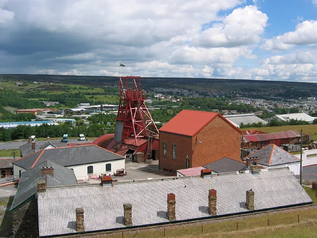
Big Pit National Coal Museum
Big Pit National Coal Museum — former coal mine and industrial heritage museum in Blaenavon in south-east Wales, United Kingdom.
 📷 5
📷 5Museums · South Wales
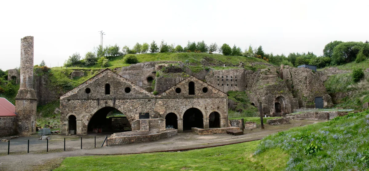
Blaenavon Ironworks
Blaenavon Ironworks — former ironworks transformed into a museum.
 📷 4
📷 4Museums · South Wales
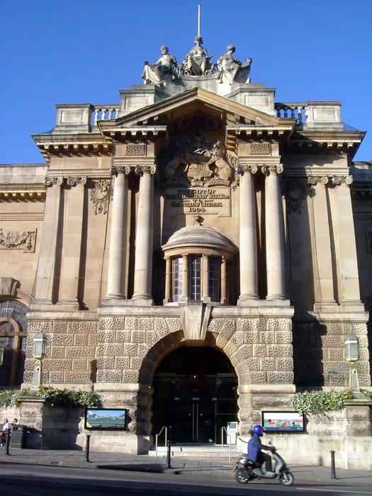
Bristol City Museum & Art Gallery
Bristol City Museum & Art Gallery is a museum in the United Kingdom.
Frequently asked questions
- Where is Canon's Marsh?
- Canon's Marsh is in South Wales, in the United Kingdom — coordinates 51.4500°, -2.6000°.
- Is Canon's Marsh wheelchair accessible?
- Yes — Canon's Marsh is tagged in OpenStreetMap as wheelchair-accessible.
- What are the opening hours for Canon's Marsh?
- OpenStreetMap records opening hours as: Mo-Fr 10:00-17:00, Sa-Su 10:00-18:00. Check the official site to confirm seasonal changes.