Towns & cities · West Midlands
Bourton-on-the-Water
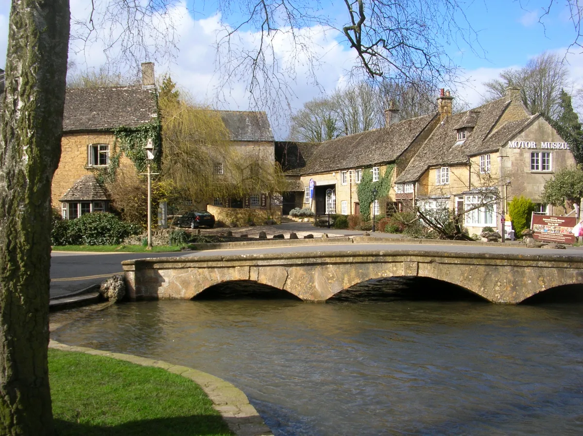
Bourton-on-the-Water — village and civil parish in Gloucestershire, United Kingdom.

Wikimedia Commons contributors — see linked file page for photographer and licence licence
Plan your visit
- Typical visit
- 3 h–6 h
- Nearest railway station
- Kingham · 9.1 km
- Free entry
- Family-friendly
- Dog-friendly
About
Bourton-on-the-Water is a town, city, village or settlement in the United Kingdom. Recent population estimates put it at around 3,093 people. Address: GL54. Wikidata describes it as: "village and civil parish in Gloucestershire, United Kingdom". Coordinates: 51.8860°, -1.7590°.
Photo gallery
Protected designations
- Area of Outstanding Natural Beauty: Cotswolds
Designations sourced from Natural England open data under OGL v3.
From the Wikipedia article
Bourton-on-the-Water is a village and civil parish in Gloucestershire, England, that lies on a wide flat vale within the Cotswolds Area of Outstanding Natural Beauty. The village had a population of 3,296 at the 2011 census. Much of the village centre is a designated Conservation Area.
Excerpt from Wikipedia under CC BY-SA 4.0. See the source article linked in Sources below.
Background
History
The earliest evidence of human activity within the Bourton-on-the-Water area was found in the Slaughter Bridge gravel-spread, where Neolithic pottery (dated c. 4000 B.C.) was discovered. Moreover, excavations of the Salmonsbury Camp give evidence of almost continuous habitation through the Neolithic period, the Bronze Age and throughout England's Roman period (c. 43 to 410 A.D.). A Roman road, Icknield Street (also known as Ryknild Street), ran from the Fosse Way at Bourton-on-the-Water to Templeborough in South Yorkshire. Ancient Roman pottery and coins discovered in the village itself give clear evidence of extended Roman occupation. By the 11th century a Christian church, Norman, was…
Description
Bourton-on-the-Water's high street is flanked by long wide greens and the River Windrush that runs through them. The river is crossed by five low, arched stone bridges. They were built between 1654 and 1953, leading to the nickname of "Venice of the Cotswolds". The village often has more visitors than residents during the peak tourist season. Some 300,000 visitors arrive each year as compared to under 3,500 permanent residents. There are three churches, Our Lady and St Kenelm Roman Catholic Church, Bourton-on-the-Water Baptist Church and St Lawrence, Church of England. The latter is usually open to visitors during the week. It is a Grade II listed building. A part of it was built in the…
Visiting
Bourton has a number of tourist attractions: Long-distance footpaths and local walks start, finish or pass through Bourton-on-the-Water. One such route that begins its 100-mile route north is the Heart of England Way.
Sourced from Wikipedia under CC BY-SA 4.0.
- Coordinates
- 51.8860, -1.7590
- County
- Gloucestershire
- District
- Cotswold
- Parish
- Bourton-on-the-Water
- Postcode
- GL54
- Parliamentary constituency
- North Cotswolds
- Phone
- +44 1451 821255
- Population
- 3,093
- Nearest railway station
- Kingham — 9.1 km
- Official site
- www.bourtoninfo.com
Sources
- wikidata: Q895264 (CC0)
- wikipedia: Bourton-on-the-Water (CC BY-SA 4.0)
- commons: Bourton-on-the-Water 2010 PD 09.JPG (CC BY-SA 4.0)
Featured in these 3 guides
Itinerary
Bath and the Cotswolds: a long weekend in honey-coloured stone
Roman baths, Georgian crescents, and the most picturesque villages in England.
Itinerary
A week in the Cotswolds
Chipping Campden, Stow, Bourton, Burford — six honey-stone villages and a Roman villa.
Itinerary
A Cotswolds weekend
Honey-stone villages, Sezincote, Snowshill — two days in the Cotswolds without driving fast.
Other places nearby
Loading nearby places…
Nearby
 📷 3
📷 3Museums · West Midlands
Cotswold Motoring Museum & Toy Collection
Cotswold Motoring Museum & Toy Collection — a museum in england-west-midlands, United Kingdom.
 📷 5
📷 5Museums · West Midlands
Cotswold Motoring Museum
Cotswold Motoring Museum — museum in Bourton-on-the-Water, Gloucestershire, England, UK.
.jpg?width=1200) 📷 5
📷 5Memorials & monuments · West Midlands
War Memorial
War Memorial is a memorial in the United Kingdom.
 📷 3
📷 3Historic bridges · West Midlands
Big Bridge
Big Bridge — Grade II listed building-listed bridge in england-west-midlands, United Kingdom.
 📷 3
📷 3Memorials & monuments · West Midlands
Bourton-on-the-Water War Memorial including gated enclosure
Bourton-on-the-Water War Memorial including gated enclosure — Grade II listed building-listed memorial in england-west-midlands, United Kingdom.
Hotels · West Midlands
The Old Manse
The Old Manse — a hotel in england west midlands.
More towns in this region
 Flagship📷 3
Towns & cities · West Midlands
Adderbury
Adderbury — village and civil parish in Cherwell district, Oxfordshire, England.
 Flagship📷 3
Towns & cities · West Midlands
Admington
Admington — village in Warwickshire, England, UK.
 Flagship📷 3
Towns & cities · West Midlands
Aldington
Aldington — village in Worcestershire, United Kingdom.
 Flagship📷 5
Towns & cities · West Midlands
Anstey
Anstey — large village in Leicestershire, England.
Frequently asked questions
- Where is Bourton-on-the-Water?
- Bourton-on-the-Water is in Gloucestershire, the West Midlands, United Kingdom (postcode GL54), in the parish of Bourton-on-the-Water.
- Is Bourton-on-the-Water a protected site?
- Yes — Bourton-on-the-Water is part of the Cotswolds National Landscape (AONB).
- Is Bourton-on-the-Water free to visit?
- Yes, Bourton-on-the-Water is free to enter.
- How do I get to Bourton-on-the-Water?
- Drivers can navigate to postcode GL54. It sits within the North Cotswolds parliamentary constituency.