Archaeological sites · West Midlands
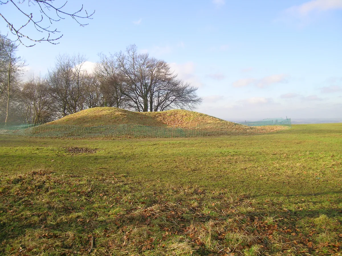
Cold Aston long barrow 200yds (180m) E of Camp Farm
Cold Aston long barrow 200yds (180m) E of Camp Farm — archaeological site in Cold Aston, Cotswold, England, UK.

Wikimedia Commons contributors — see linked file page for photographer and licence licence
Plan your visit
- Typical visit
- 45 min–1.5 h
- Free entry
- Dog-friendly
About
Cold Aston long barrow 200yds (180m) E of Camp Farm is a place of interest in Gloucestershire, the West Midlands. Officially recognised as scheduled monument. The site is within the Cotswolds National Landscape (AONB). It sits within the North Cotswolds parliamentary constituency. Postcode area GL54.
Photo gallery
Protected designations
- Area of Outstanding Natural Beauty: Cotswolds
Designations sourced from Natural England open data under OGL v3.
Place summary
Cold Aston long barrow, located 200 yards east of Camp Farm in Gloucestershire, is an archaeological site designated as a scheduled monument. Situated within the Cotswolds Area of Outstanding Natural Beauty, it reflects the prehistoric burial practices of the region.
AI-generated from the structured facts on this page (operator, designation, listing, era). Not a substitute for visiting.
- Coordinates
- 51.8842, -1.7930
- County
- Gloucestershire
- District
- Cotswold
- Parish
- Cold Aston
- Postcode
- GL54 3BZ
- Parliamentary constituency
- North Cotswolds
Sources
- wikidata: Q17649087 (CC0)
- commons: Long Barrow - geograph.org.uk - 1853705.jpg (CC BY-SA 4.0)
Other places nearby
Loading nearby places…
Nearby
Campsites · West Midlands
Field Barn Park
Field Barn Park — a campsite in england west midlands.
Campsites · West Midlands
Bell Tents Area
Bell Tents Area — a campsite in england west midlands.
 📷 3
📷 3Historic bridges · West Midlands
Bourton Bridge
Bourton Bridge — Grade II listed building-listed bridge in england-west-midlands, United Kingdom.
Campsites · West Midlands
The Wildings
The Wildings — a campsite in england west midlands.
 📷 3
📷 3Historic bridges · West Midlands
Bridge Over River Windrush Leading Between Mill House And Pockhill Farmhouse
Bridge Over River Windrush Leading Between Mill House And Pockhill Farmhouse — Grade II listed building-listed bridge in england-west-midlands, United Kingdom.
Campsites · West Midlands
Folly Farm Camping
Folly Farm Camping — a campsite in england west midlands.
More archaeological sites in this region
 📷 3
📷 3Archaeological sites · West Midlands
A Neolithic barrow on Whiteleaf Hill, 50m east of Whiteleaf Cross
A Neolithic barrow on Whiteleaf Hill, 50m east of Whiteleaf Cross — archaeological site in Princes Risborough, Buckinghamshire, England, UK.
 📷 3
📷 3Archaeological sites · West Midlands
Asthall Barrow: an Anglo-Saxon burial mound 100m SSW of Barrow Farm
Asthall Barrow: an Anglo-Saxon burial mound 100m SSW of Barrow Farm — archaeological site in Asthall, West Oxfordshire, England, UK.
 📷 3
📷 3Archaeological sites · West Midlands
Barnhill moated site at Hambleton
Barnhill moated site at Hambleton — archaeological site in Hambleton, Rutland, England, UK.
 📷 2
📷 2Archaeological sites · West Midlands
Bottom Wood
Bottom Wood — English nature reserve.
Frequently asked questions
- Where is Cold Aston long barrow 200yds (180m) E of Camp Farm?
- Cold Aston long barrow 200yds (180m) E of Camp Farm is in Gloucestershire, the West Midlands, United Kingdom (postcode GL54 3BZ), in the parish of Cold Aston.
- Is Cold Aston long barrow 200yds (180m) E of Camp Farm a listed building?
- Cold Aston long barrow 200yds (180m) E of Camp Farm is officially recognised as scheduled monument listed.
- Is Cold Aston long barrow 200yds (180m) E of Camp Farm a protected site?
- Yes — Cold Aston long barrow 200yds (180m) E of Camp Farm is part of the Cotswolds National Landscape (AONB).
- How do I get to Cold Aston long barrow 200yds (180m) E of Camp Farm?
- Drivers can navigate to postcode GL54 3BZ. It sits within the North Cotswolds parliamentary constituency.