Mountains & hills · Mid Wales
Black Mixen
Also known as: Y Domen Ddu
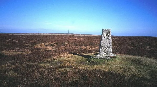
Black Mixen — Named summit at 650 m.

Wikimedia Commons contributors — see linked file page for photographer and licence licence
Plan your visit
- Typical visit
- 3 h–8 h
- Best time of year
- Late spring – early autumn (May–Oct)
- Nearest railway station
- Dolau · 6.3 km
- Free entry
- Dog-friendly
About
Black Mixen is a named summit in the United Kingdom. Also known as: Y Domen Ddu. Wikidata describes it as: "Named summit at 650 m.". Coordinates: 52.2718°, -3.1788°.
Photo gallery
Protected designations
- Site of Special Scientific Interest: River Teme SSSI
Designations sourced from Natural England open data under OGL v3.
From the Wikipedia article
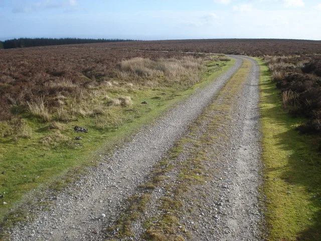
Black Mixen (Welsh: Y Domen Ddu) is a subsidiary summit of Rhos Fawr or Great Rhos in the Radnor Forest. The summit is large peat bog plateau. The summit is marked with a cairn, and is next to a radio transmitter and its building. Black Mixen is the only Nuttall to have a communications mast (a radio transmitter) on its summit. To the east is Bache Hill, to the south are the Black Mountains, to the west is the Great Rhos plateau. The summit cairn is probably of Bronze Age date, with most peaks in the area showing similar barrowss.
Excerpt from Wikipedia under CC BY-SA 4.0. See the source article linked in Sources below.
- Coordinates
- 52.2718, -3.1788
- Address
- Powys, Wales
- Nearest railway station
- Dolau — 6.3 km
Sources
- osm: n3487079603 (ODbL)
- wikipedia: Black Mixen (CC BY-SA 4.0)
- commons: Track on Black Mixen - geograph.org.uk - 682562.jpg (CC BY-SA 4.0)
Other places nearby
Loading nearby places…
Nearby
 📷 3
📷 3Natural landmarks · Mid Wales
Black Mixen
Black Mixen — mountain (650m) in Powys.
 📷 4
📷 4Forests & woodlands · Mid Wales
Radnor Forest
Radnor Forest in Wales Mid, United Kingdom.
 📷 3
📷 3Mountains & hills · Mid Wales
Great Creigiau
Great Creigiau — a mountain in wales-mid, United Kingdom, 646 m.
 📷 3
📷 3Natural landmarks · Mid Wales
Rhos Fawr
Rhos Fawr — mountain (660m) in Powys.
 📷 3
📷 3Mountains & hills · Mid Wales
Rhos Fawr
Rhos Fawr — Named summit at 660 m.
 📷 3
📷 3Natural landmarks · Mid Wales
Bache Hill
Bache Hill — mountain (610m) in Powys.
More mountains in this region
 📷 3
📷 3Mountains & hills · Mid Wales
Black Hill
Black Hill — Named summit at 640 m.
 📷 5
📷 5Mountains & hills · Mid Wales
Cadair Idris
Cadair Idris — Named summit at 893 m.
 📷 3
📷 3Mountains & hills · Mid Wales
Caer Caradoc
Caer Caradoc — Named summit at 459 m.
 📷 3
📷 3Mountains & hills · Mid Wales
Cardigan Bay
Cardigan Bay is a mountain or hill in the United Kingdom.
Frequently asked questions
- Where is Black Mixen?
- Black Mixen is in Mid Wales, United Kingdom.
- Is Black Mixen a protected site?
- Yes — Black Mixen is part of the River Teme SSSI Site of Special Scientific Interest.
- Is Black Mixen free to visit?
- Yes, Black Mixen is free to enter.
- How do I get to Black Mixen?
- The nearest railway station is Dolau, about 6.3 km away.