Towns & cities · Yorkshire & the Humber
Beal
Beal — village and civil parish in North Yorkshire, England.

Wikimedia Commons contributors — see linked file page for photographer and licence licence
Plan your visit
- Typical visit
- 3 h–6 h
- Nearest railway station
- Whitley Bridge · 3.5 km
- Free entry
- Family-friendly
- Dog-friendly
About
Beal is a town, city, village or settlement in the United Kingdom. Recent population estimates put it at around 720 people. Address: DN14. Wikidata describes it as: "village and civil parish in North Yorkshire, England". Coordinates: 53.7230°, -1.1940°.
Photo gallery
From the Wikipedia article
Beal is a village and civil parish in North Yorkshire, England. It is situated on the River Aire, 3.5 miles (6 km) north-east of Knottingley, 8 miles (13 km) south-west of Selby, and 21 miles (34 km) south of York. The parish includes the village of Kellingley, and borders the City of Wakefield in West Yorkshire. At the 2001 census it had a population of 720, increasing to 738 at the 2011 census.
Excerpt from Wikipedia under CC BY-SA 4.0. See the source article linked in Sources below.
Background
Description
The name "Beal" is of Old English origins and means "Nook of land in a river-bend". It is composed of the elements bēag ("river-bend") and halh ("nook of land"). The village was recorded as Begale in the Domesday Book of 1086. Kellingley Colliery, the last operating deep coal mine in the United Kingdom, was located in the parish until its closure in December 2015. Fishing on the River Aire is controlled by Leeds and District Amalgamated Society of Anglers. The main catches are roach and bream. Bus service 476 operated by Arriva Yorkshire, connects the village with Pontefract, Ferrybridge, Knottingley, Kellingley, Beal, Kellington, Eggborough, Burn, Brayton and Selby.
Sourced from Wikipedia under CC BY-SA 4.0.
- Coordinates
- 53.7230, -1.1940
- District
- North Yorkshire
- Parish
- Beal
- Postcode
- DN14
- Parliamentary constituency
- Selby
- Population
- 720
- Nearest railway station
- Whitley Bridge — 3.5 km
Sources
- wikidata: Q593871 (CC0)
- wikipedia: Beal, North Yorkshire (CC BY-SA 4.0)
- commons: River Aire, Beal.jpg (CC BY-SA 4.0)
Other places nearby
Loading nearby places…
Nearby
 📷 3
📷 3Memorials & monuments · Yorkshire & the Humber
Beal Stone
Beal Stone — a memorial in england-yorkshire, United Kingdom.
 📷 5
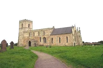
📷 5Historic churches · Yorkshire & the Humber
Church of St Mary
Church of St Mary — church in Birkin, Selby, North Yorkshire, England, UK.
 📷 3
📷 3Memorials & monuments · Yorkshire & the Humber
Birkin Stone
Birkin Stone — a memorial in england-yorkshire, United Kingdom.
 📷 3
📷 3Memorials & monuments · Yorkshire & the Humber
Silver Jubilee of Queen Elizabeth II
Silver Jubilee of Queen Elizabeth II — a memorial in england-yorkshire, United Kingdom.
 📷 3
📷 3Historic churches · Yorkshire & the Humber
Church of St Edmund
Church of St Edmund — church in Kellington, North Yorkshire, England, UK.
 📷 3
📷 3Windmills · Yorkshire & the Humber
Kellington Windmill
Kellington Windmill is a windmill in the United Kingdom.
More towns in this region
 Flagship📷 4
Towns & cities · Yorkshire & the Humber
Bradford
Bradford — city and largest settlement in the City of Bradford district, Yorkshire, England.
 Flagship📷 5
Towns & cities · Yorkshire & the Humber
Coxwold
Coxwold — village and civil parish in North Yorkshire, England.
 Flagship📷 5
Towns & cities · Yorkshire & the Humber
Great Ayton
Great Ayton — village in North Yorkshire, England, UK.
May2005.jpg?width=1200) Flagship📷 5
Flagship📷 5Towns & cities · Yorkshire & the Humber
Great Langton
Great Langton — village in North Yorkshire, England, UK.
Frequently asked questions
- Where is Beal?
- Beal is in Yorkshire, United Kingdom (postcode DN14), in the parish of Beal.
- Is Beal free to visit?
- Yes, Beal is free to enter.
- How do I get to Beal?
- The nearest railway station is Whitley Bridge, about 3.5 km away. Drivers can navigate to postcode DN14.