Towns & cities · East Midlands
Barton Turf
Barton Turf — village in Norfolk, England, UK.

Wikimedia Commons contributors — see linked file page for photographer and licence licence
Plan your visit
- Typical visit
- 3 h–6 h
- Nearest railway station
- Wroxham BVR · 6.2 km
- Free entry
- Family-friendly
- Dog-friendly
About
Barton Turf is a town, city, village or settlement in the United Kingdom. It covers approximately 11 km². Recent population estimates put it at around 445 people. Address: NR12. Wikidata describes it as: "village in Norfolk, England, UK". Coordinates: 52.7480°, 1.4849°.
Photo gallery
Protected designations
- Site of Special Scientific Interest: Ant Broads and Marshes SSSI
- National Nature Reserve: ANT BROADS AND MARSHES
- Area of Outstanding Natural Beauty: Norfolk Coast
- Ramsar wetland: Broadland
Designations sourced from Natural England open data under OGL v3.
From the Wikipedia article
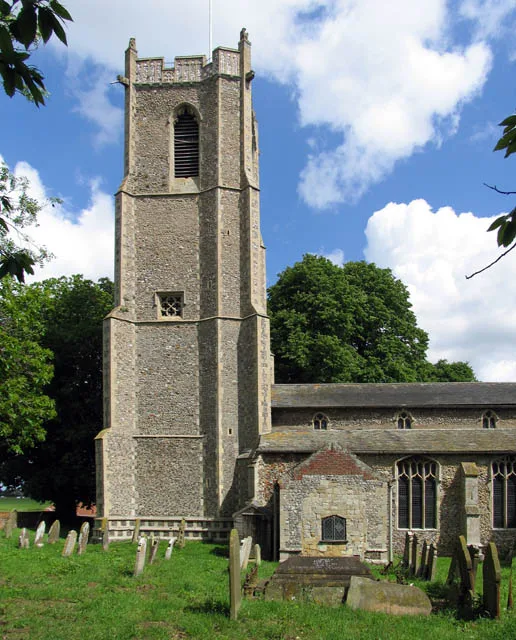
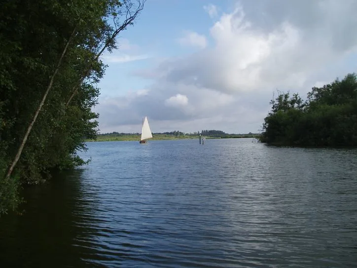
Barton Turf is a village and civil parish in the English county of Norfolk. It is 12 miles (19 km) north-east of the city of Norwich, on the north-western edge of Barton Broad, the second largest of the Norfolk Broads. The parish is in the district of North Norfolk. The civil parish, which includes the whole of Barton Broad and the smaller village of Irstead at its southern end, has an area of 10.86 square kilometres (4.19 sq mi). In the 2001 census it had a population of 480 in 181 households, the population decreasing to 467 at the 2011 Census. The church of St Michael and All Angels Church, Barton Turf, about 1 mile (1.6 km) from the clustered village centre, has a large, ornate medieval painted rood screen such as many medieval parishes who could afford fine artisans once had, but which have rarely survived the English Reformation. The 18th-century antiquarian Antony Norris lived in Barton Turf, and is buried at the church.
Excerpt from Wikipedia under CC BY-SA 4.0. See the source article linked in Sources below.
- Coordinates
- 52.7480, 1.4849
- County
- Norfolk
- District
- North Norfolk
- Parish
- Barton Turf
- Postcode
- NR12
- Parliamentary constituency
- North Norfolk
- Population
- 445
- Nearest railway station
- Wroxham BVR — 6.2 km
Sources
- wikidata: Q349132 (CC0)
- wikipedia: Barton Turf (CC BY-SA 4.0)
- commons: St Michael and All Angels, Barton Turf, Norfolk - geograph.org.uk - 481379.jpg (CC BY-SA 4.0)
Other places nearby
Loading nearby places…
Nearby
 📷 3
📷 3Public art & sculpture · East Midlands
Barton Turf Village Sign
Barton Turf Village Sign — a public art in england-east-midlands, United Kingdom.
 📷 5
📷 5Historic churches · East Midlands
St Michael and All Angels Church
St Michael and All Angels Church — Grade I listed church in Barton Turf, Norfolk, England, UK.
 📷 3
📷 3Natural landmarks · East Midlands
Barton Broad
Barton Broad — lake in the United Kingdom.
 📷 3
📷 3Viewpoints · East Midlands
Barton Broad Boardwalk
Barton Broad Boardwalk is a viewpoint in the United Kingdom.
 📷 3
📷 3Windmills · East Midlands
Hunsett Mill
Hunsett Mill is a windmill in the United Kingdom.
 📷 3
📷 3Public art & sculpture · East Midlands
Neatishead Village Sign
Neatishead Village Sign — a public art in england-east-midlands, United Kingdom.
More towns in this region
 Flagship📷 3
Towns & cities · East Midlands
Aldborough
Aldborough — village in Norfolk, England, UK.
 Flagship📷 4
Towns & cities · East Midlands
Alderford
Alderford — village and civil parish in Norfolk, UK.
 Flagship📷 5
Towns & cities · East Midlands
Ashmanhaugh
Ashmanhaugh — village in Norfolk, England, UK.
 Flagship📷 3
Towns & cities · East Midlands
Attlebridge
Attlebridge — a village located in Broadland, United Kingdom.
Frequently asked questions
- Where is Barton Turf?
- Barton Turf is in Norfolk, the East Midlands, United Kingdom (postcode NR12), in the parish of Barton Turf.
- Is Barton Turf a protected site?
- Yes — Barton Turf is part of the Ant Broads and Marshes SSSI Site of Special Scientific Interest and the ANT BROADS AND MARSHES National Nature Reserve.
- Is Barton Turf free to visit?
- Yes, Barton Turf is free to enter.
- How do I get to Barton Turf?
- The nearest railway station is Wroxham BVR, about 6.2 km away. Drivers can navigate to postcode NR12.